| PalestineRemembered | About Us | Oral History | العربية | |
| Pictures | Zionist FAQs | Haavara | Maps | |
| Search |
| Camps |
| Districts |
| Acre |
| Baysan |
| Beersheba |
| Bethlehem |
| Gaza |
| Haifa |
| Hebron |
| Jaffa |
| Jericho |
| Jerusalem |
| Jinin |
| Nablus |
| Nazareth |
| Ramallah |
| al-Ramla |
| Safad |
| Tiberias |
| Tulkarm |
| Donate |
| Contact |
| Profile |
| Videos |
Welcome To al-Mansura, Khirbat - خربة المنصورة (ח'ירבת אל-מנצורה)
|
District of Haifa
Ethnically cleansed days ago |
العربية Google Earth |
| Gallery (13) |
- Statistics & Facts
- Satellite View
- Articles 1
- Pictures 13
- Members
- All That Remains
- Wikipedia
- Videos
- Guest Book
- Links
| Statistic & Fact | Value | |||||||||
| Occupation Date | April 28, 1948 | |||||||||
| Distance From District | 18.5 (km) South East of Haifa | |||||||||
| Elevation | 100 (meters) | |||||||||
| Map Location | See location #13 on the map View from satellite |
|||||||||
| Military Operation | Either Bi'ur Chametz or Operation Bi'ur Chametz | |||||||||
| Attacking Units | Most likely the Carmeli Brigade | |||||||||
| Exodus Cause | Expulsion by Zionist troops | |||||||||
| Village Temains | The village has been completely obliterated | |||||||||
| Ethnically Cleansing | al-Mansura, Khirbat inhabitants were completely ethnically cleansed. | |||||||||
| Population |
|
|||||||||
| Near By Towns |
||||||||||
|
||||||||||
| Inhabitants Place of Origin | N/A (predominantly Muslim Palestinian Arab Druze) | |||||||||
| Archeological Sites | Khirbat al-Mansura contained the ruins of building foundations and rock-cut tombs in and around the village site. | |||||||||
| Exculsive Jewish Colonies Who Usurped Village Lands |
The Palestinian Druze town of Daliyat al-Karmil occupies some of the village lands. | |||||||||
Village Before NakbaThe village, located on the top of a round hill on the northeastern slope of Mount Carmel, faced the Marj ibn Amir plain in the east and north. The mound of Tall Qamun was about 1 km to the southeast. Khirbat al-Mansura was classified as a hamlet in the Palestine Index Gazetteer. The villagers were predominantly Druze. Although it has not been possible to identify Khirbat al-Mansura with any known historical site its antiquity was evident from the ruins of building foundations and rock-cut tombs in and around the site.Village Occupation and Ethnic CleaningMost of the villages around Khirbat al-Mansura were occupied in the wake of the fall of Haifa. Khirbat al-Mansura was probably no exception; it may have succumbed to a Haganah assault as part of Operation Bi'ur Hametz ("Passover Clearing").Zionists Colonies on Village LandsThe village lands have been merged with those of the Arab town of Daliyat al-Karmil.Village TodayNo traces of the houses remain. Storage houses for grain have been built 200 m south of the site by a farmer from the Arab town of Isfiya.SourceDr. Walid al-Khalidi, 1992: All That Remains. |
||||||||||
| Related Maps | Town Lands' Demarcation Maps خرائط للقضاء توضح حدود القرى والاودية Town's map on MapQuest View from satellite Help us map this town at WikiMapia |
|||||||||
| Related Links | Wikipedia's Page Google Search Google For Images Google For Videos |
|||||||||
| More Information | في كتاب كي لا ننسى المزيد من موقع هوية |
|||||||||
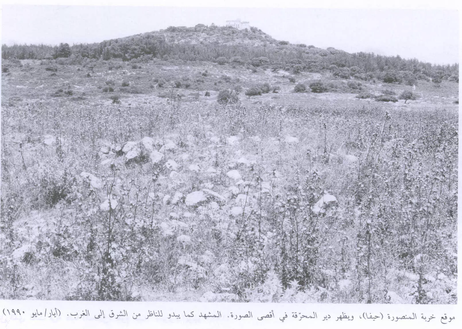
- منظر عام للقرية المدمرة والمطهرة عرقياً كما تبدو للمشاهد من الشرق الى الغرب ويظهر دير المحرّقة على قمة الجبل، اُنقر الصورة لتكبيرها. 1990
Scanned from "All That Remains" by Dr. Walid Khalidi - موقع القريه واثار بيوتها مغطى بالاعشاب
Posted by abu raya - منظر بالقرب من القريه
Posted by abu raya - اراضي القريه في مرج بن عامر
Posted by abu raya - موقع القريه
Posted by abu raya - طريق قديم بجانب القريه
Posted by abu raya - بىر قديم بالقرب من القريه
Posted by abu raya - غرب القريه
Posted by abu raya - من غرب القريه
Posted by abu raya - اثار بيوت القريه
Posted by abu raya - القريه من الجهه الشماليه
Posted by abu raya - بجانب القريه
Posted by abu raya - موقع مدبغة جلود وقماش - خربة المنصورة - الكرمل -قضاء حيفا ....
بروفيسور مصطفى كبها
Want to browse more? 80,000 pictures were grouped in these gallaries:
| Display Name | Clan/Hamolah | Country of Residence |
No links have been shared yet, be free to the first to share the first link.


