| PalestineRemembered | About Us | Oral History | العربية | |
| Pictures | Zionist FAQs | Haavara | Maps | |
| Search |
| Camps |
| Districts |
| Acre |
| Baysan |
| Beersheba |
| Bethlehem |
| Gaza |
| Haifa |
| Hebron |
| Jaffa |
| Jericho |
| Jerusalem |
| Jinin |
| Nablus |
| Nazareth |
| Ramallah |
| al-Ramla |
| Safad |
| Tiberias |
| Tulkarm |
| Donate |
| Contact |
| Profile |
| Videos |
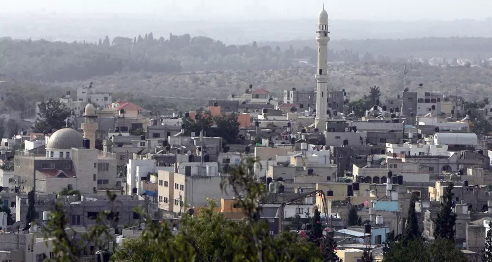
Welcome To Qaffein - قفين (קפין)
|
District of Tulkarm
Occupied days ago |
العربية Google Earth |
 |
Gallery (85) |
- Statistics & Facts
-
Before & After

- Satellite View
- Articles 2
- Pictures 85
- Land Deeds 1
- Members 11
- Wikipedia
- Videos 2
- Guest Book 3
- Links 2
| Statistic & Fact | Value | ||||||||||||||||||||
| Distance From District | 22 km northeast of Tulkarm | ||||||||||||||||||||
| Elevation | 125 meters | ||||||||||||||||||||
| Before & After Nakba, Click Map For Details |
|||||||||||||||||||||
|
|||||||||||||||||||||
| Land Ownership |
**Town Lands' Demarcation Maps |
||||||||||||||||||||
| Land Usage As of 1945 |
|
||||||||||||||||||||
| Lands usurped within armistice area | 13,738 Dunums | ||||||||||||||||||||
| Population |
|
||||||||||||||||||||
| Near By Towns |
|||||||||||||||||||||
|
|||||||||||||||||||||
| Featured Video | |||||||||||||||||||||
| Related Maps | Town Lands' Demarcation Maps خرائط للقضاء توضح حدود القرى والاودية View from satellite Town's map on MapQuest Help us map this town at WikiMapia |
||||||||||||||||||||
| Related Links | Wikipedia's Page Facebook Page Google Search Google For Images Google For Videos في كتاب بلادنا فلسطين المزيد من موقع هوية |
||||||||||||||||||||
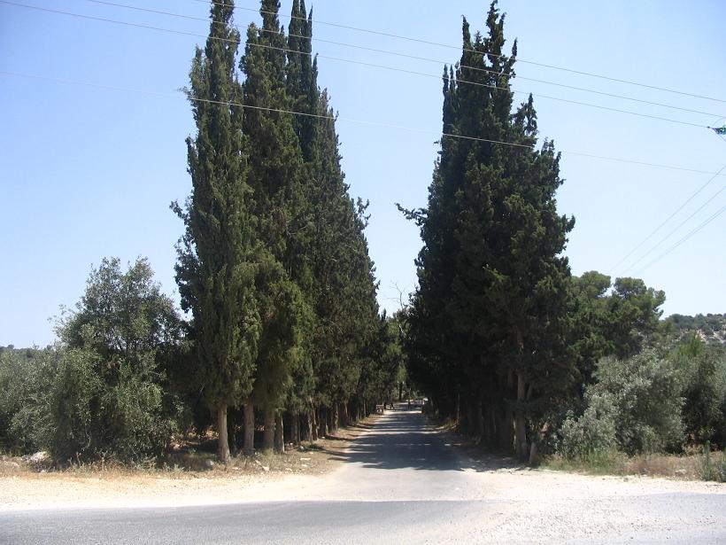
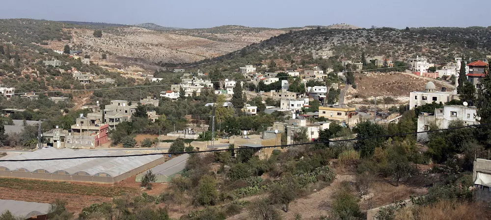
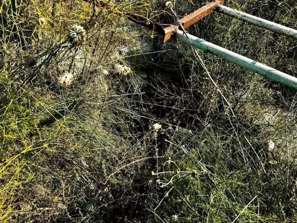
- منظر عام لقفين من منطقة الحاووز القديم
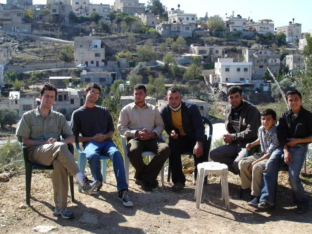
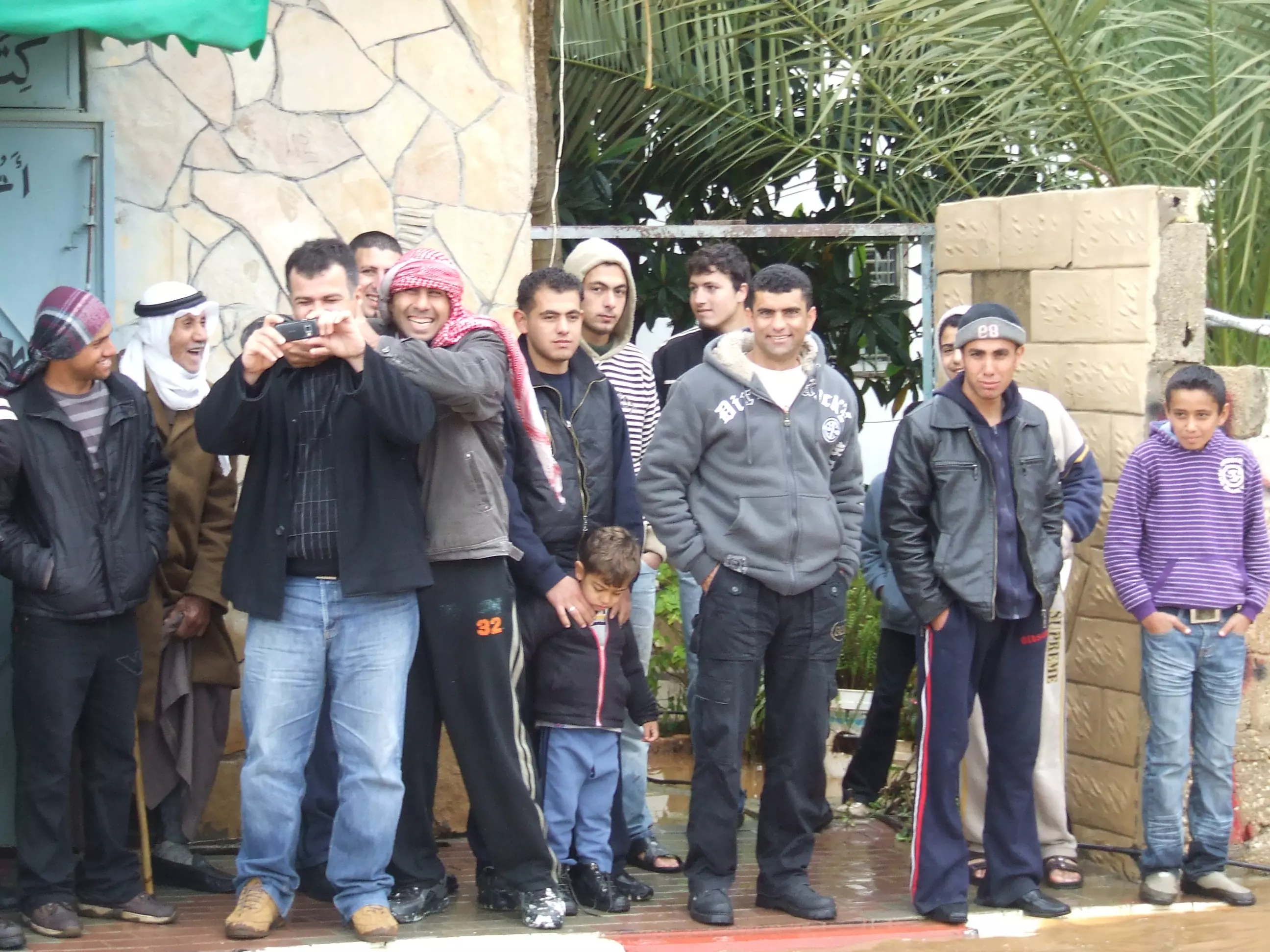
Posted by saher kaddarah 1 - General view with some locals in the forground
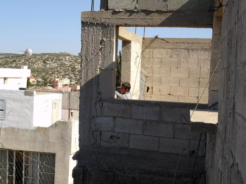
4 - Rooftop view
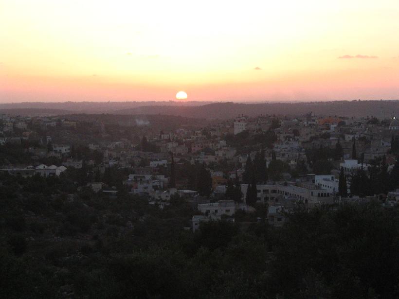
3 - منظر عام عند الغروب
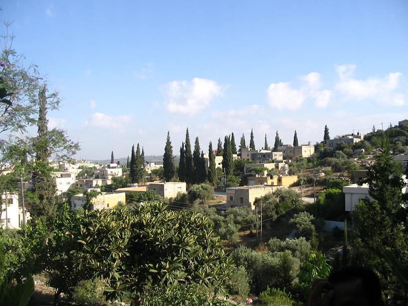
Posted by Dr.RanaTaiseer Sabbah 2 - منظر للبلد
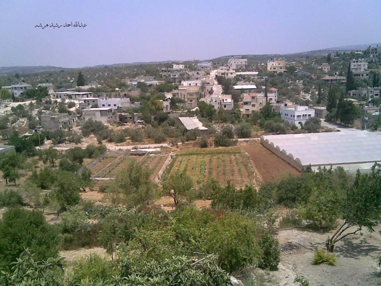
Posted by وسيم كتاني - منظر عام على جهة الشمال من قفين
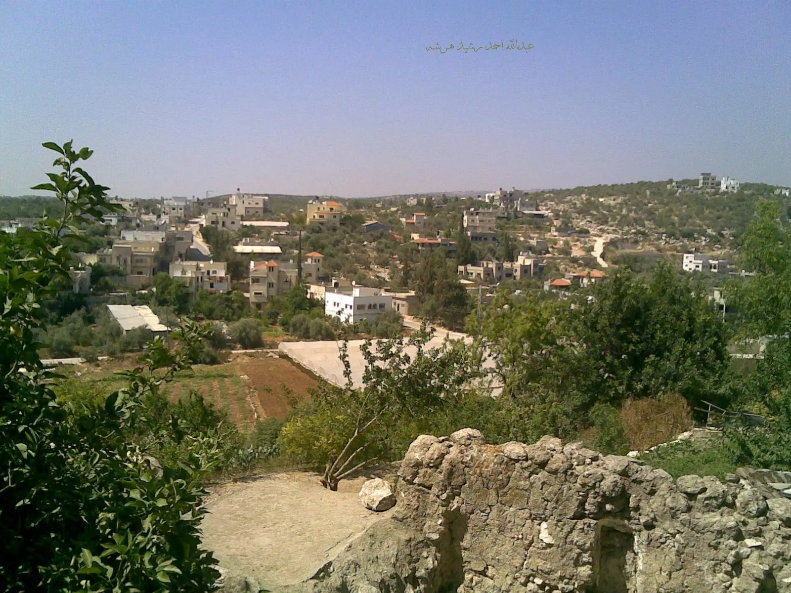
Posted by م.عبدالله احمد رشيد هرشه 3 - منظر عام لقفين من منطقة الحاووز القديم
Posted by saher kaddarah - منظر عامآخر لقفين من منطقة الحاووز القديم
Posted by saher kaddarah - Art work on the wall
2 - طلعة البابور

Posted by وسيم كتاني - The Kids

2 - The main enterance
Posted by Dr.RanaTaiseer Sabbah 4 - منظر عام
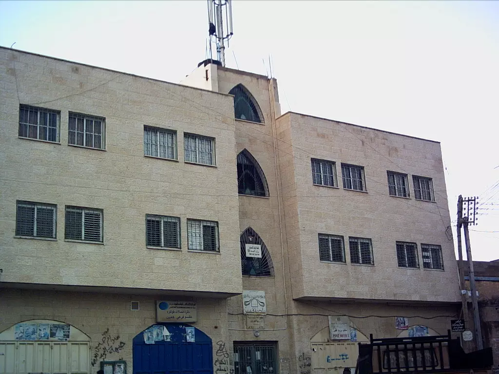
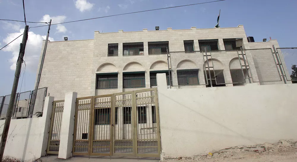
Posted by Dr.RanaTaiseer Sabbah 5 - بلدية قفين
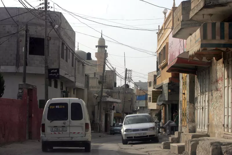
Posted by وسيم كتاني 3 - الشارع الرئيسي

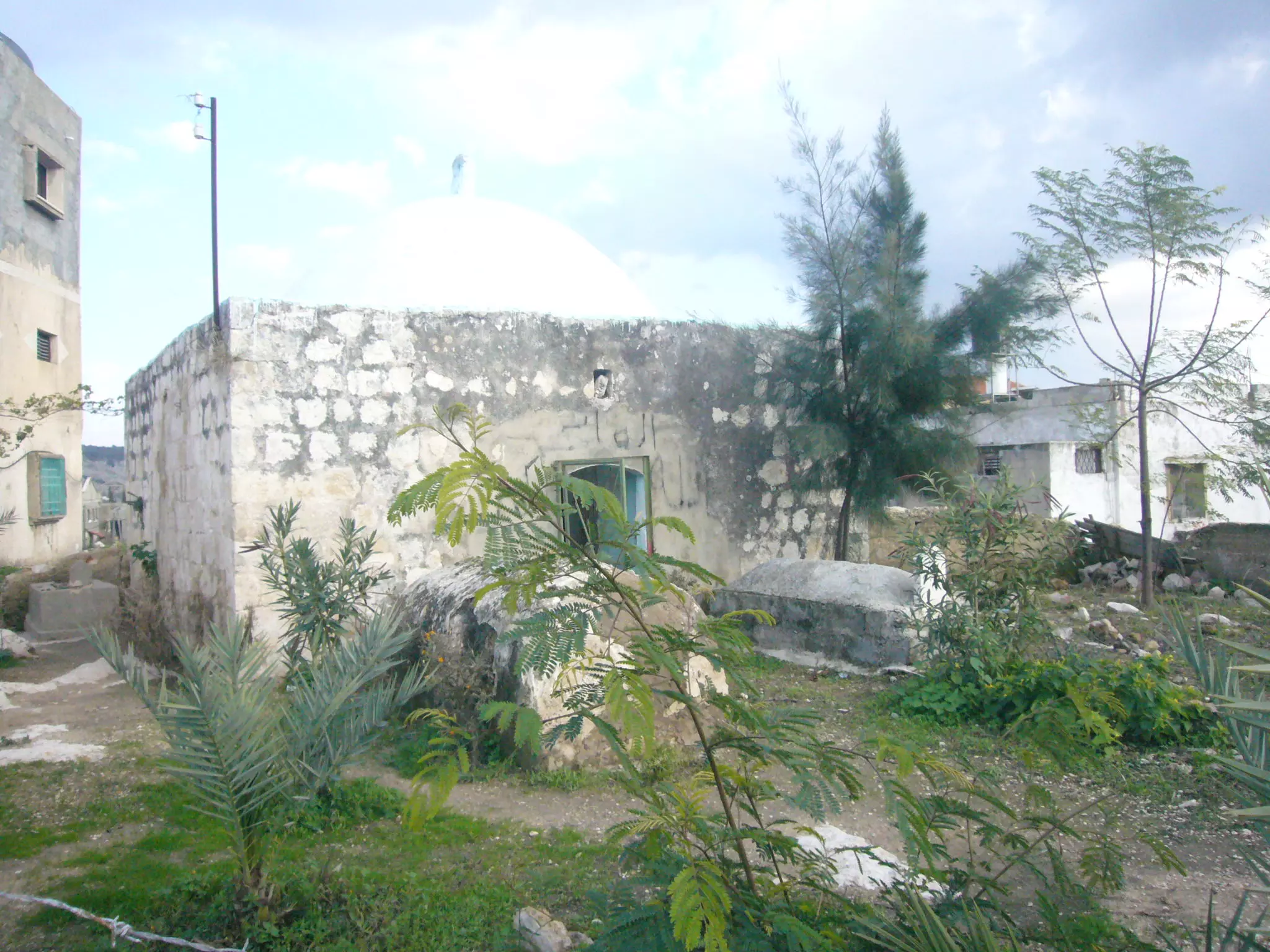
Posted by وسيم كتاني 1 - مقام الشيخ عثمان
Posted by وسيم كتاني 4 - صالون المجد
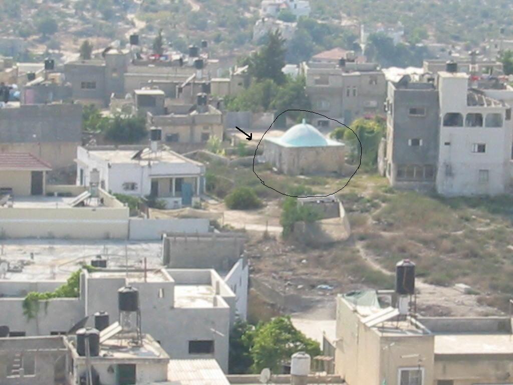
Posted by مجهولة الهوية 4 - قبر الشيخ عثمان الكتاني

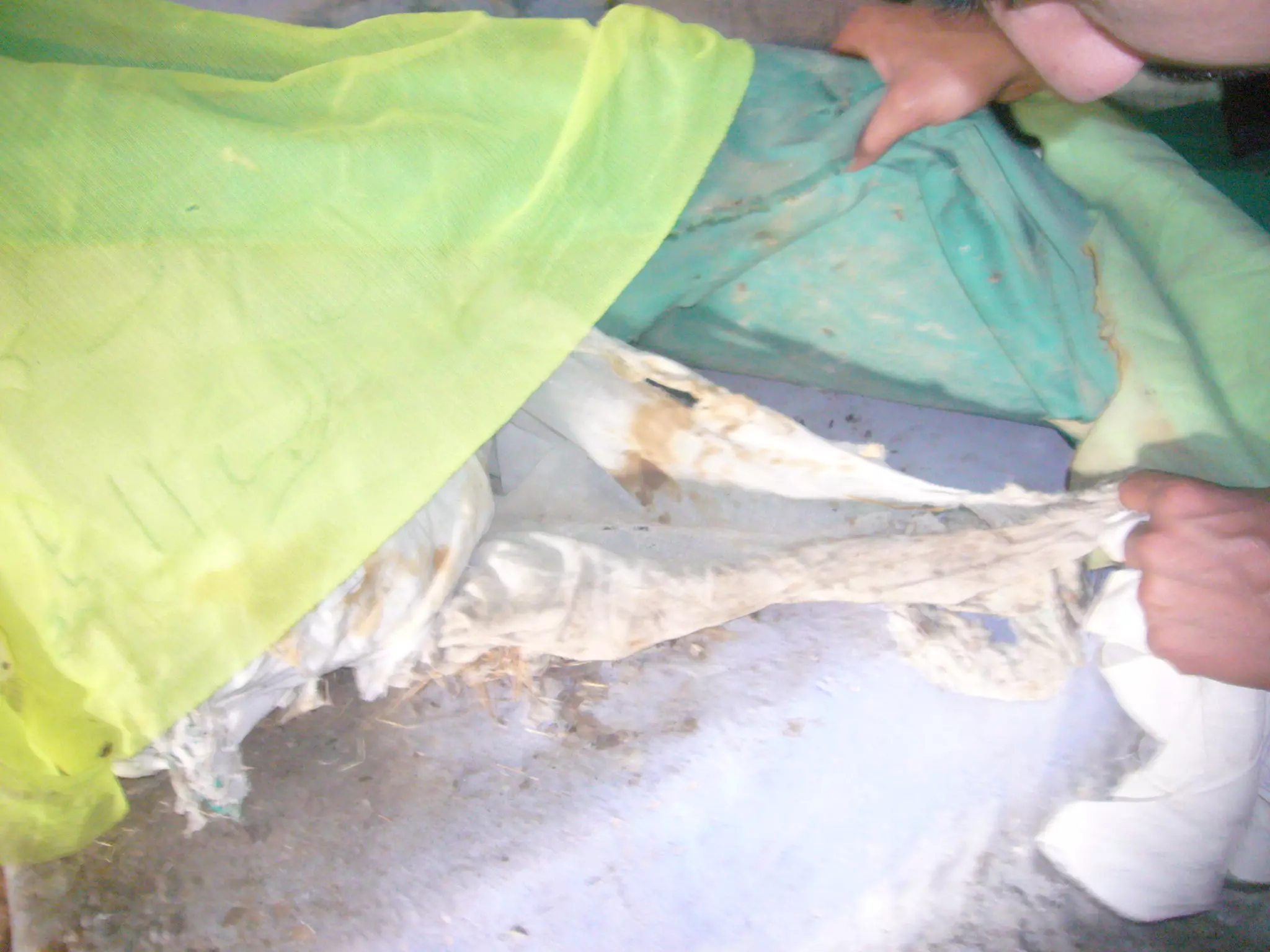
Posted by وسيم كتاني - عمامة الشيخ عثمان الكتاني وعمرها اكثر من 700 سنه
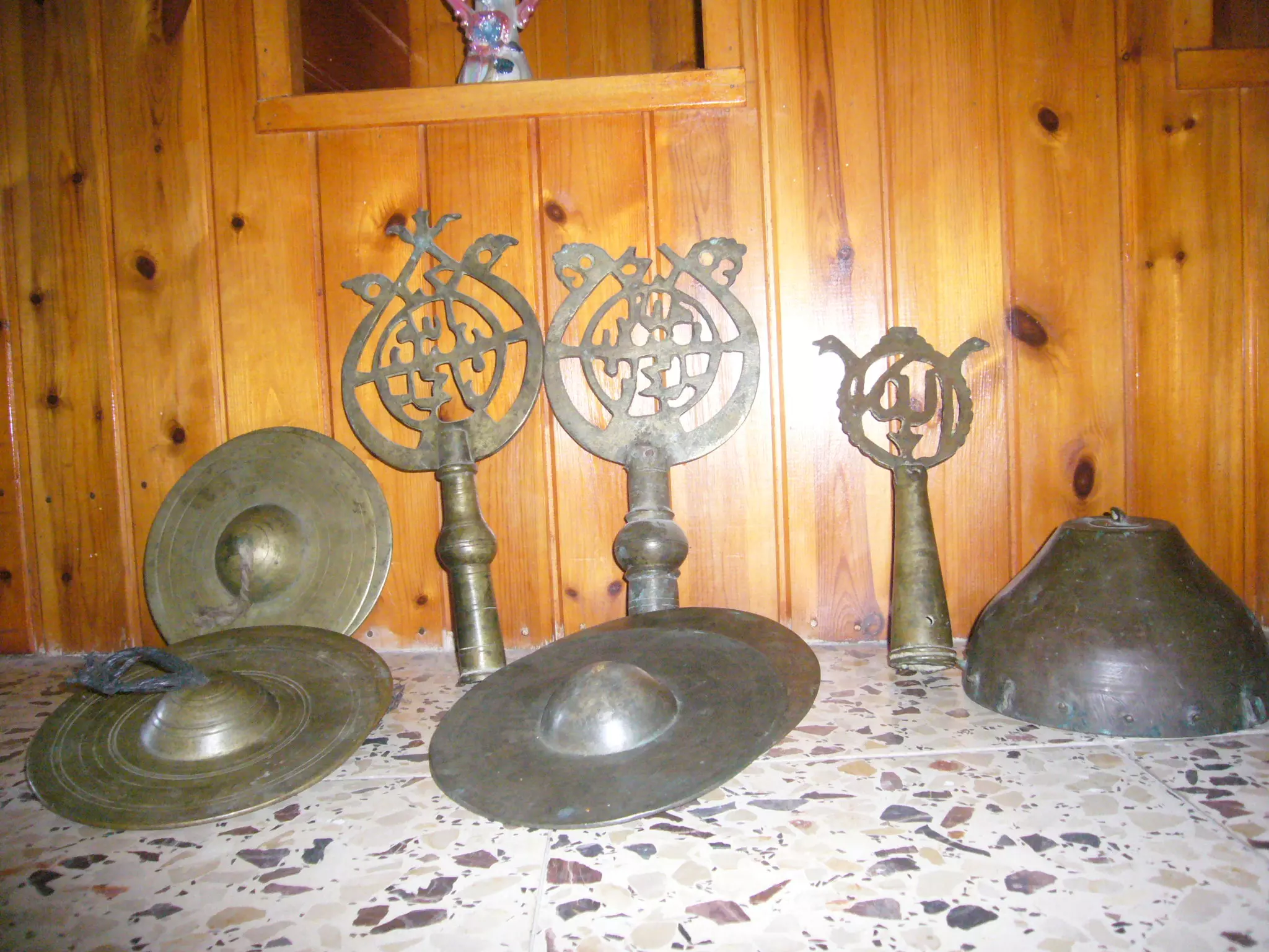
Posted by وسيم كتاني - العده التي كانت تستخدم في المناسبات لآل كتاني وعمرها اكثر من 700 سنه
Posted by وسيم كتاني 3 - حطة الشيخ عثمان
Posted by وسيم كتاني - مدخل مقام الشيخ عثمان الكتاني الذي كان يعرف بمكارمه
Posted by وسيم كتاني - منظر عام - الحارة في اول البلد
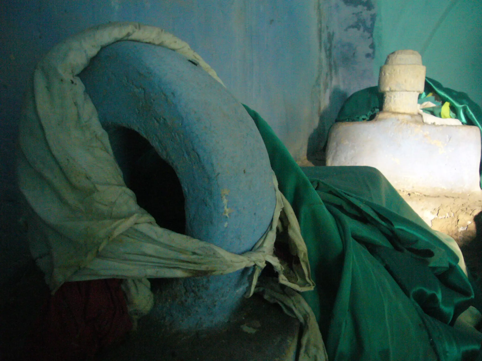
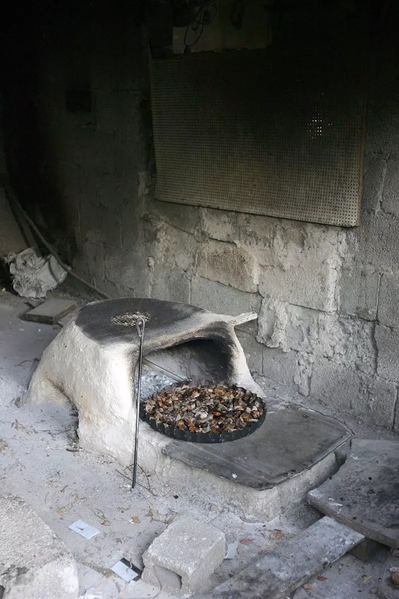
Posted by saher kaddarah - الفرنية التي يخبز الأهالي بها الخبز والتي لا تزال تستعمل في بعض بيوت قفين
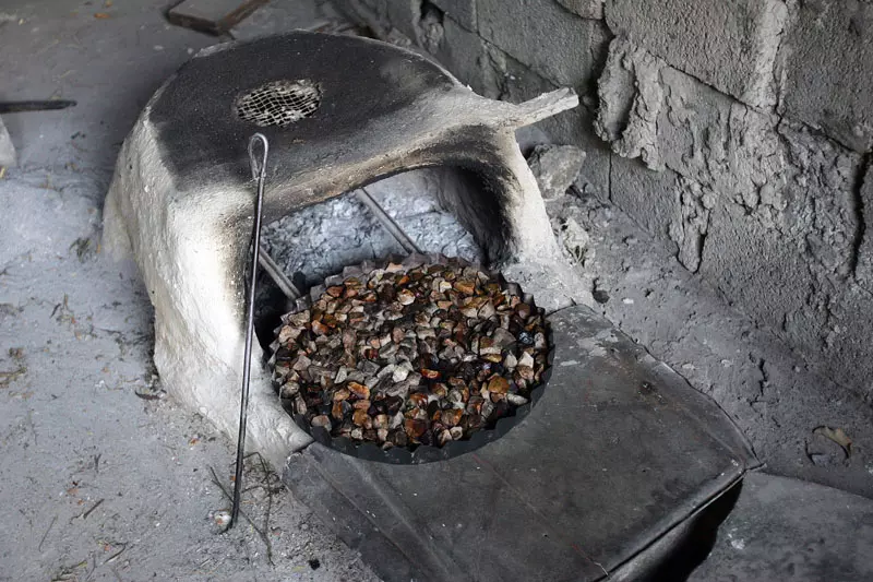
Posted by saher kaddarah - الفرنية التي يخبز الأهالي بها الخبز والتي لا تزال تستعمل في بعض بيوت قفين
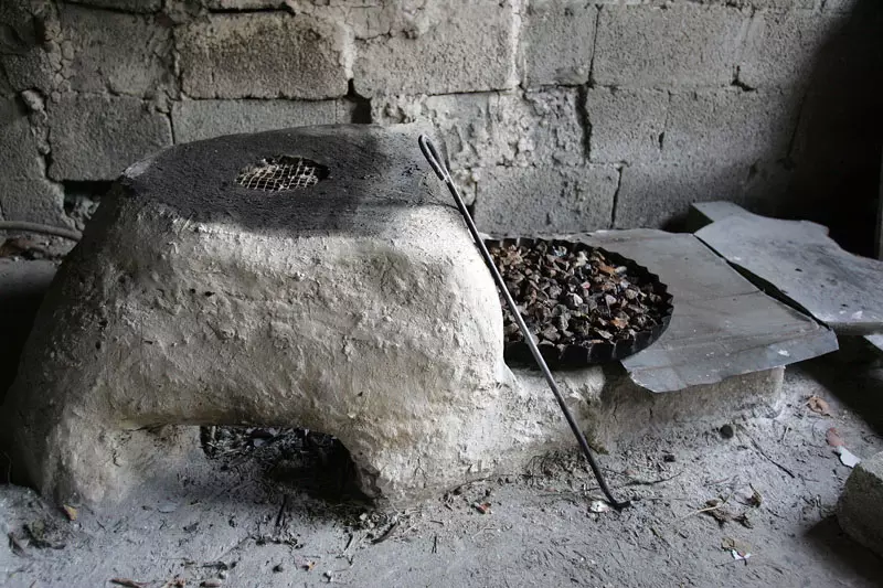
Posted by saher kaddarah 1 - الفرنية التي يخبز الأهالي بها الخبز والتي لا تزال تستعمل في بعض بيوت قفين
Posted by saher kaddarah - شجرة الكينه في ام الرجمان-قفين

Posted by م.عبدالله احمد رشيد هرشه - نزله في حدود وسط البلد

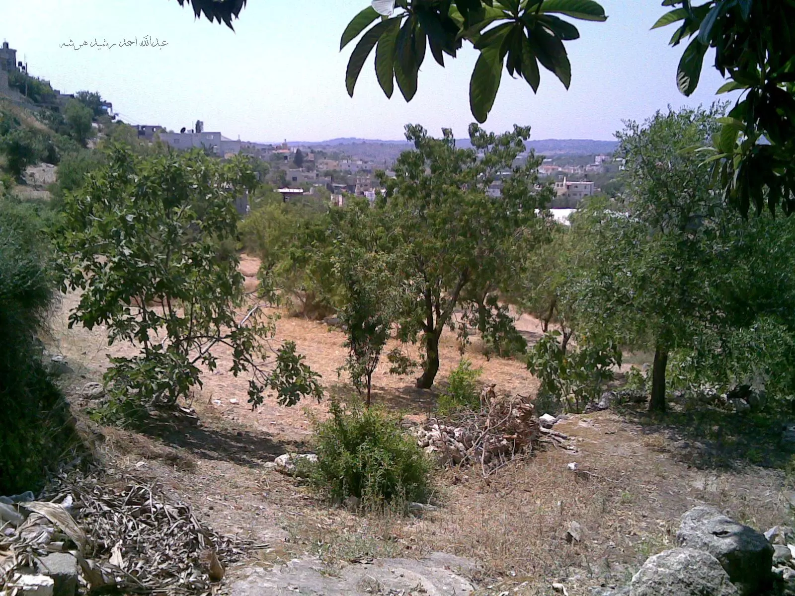
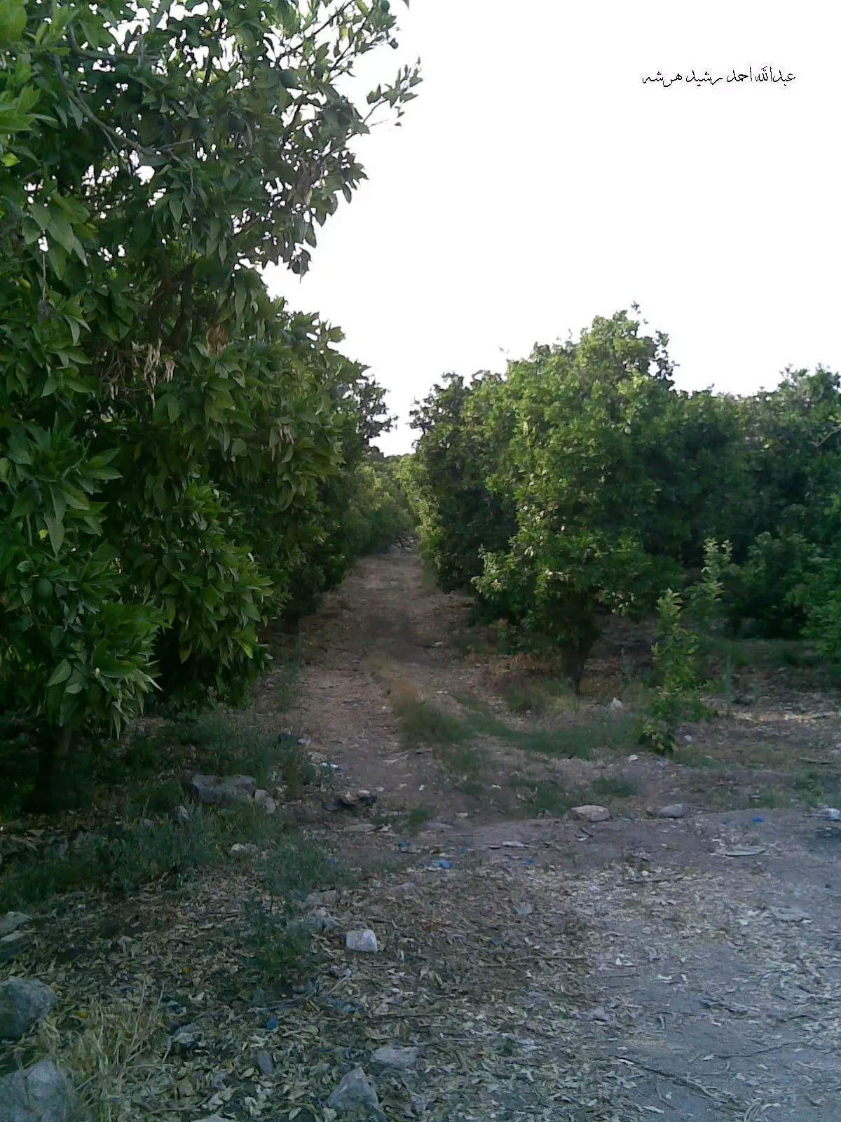
Posted by م.عبدالله احمد رشيد هرشه 1 - منظر للبساتين خلف بيوت وسط البلد
Posted by م.عبدالله احمد رشيد هرشه - بيوت قديمه لبلدة فراسين المندثره -قفين
Posted by م.عبدالله احمد رشيد هرشه - بيوت قديمه لبلدة فراسين المندثره -قفين
Posted by م.عبدالله احمد رشيد هرشه - منظر عام للقريه -اول جنوب قفين
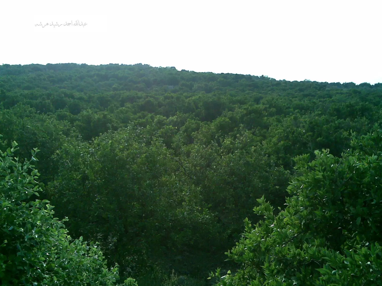
Posted by م.عبدالله احمد رشيد هرشه - البيارات-قفين
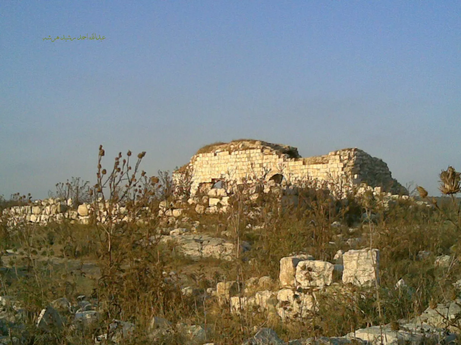
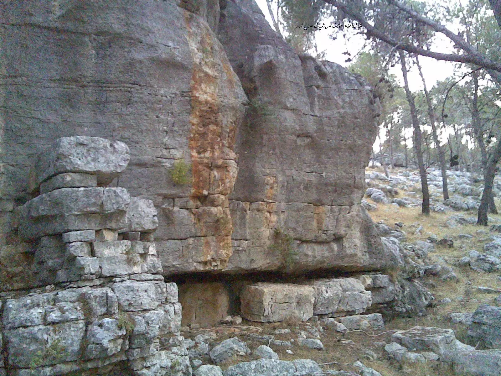
Posted by م.عبدالله احمد رشيد هرشه 1 - اثار بلدة فراسين-قفين
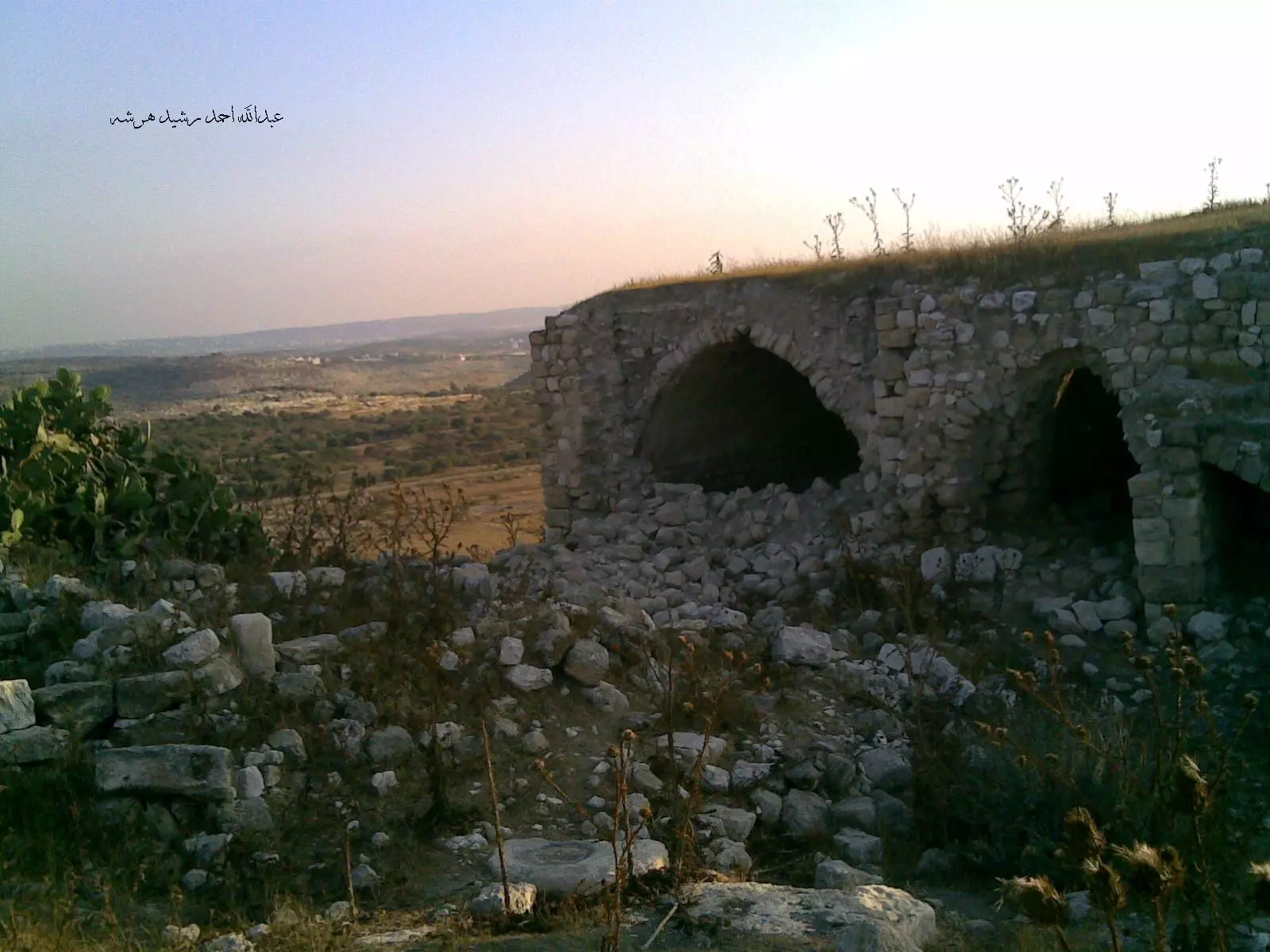
Posted by م.عبدالله احمد رشيد هرشه - اثار بلدة فراسين-قفين

Posted by م.عبدالله احمد رشيد هرشه 1 - البيارات-قفين
Posted by م.عبدالله احمد رشيد هرشه 2 - صخرة عرقان النمر داخل احراش قفين
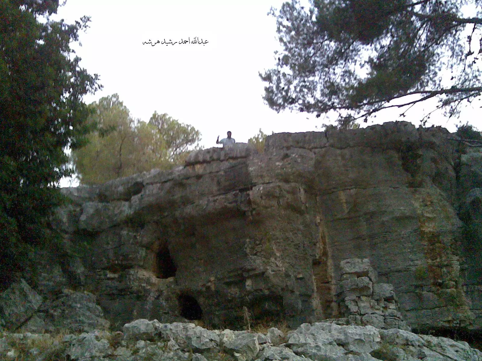
Posted by م.عبدالله احمد رشيد هرشه 1 - صخرة عرقان النمر داخل احراش قفين
Posted by م.عبدالله احمد رشيد هرشه - السيول
Posted by فهمي صباح - سيول في قفين
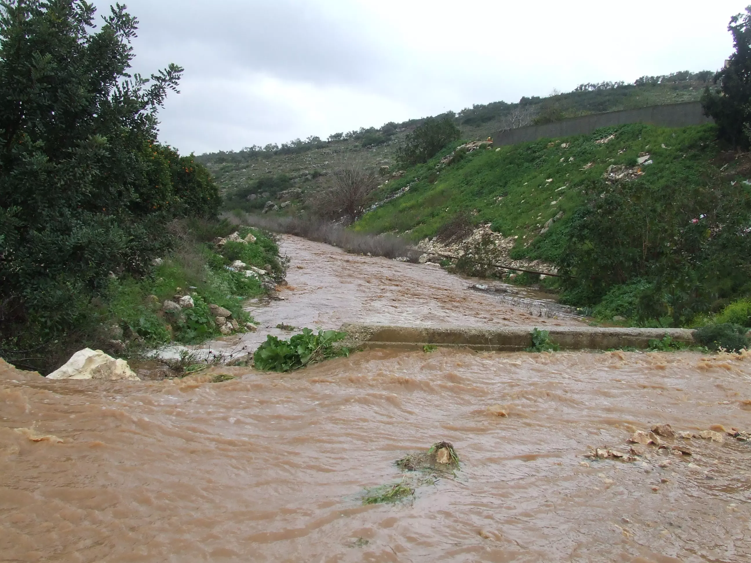
Posted by فهمي صباح - سيول في قفين

Posted by فهمي صباح 1 - سيول في قفين
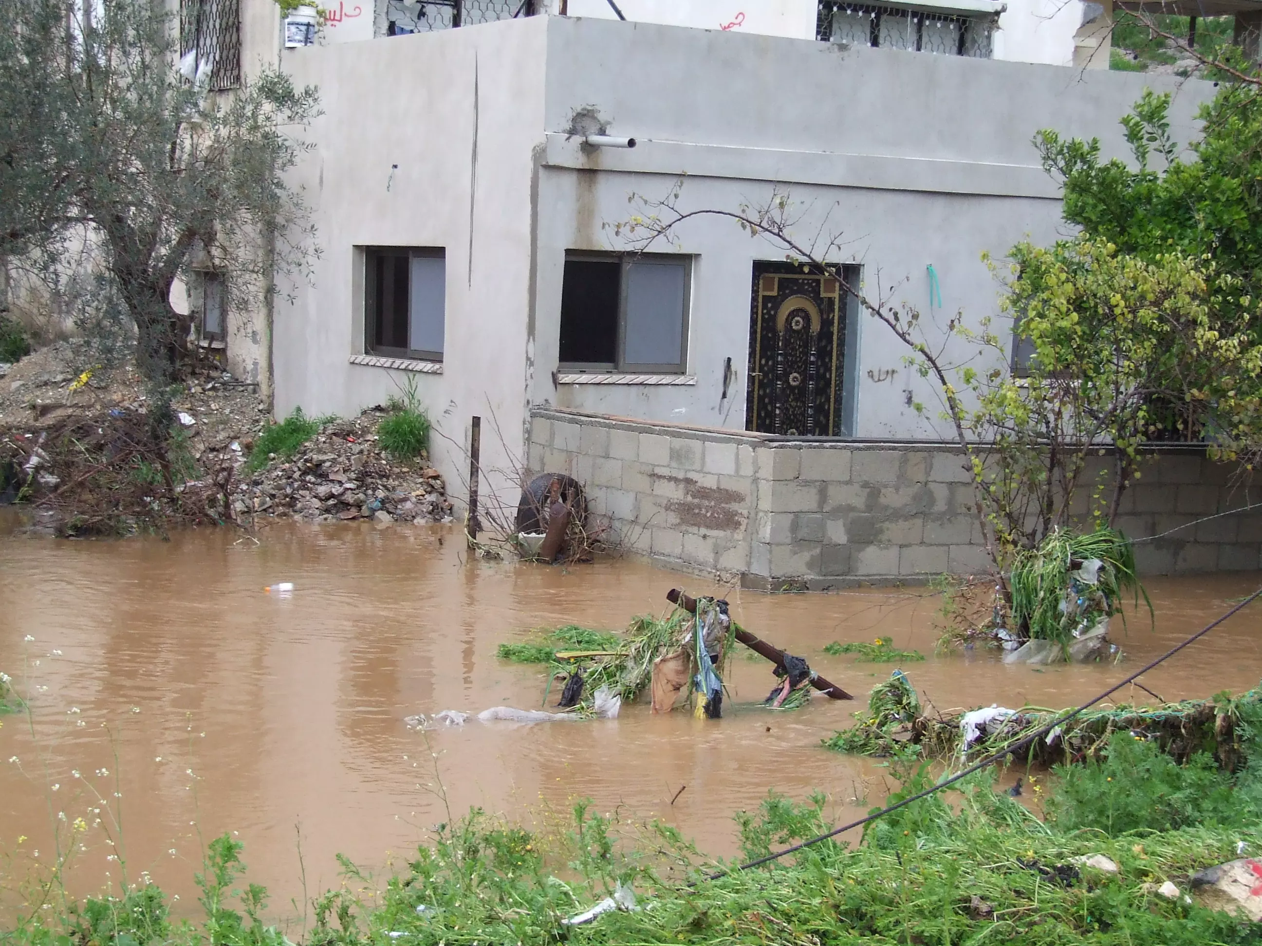
Posted by فهمي صباح - سيول في قفين

Posted by فهمي صباح - منظر عامآخر لقفين من منطقة الحاووز القديم
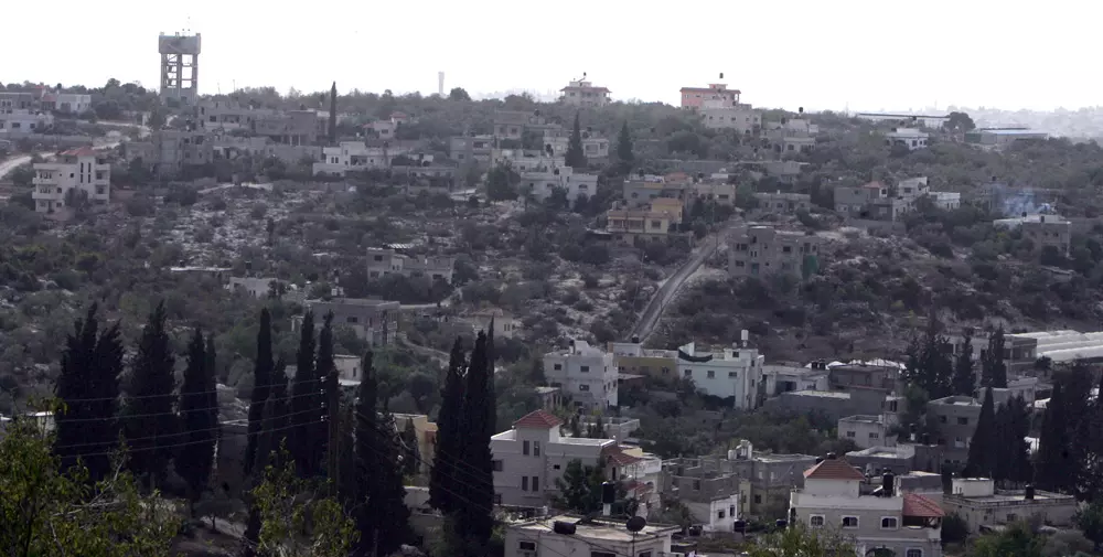
Posted by saher kaddarah 1 - منظر للمنطقة الشمالية من قفين
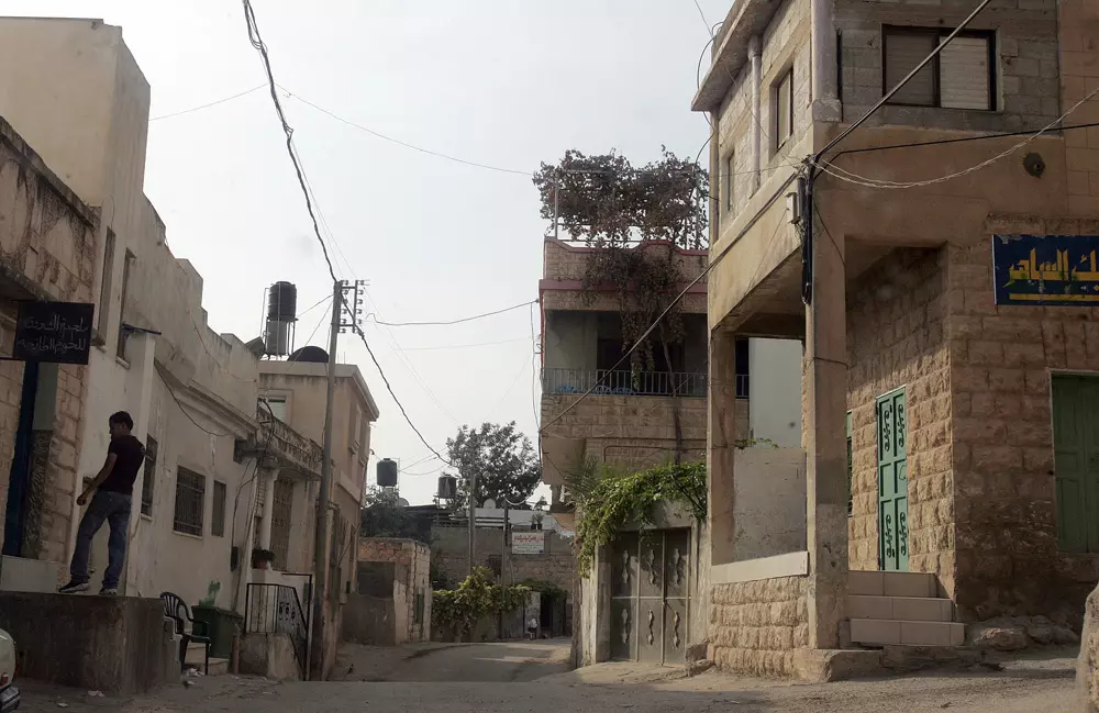
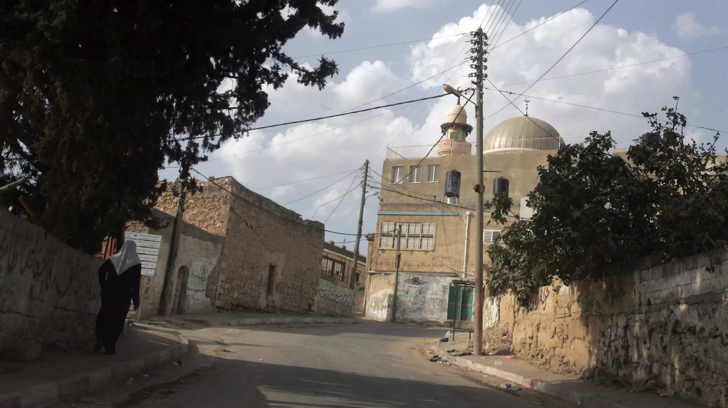
Posted by saher kaddarah - الشارع وسط البلد باتجاه الحارة الشرقية

Posted by saher kaddarah - المدرسة الثانوية الجديدة بالمنطقة الشمالية الغربية من البلد
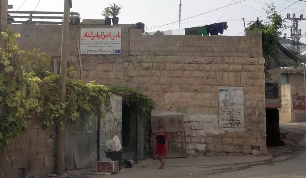
Posted by saher kaddarah - نادي قفين الرياضي الثقافي بوسط البلد
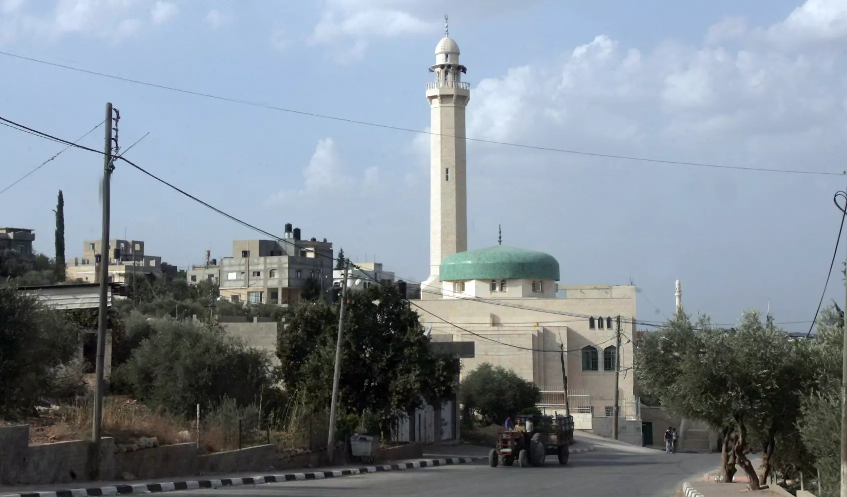
Posted by saher kaddarah 2 - المسجد القديم بوسط البلد

Posted by saher kaddarah - حارات قديمة وسط قفين
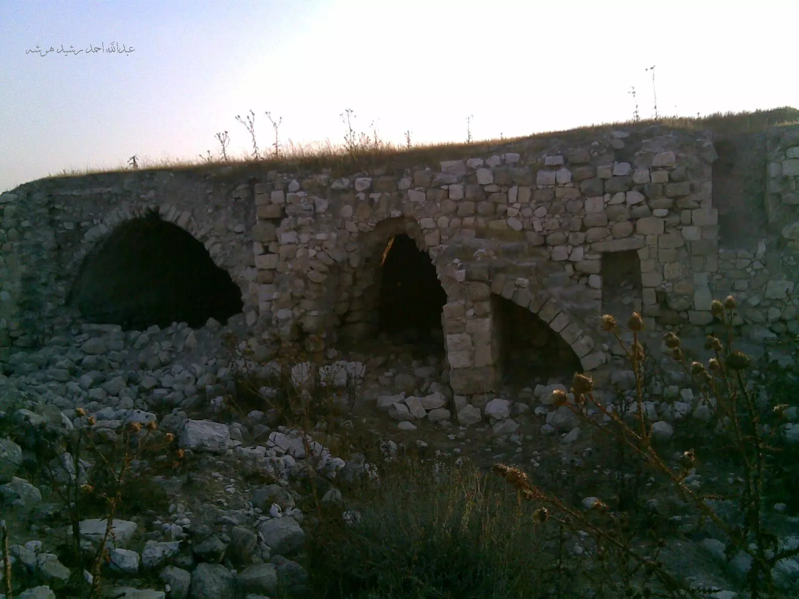
Posted by saher kaddarah 1 - آثار فراسين الشهيرة القريبة من قفين

Posted by saher kaddarah - آثار فراسين الشهيرة القريبة من قفين
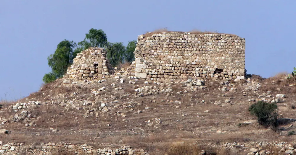
Posted by saher kaddarah - آثار فراسين الشهيرة القريبة من قفين
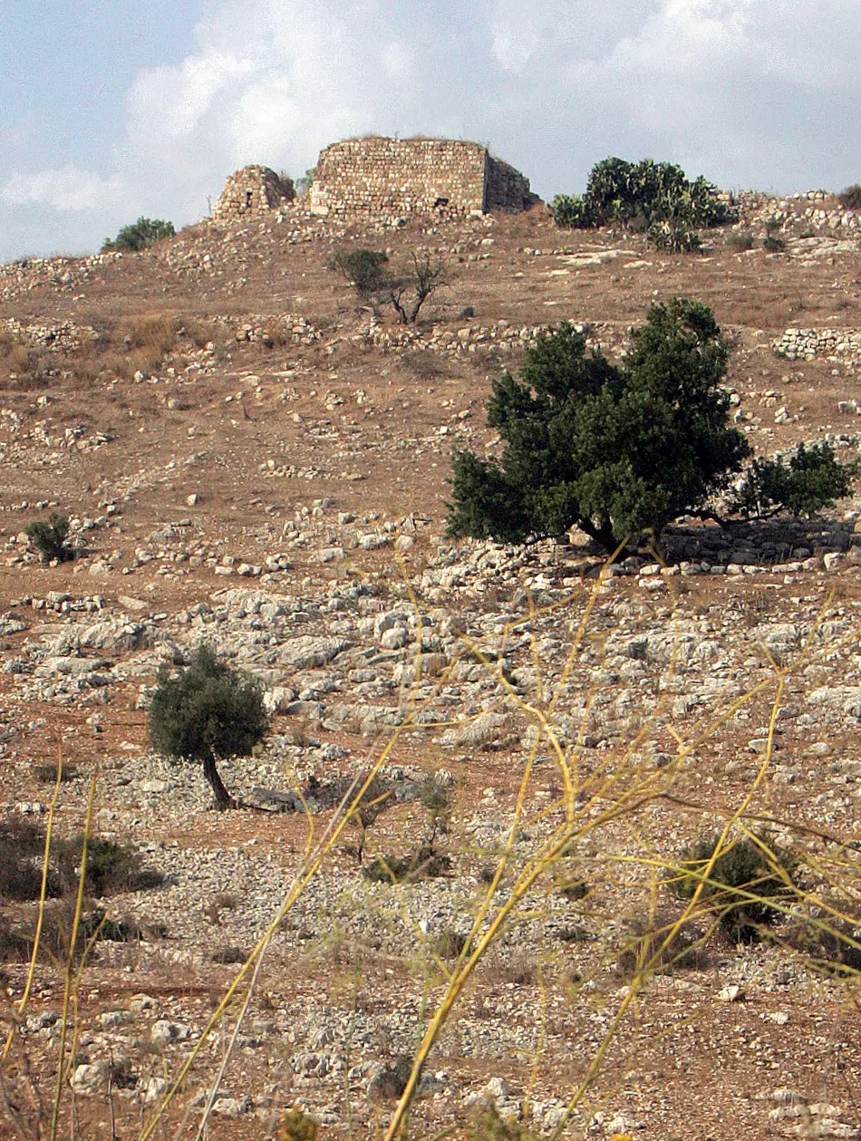
Posted by saher kaddarah - آثار فراسين الشهيرة القريبة من قفين
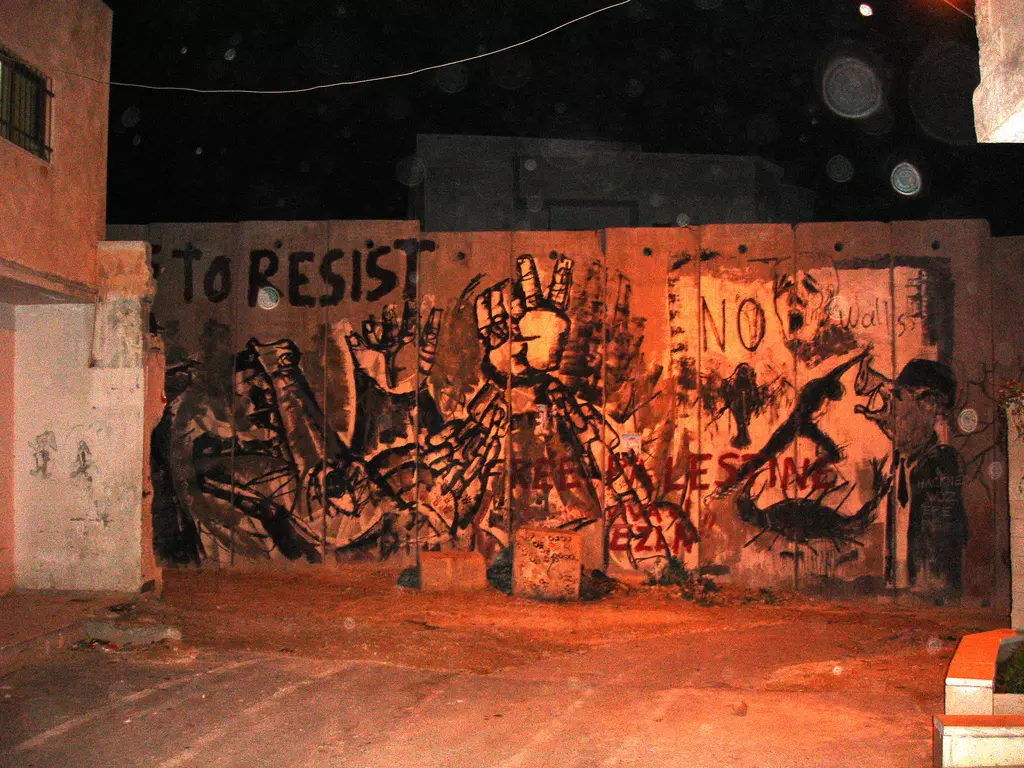
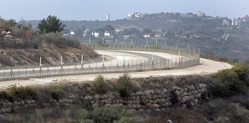
Posted by saher kaddarah - الجدار العنصري الصهيوني غرب قفين والذي ابتلع أغلب أراضي القرية في الناحية الغربية والمزروعة بأغلبها بأشجار الزيتون

Posted by saher kaddarah - الجدار العنصري الصهيوني غرب قفين والذي ابتلع أغلب أراضي القرية في الناحية الغربية والمزروعة بأغلبها بأشجار الزيتون
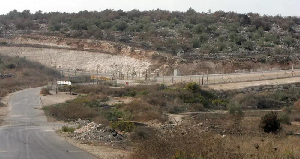
Posted by saher kaddarah - بوابة الجدار الفاصل العنصري التي يعبر منها المزارعون والعمال وأصحاب الأراضي لأراضيهم التي ابتلعها الجدار حيث يتحكم بها جنود الإحتلال الصهيوني
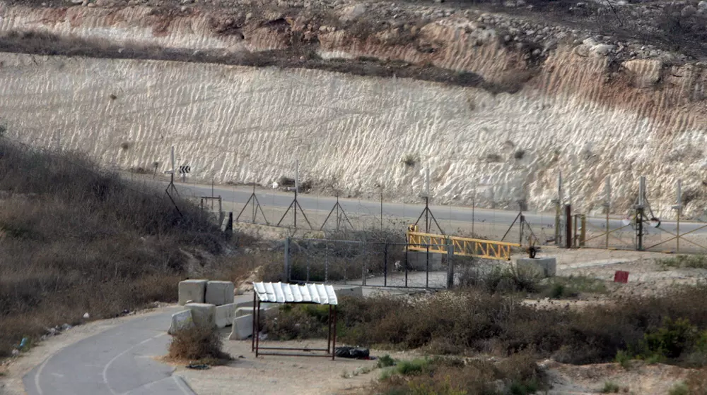
Posted by saher kaddarah - بوابة الجدار الفاصل العنصري التي يعبر منها المزارعون والعمال وأصحاب الأراضي لأراضيهم التي ابتلعها الجدار حيث يتحكم بها جنود الإحتلال الصهيوني
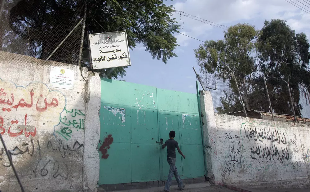
Posted by saher kaddarah - بوابة مدرسة ذكور قفين الثانوية التي تختزل ذكريات جميلة من أيام الدراسة والصبا والفرح
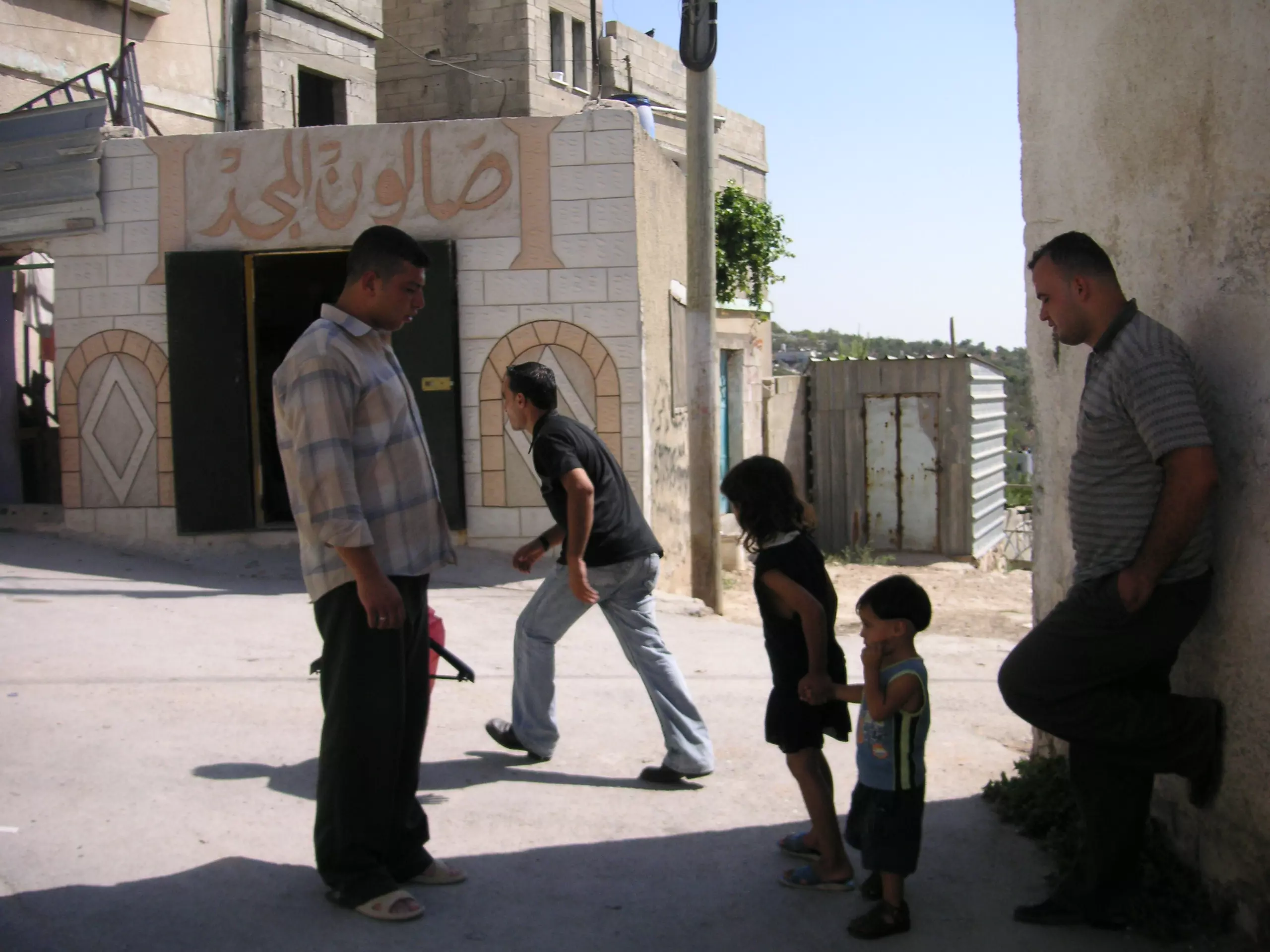
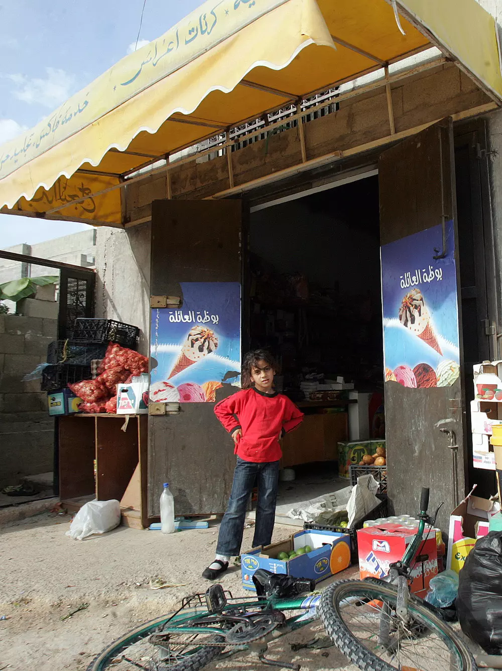
Posted by saher kaddarah - نظرة أمل وتفاؤل بمستقبل مشرق من هذه الطفلة الجميلة على باب دكانة بالحارة الغربية من البلد
Posted by saher kaddarah - مشهد من وسط البلد
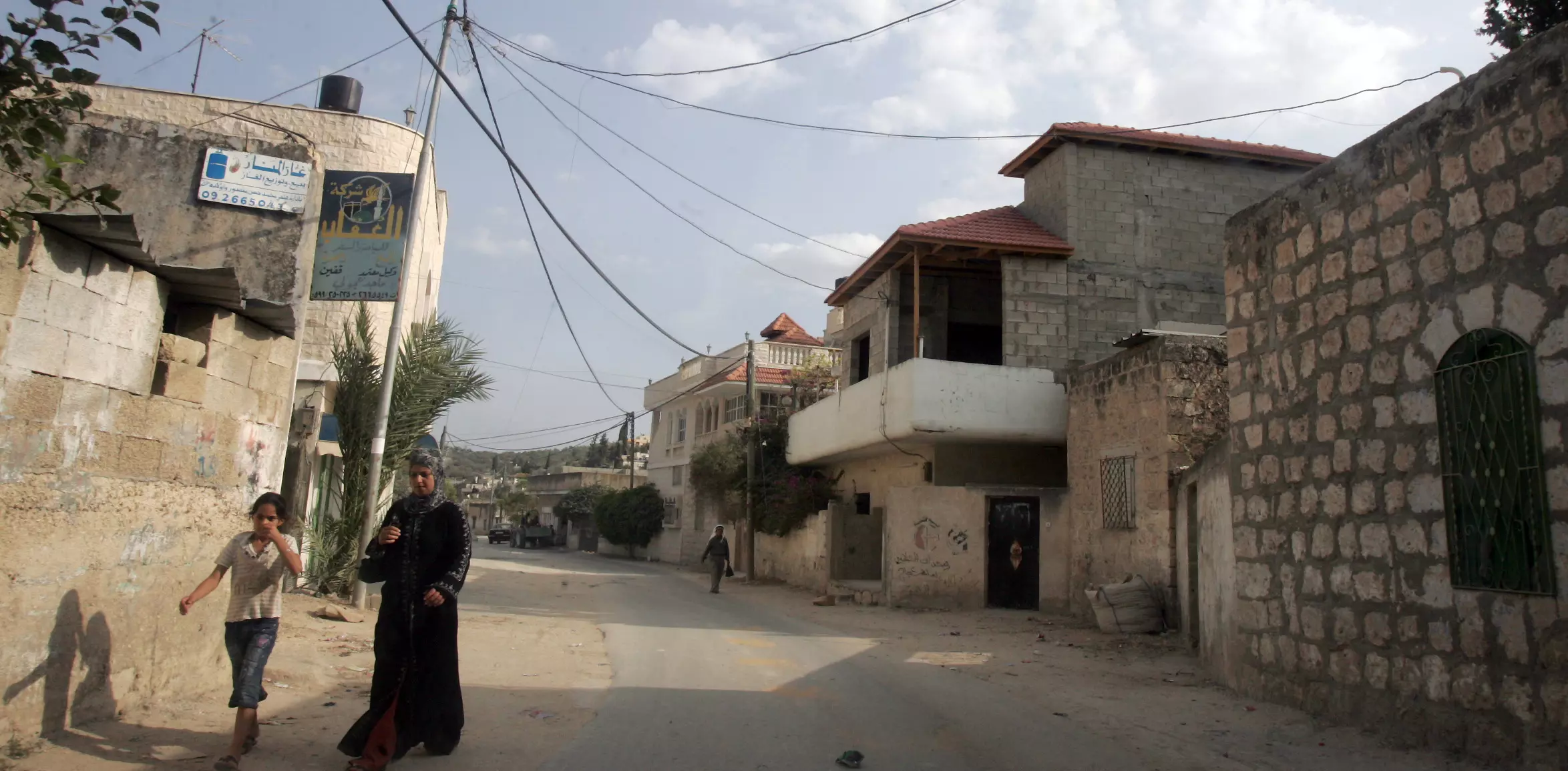
Posted by saher kaddarah - مشهد من وسط البلد
Posted by saher kaddarah - مشهد من وسط البلد باتجاه الحارة الشرقية
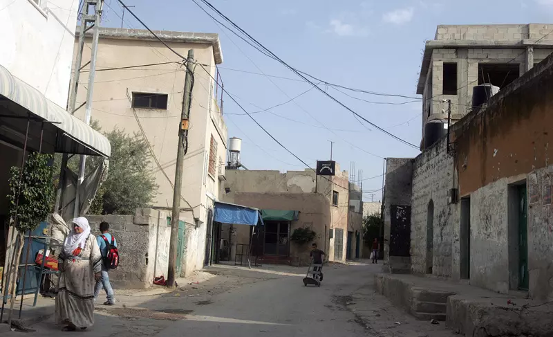
Posted by saher kaddarah - مشهد آخر من وسط البلد باتجاه الحارة الشرقية
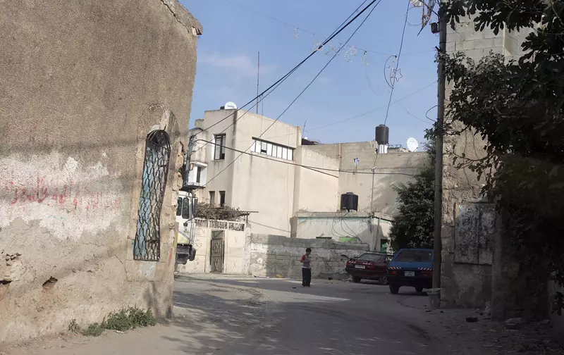
Posted by saher kaddarah - جانب من الحارة الشرقية
Posted by saher kaddarah - جانب من الحارة الغربية

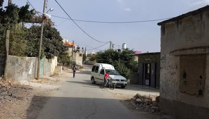
Posted by saher kaddarah - منظر عام تظهر فيه منطقة المدارس

Posted by saher kaddarah - بيوت في الحارة الغربية
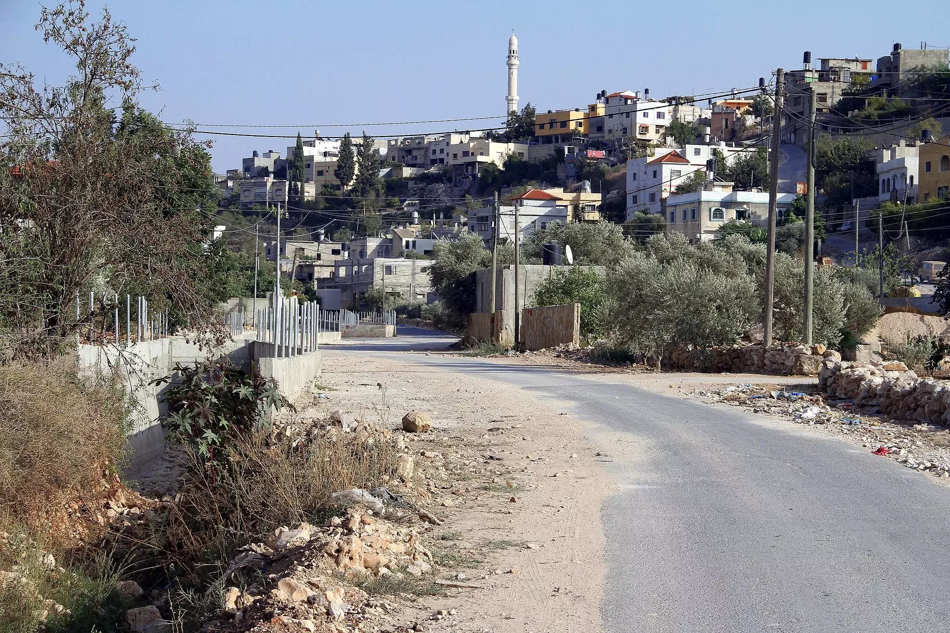
Posted by saher kaddarah - الشارع وسط البلد
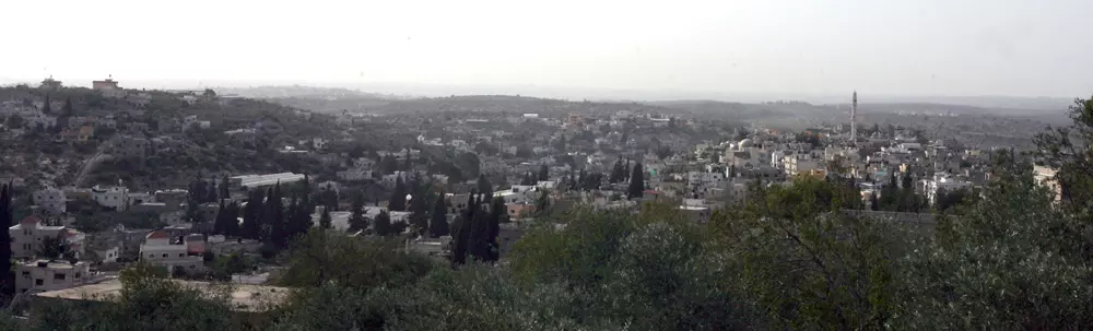
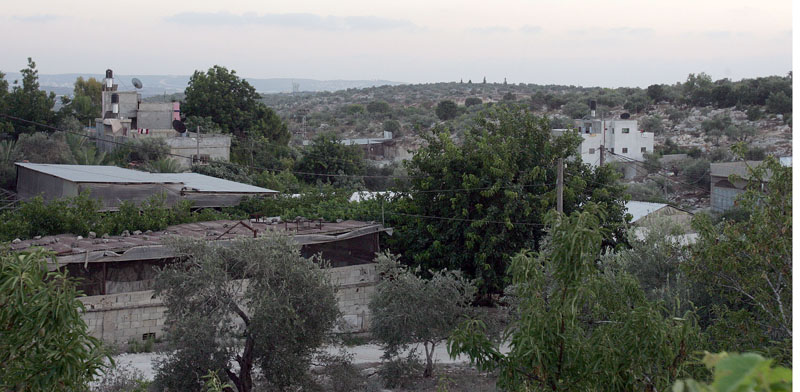
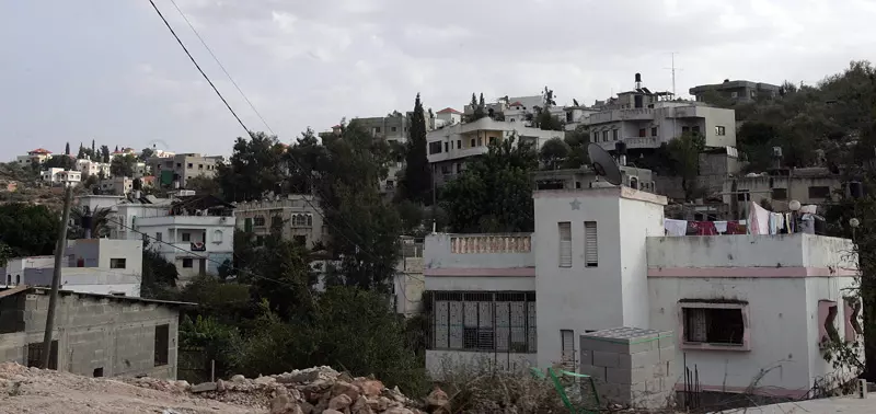
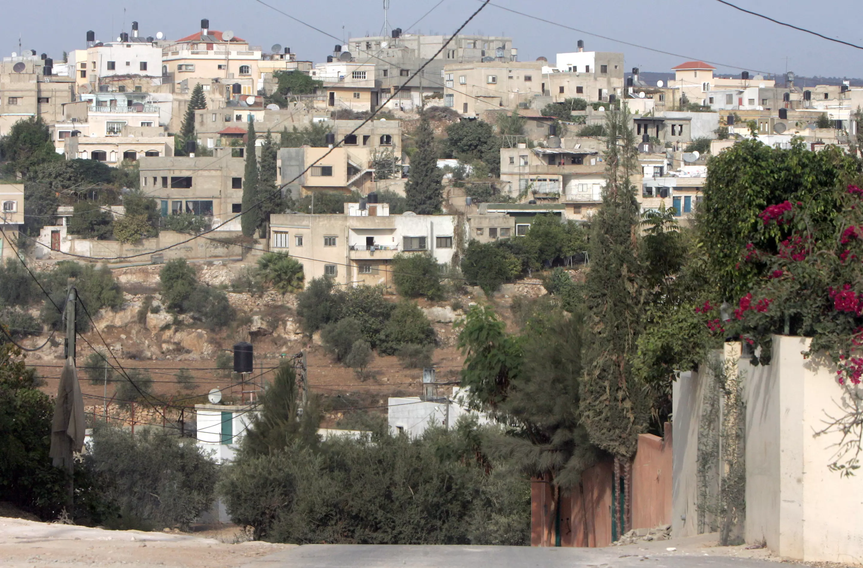
Posted by saher kaddarah - منظر عام

Posted by saher kaddarah 1 - منظر عام
Posted by saher kaddarah - منظر عام
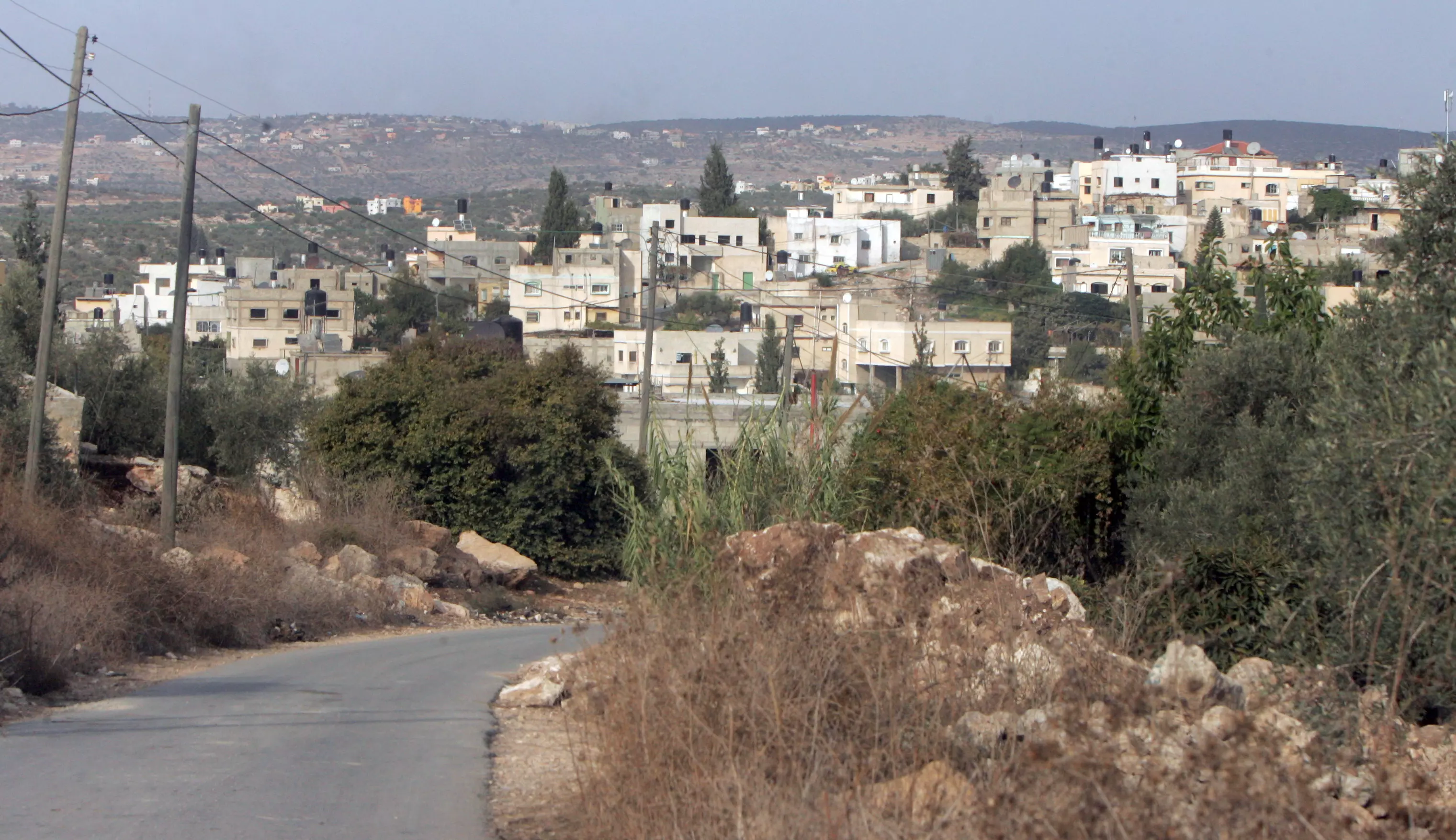
Posted by saher kaddarah - منظر عام
Posted by saher kaddarah - منظر عام
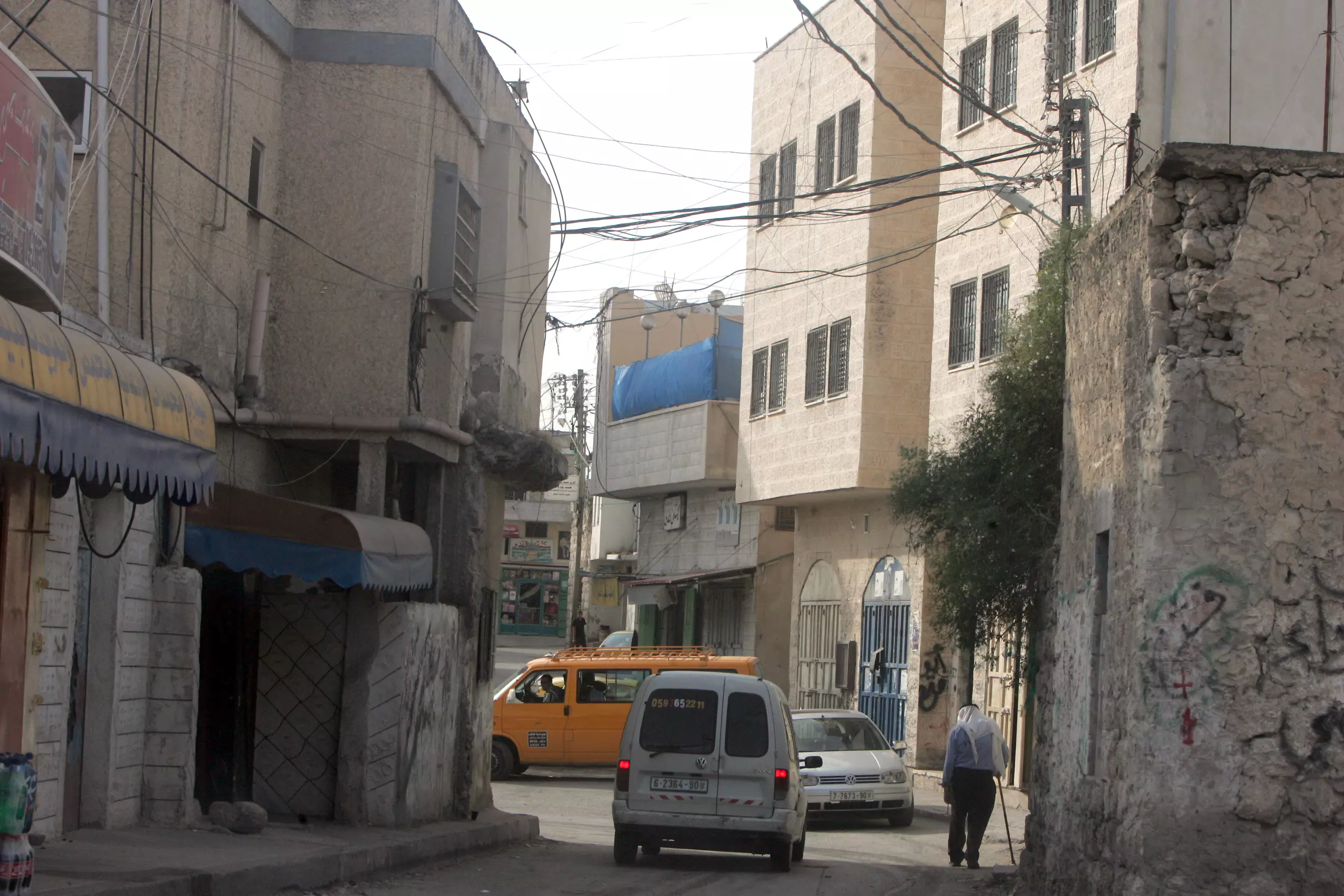
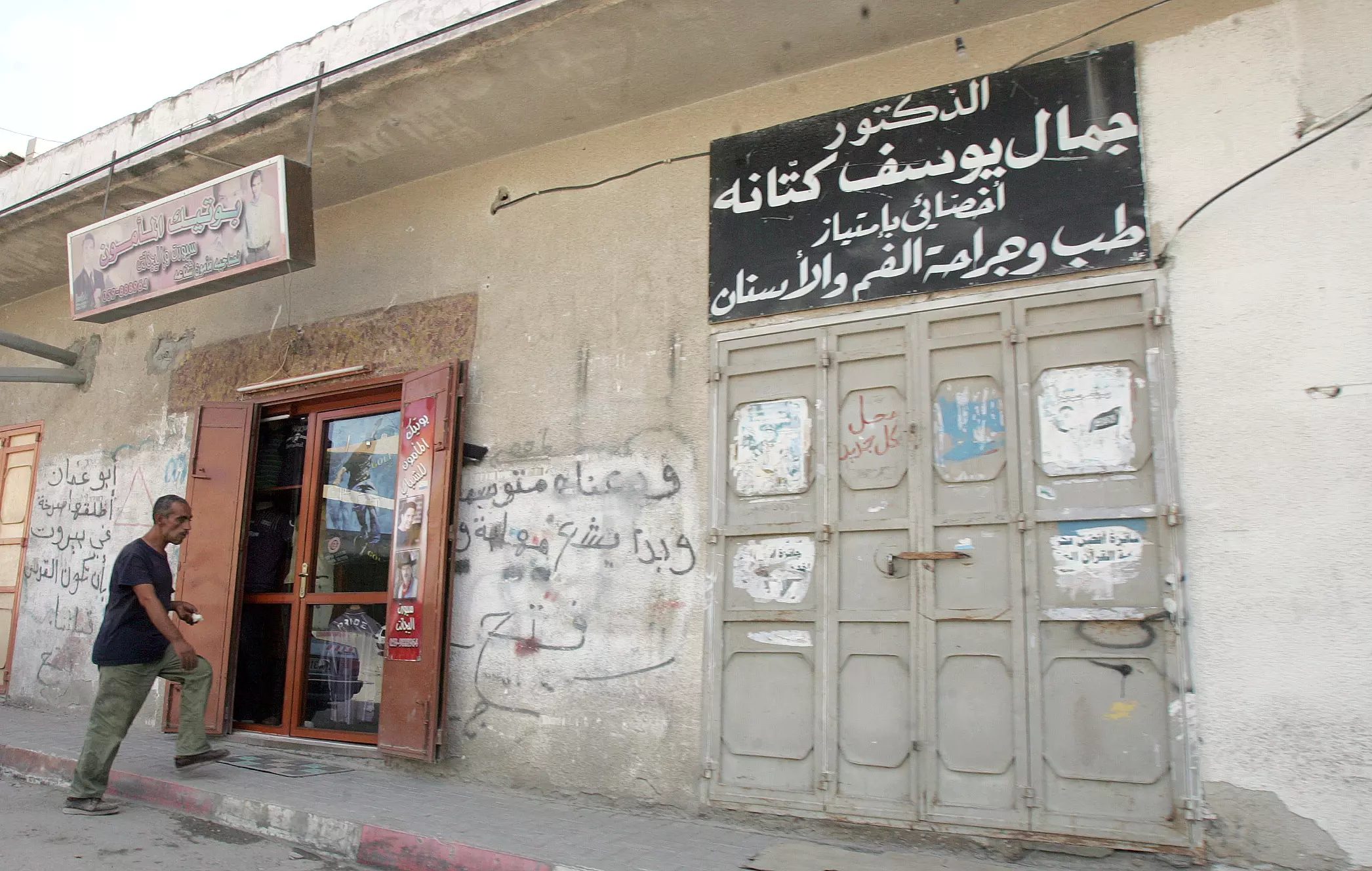
Posted by saher kaddarah - محلات بوسط البلد
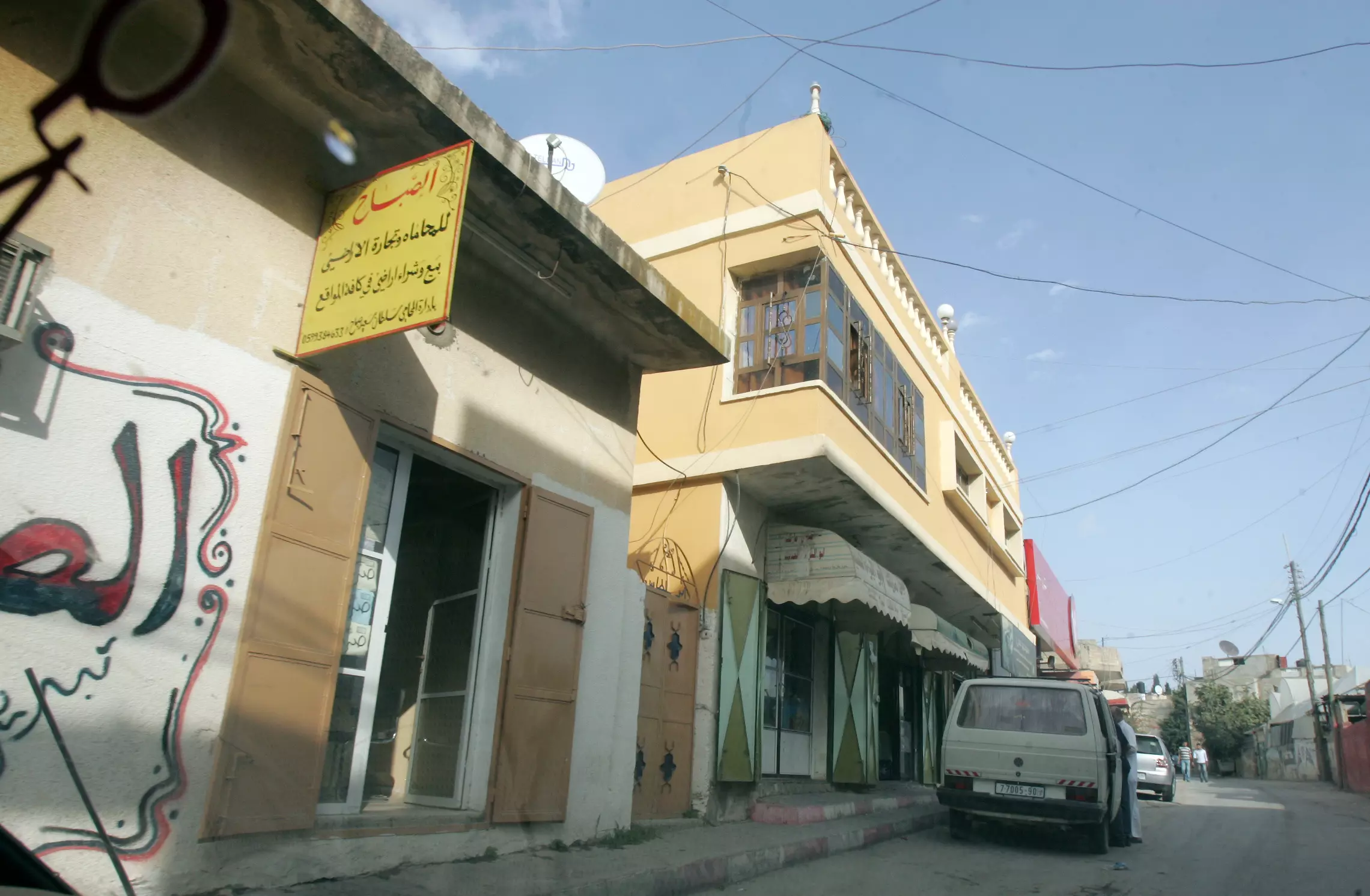
Posted by saher kaddarah - محلات بوسط البلد

Posted by saher kaddarah - محلات بوسط البلد
Posted by saher kaddarah - منظر عام
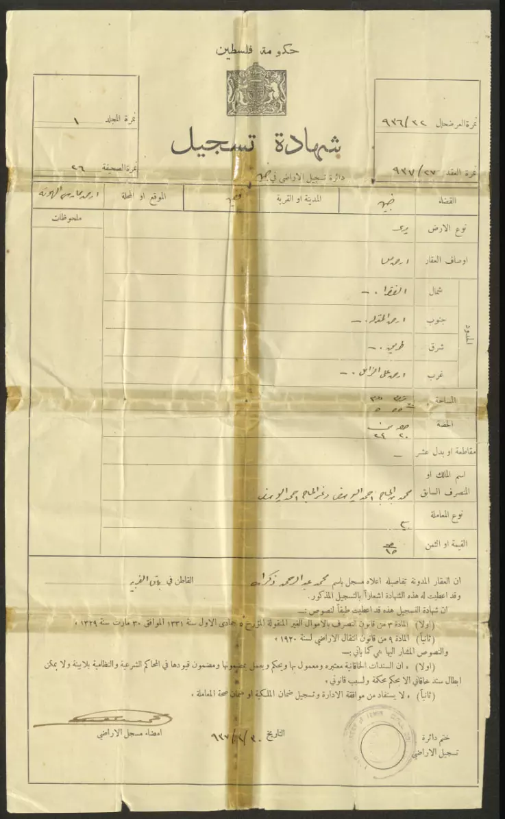
- كوشان لارض في قفين سجلت قبل النكبة عام 1937 وتعود ملكيتها لمحمد عبد الرحمن زكارنة من باقة الغربية
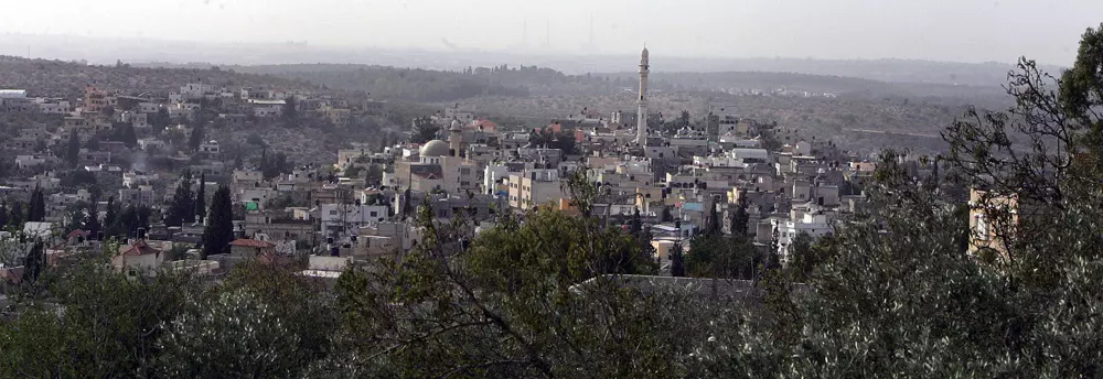
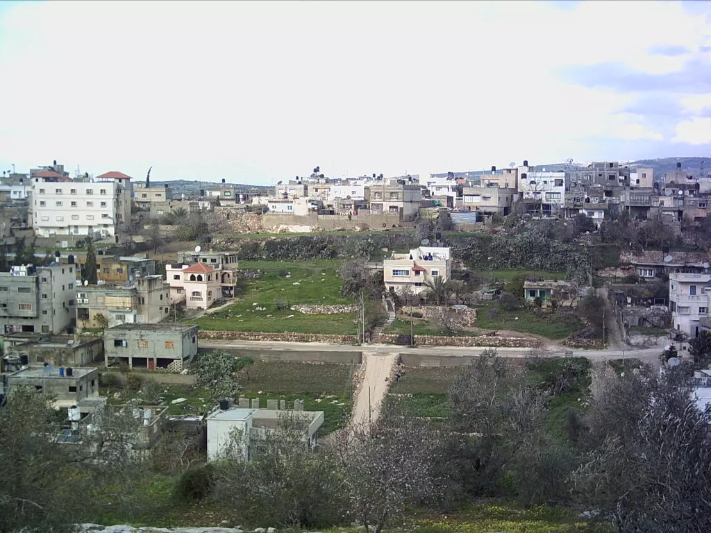
- منظر عام
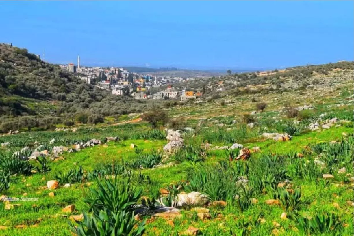
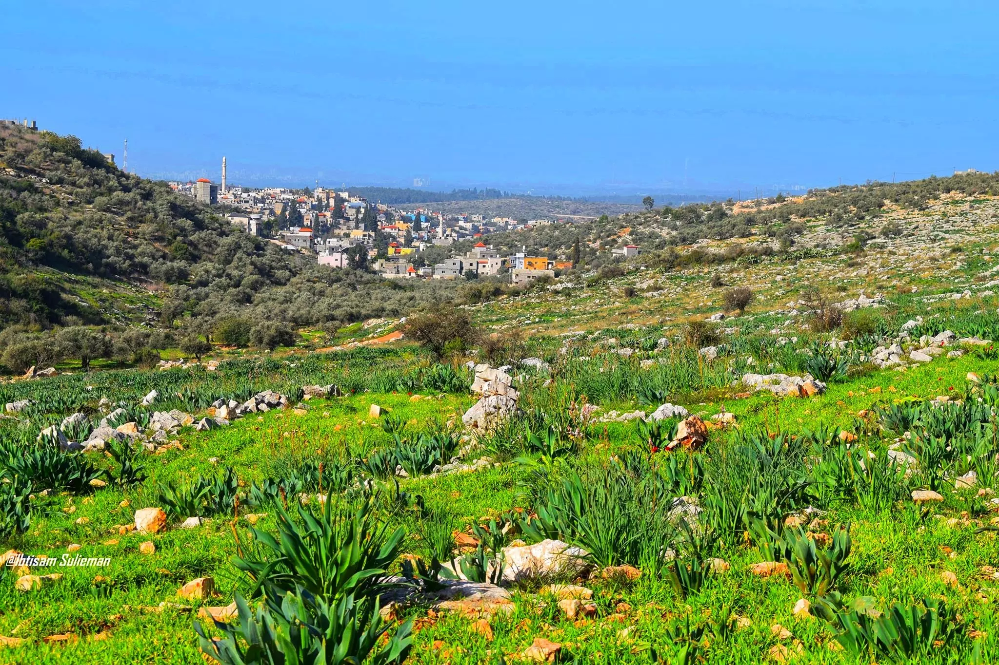
- منظر عام--Ibtisam Sulieman
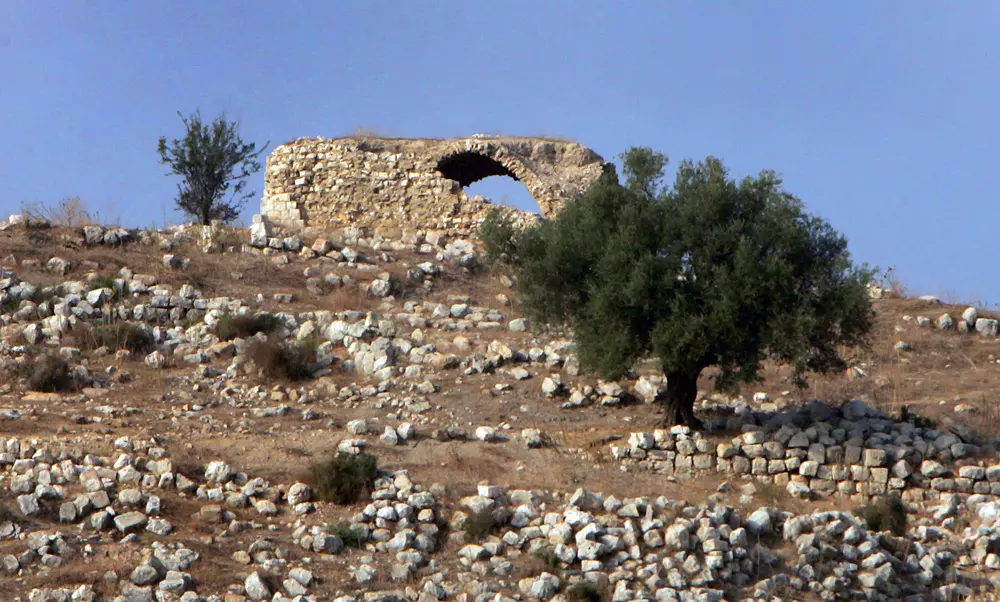
- صور من خربة بير السّيَر المطهرة عرقياً والمدمرة تقريباً كلياً. كانت القرية تُعد من قرى قفّين قبل ال48. الصور هي لمقام الشيخ المجاهد، بقايا بيوت، والبئر الأثري
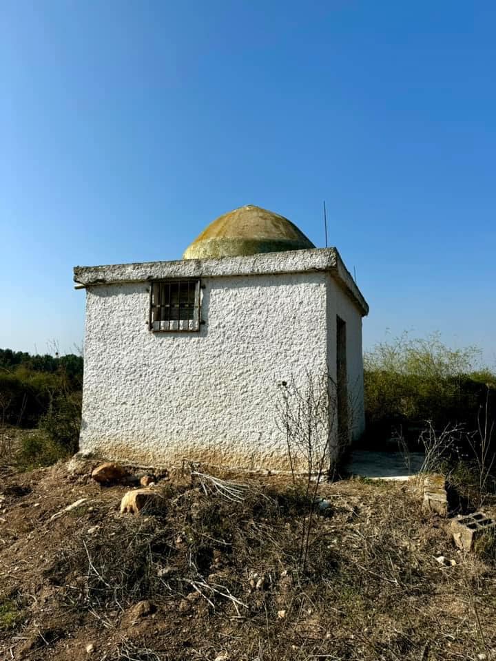
- صور من خربة بير السّيَر المطهرة عرقياً والمدمرة تقريباً كلياً. كانت القرية تُعد من قرى قفّين قبل ال48. الصور هي لمقام الشيخ المجاهد، بقايا بيوت، والبئر الأثري #2
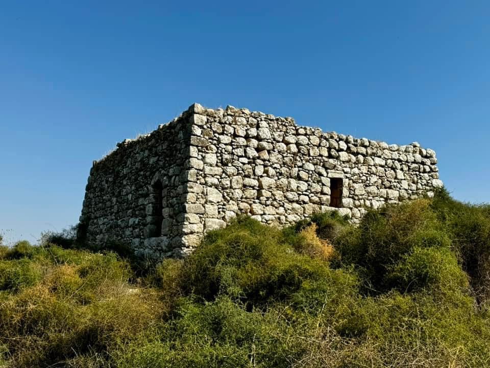
- صور من خربة بير السّيَر المطهرة عرقياً والمدمرة تقريباً كلياً. كانت القرية تُعد من قرى قفّين قبل ال48. الصور هي لمقام الشيخ المجاهد، بقايا بيوت، والبئر الأثري #3
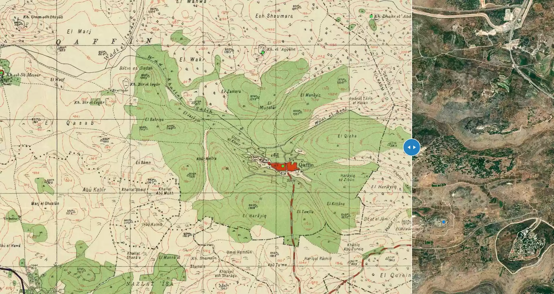
- خارطة تُظهِر الحدود والطرق بأنواعها والأماكن المقدسة والطبيعة الطوبغرافية من تلال وسهول ومنحدرات والتشكيلة الطبيعية للأرض وأنواع المزروعات. نُشرت الخريطة فترة الانتداب البريطاني، تم إضافة تعديلات عليها من قِبَل خدمة الخرائط والصور التابعة للقوات العسكرية الاسرائيلية فترة الأربعينيات.

Want to browse more? 80,000 pictures were grouped in these gallaries:
| Display Name | Clan/Hamolah | Country of Residence |
| ابو احمد | صباح | - |
| Slipknot | - | - |
| MOHAMAD YOUSEF HOURANI | al zaben | alkhobar , saudi arabia |
| عبد الرحمن الخصيب | الخصيب | الشرقية, السعودية |
| ابو احمد | - | - |
| special smile | - | - |
| Fathi Khaseeb | الخصيب | Doha/ Qatar |
| ابو وطن | طعمه | - |
| محمد راضي | هرشة | - |
| وسيم كتاني | - | - |
| Moe Hershey | - | New Jersey, UAS |
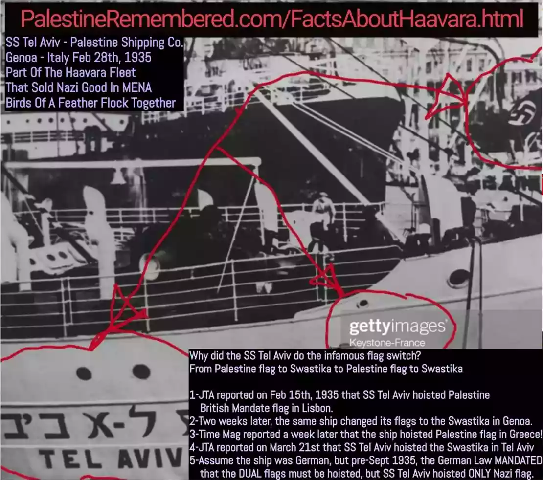 Fake Valor: Why Did Zionist Jews Hoist Nazis Flag on Their Ships in the 1930s?
What is new?
-
Facts About Oct. 7th Gaza Raid
-
Remined Us Please:: Who Did Rape Who? Palestinians Raped Israelis? Or, was the other way around?
-
When Prof. Edward Said was invited to debate Bibi Netanyahu in the 1980s, watch what happened!
-
Ezra Klein of the NY Times on the "Jewish Race".
-
Abusing Blood Libel!
-
Did Israeli Soldiers Activate The Hanniba Direective On Oct. 7th? You Be The Judge
-
Zionist FAQ: Isn't it true that Palestinians don't want peace? Palestinians never accepted the two-state solution
- Facts about Haavara (Transfer) Agreement between Ben-Gurion & Hitler
-
Haavara FAQs: Why Did Zionist Jews Hoist Nazis' Flags on Their Ships in the 1930s?
- Haavara FAQs: When Chaim Weizmann met FDR in mid-1943, why was he silent about rescuing European Jewry?
-
Dear ChatGPT: How did Palestinians resist Napoleon's invasion of their country in 1799?
-
Dear ChatGPT: Gaza had a vibrant Jewish community in the mid-17th century. What happened to them?
-
Dear ChatGPT: Why did the Jewish Agency suppress news of the Holocaust during WWII?
-
Video Playlist: Jews share their DNA tests to end the conflict for good.
-
A Tale of Two Conflicts: Examining the Definition of Genocide
-
Prof. Abraham Polak And The Suppressed History of the Khazars and European Jewry
-
How Ronald Reagan would have framed the genocide in Gaza if he were still alive?
-
Haavara FAQs: Let us do the math: how many German Jews did The Haavara Agreement save?
-
Zionist FAQs: The Hebron Massacre of 1929, "clearly proves" that Palestinians are antisemitic, how could you deny it?
-
Zionist FAQs: Why Anti-Zionist Is Not Antisemitism?
-
Zionist FAQs: Isn't it true that the KGB created Palestinian Nationalism in the early 1960s?
- Zionist FAQs: Muslims are killing Muslims all the time; why are Israeli Jews being singled out in the media?
- Zionist FAQs: How is Israel an apartheid state when 20% of its citizens are Arabs who enjoy full rights?
-
Haavara FAQs: Why Did Dorothy Thompson Flip From A Zionist Advocate to A Silenced Dissenter?
-
Haavara FAQs: Analysis of Herzl's Uganda Scheme and how it could have saved millions of Jews.
-
Haavara FAQs: Why did Hayim Greenberg describe American Jewry as "morally bankrupt" in early 1943?
-
Haavara FAQs: What if the Evian Conference was a resounding success? What would have been the impact of saving European Jewry on Zionism?
- Haavara FAQs: What if the six million were saved, how that would have impacted the Zionist project?
-
Haavara FAQs: How did Zionist leaders react when Europe's Jews lingered in the DP camps after WWII ended?
-
Why does the American Jewish community repeat lies that David Ben-Gurion had debunked before he died?
-
Who has the power to rename the Tatar/Khazar Gene Marker to Jewish IV?
-
Zionist FAQs: Why won't Egypt, Syria, and Jordan take their people back? Jews are indigenous to Palestine, and Arabs immigrated after Jews developed the country. Arabs should leave.
-
Haavara FAQs: Did Hitler and the Nazis conflate between Judaism and Zionist? If that wasn't case, then why?
-
Haavara FAQs: Winston Churchill and antisemitism, a collection of articles written Churchill.
-
Haavara FAQs: Broken by country, how many Jews survived vs. killed during the Holocaust?
-
Haavara FAQs: Why did European Jews vote with their feet and to immigrated to the Americas, not Palestine, after WWII?
-
Watch this American Jewish Girl describing Israeli Jews' cognitive dissonance like no other in under two minutes
-
Haavara FAQs: When the Nazis went out of their way to hide the Holocaust, Israeli Jews did the exact opposite by broadcasting their genocide of Gazans. But why?
-
Haavara FAQs: How Zionist Jews went out of their to show their appreciation to Nazism and Fascism?
- Haavara FAQs: Why Zionist leaders were against bombing the death camps & the Railroads leading to them?
-
Haavara FAQs: Hitler's message to the British and American people: If Jews are such noble citizens and you care about them, how come you're not letting them in? I will gladly ship them to you at my expense, even on luxury liners!
-
A shortlist of Zionist and Israeli false flag operations in the name Jews.
-
The Most Moral Army
- The Land of Kapos (Israel): Where the brave are boycotted and Kapos walk free.
- Why did early Zionists often named their communal enterprises "colonial"?
- Zionist Relations with Nazi Germany by Faris Glubb
-
Two NY Times advertisements by Zionists in the early 1943 that exposes Zionists' treason at the height of the calamity
- Facts Not Lies about the Palestinian-Israeli Conflict.
- Site's pictures have been categorized
- Campgain Against Lice
- A Survey of Palestine, the official source about Palestine before Nakba produced by the British Mandate; over 1200 pages.
- Satellite View & Google Earth: Over 6,000 placemarks identifying all destroyed towns, W. Bank & Gaza Strip Towns, & refugee camps.
- PalestineRemembered.com and its Nakba Oral History Project were featured on al-Jazeera Satellite TV.
- Nakba Oral History Video Podcast:
 Over 700 Oral History interviews (including 3,500+ hours of recording) can be viewed online.
 - Palestine Village Statistics Project
- Gaza Jail Break
- النسخة العربية للموقع الان متوفرة
- Videos: Documenting the destroyed villages in video: Tracing all that remains since Nakba.
- Videos: Responding to Zionist Propaganda
- Interview: The ethnic cleansing of Palestine: George Galloway interviews Israeli Historian Ilan Pappe.
- For Palestinians, memory matters. It provides a blueprint for their future By George Bisharat.
- Zionist FAQ now available in Hebrew שאלות שציונים שואלים, עכשיו בעברית
- Video: The Stephen Walt and John Mearsheimer report on the influence of the Israel Lobby on U.S. Foreign Policy
- The Palestinian-Israeli conflict for beginners