| PalestineRemembered | About Us | Oral History | العربية | |
| Pictures | Zionist FAQs | Haavara | Maps | |
| Search |
| Camps |
| Districts |
| Acre |
| Baysan |
| Beersheba |
| Bethlehem |
| Gaza |
| Haifa |
| Hebron |
| Jaffa |
| Jericho |
| Jerusalem |
| Jinin |
| Nablus |
| Nazareth |
| Ramallah |
| al-Ramla |
| Safad |
| Tiberias |
| Tulkarm |
| Donate |
| Contact |
| Profile |
| Videos |
Welcome To Abu al-Fadl - أبو الفضل (السطرية) (אבו אל-פדל)
|
District of al-Ramla
Ethnically cleansed days ago |
العربية Google Earth |
| Gallery (10) |
- Statistics & Facts
-
Before & After

- Satellite View
- Articles 4
- Pictures 10
- Oral History 1
- Members 11
- Families
- All That Remains
- Wikipedia
- Videos
- Guest Book 3
- Links 1
| Statistic & Fact | Value | ||||||||||||||
| Occupation Date | May 9, 1948 | ||||||||||||||
| Distance From District | 4 (km) Northwest of al-Ramla | ||||||||||||||
| Elevation | 75 (meters) | ||||||||||||||
| Before & After Nakba, Click Map For Details |
|||||||||||||||

|
|||||||||||||||
| Map Location | See location #11 on the map View from satellite |
||||||||||||||
| Military Operation | First stage of Operation Dani | ||||||||||||||
| Attacking Units | Either Har'el Brigade or Giva'ti Brigade | ||||||||||||||
| Exodus Cause | Influence of fall of, or exoduce from, neighboring town | ||||||||||||||
| Village Temains | Abu Fadl was mostly destroyed, and only five of its houses remain standing. | ||||||||||||||
| Ethnically Cleansing | Mostly terrorized out after the attack on Bir Salim on the May 9th, 1948. | ||||||||||||||
| Pre-Nakba Land Ownership |
**Town Lands' Demarcation Maps |
||||||||||||||
| Land Usage As of 1945 |
|
||||||||||||||
| Population |
|
||||||||||||||
| Near By Towns |
|||||||||||||||
|
|
|||||||||||||||
| Town's Name Through History | The village was also known by al-Sawtariyya. | ||||||||||||||
| Inhabitants Place of Origin | Most villagers trace their roots back to nomadic Bedouins from nearby Khan Yunis (in the Occupied Gaza Strip), known by the 'Arab Abu al-Fadl or al-Satariyya. | ||||||||||||||
| Exculsive Jewish Colonies Who Usurped Village Lands |
The suburbs of Rishon le-Tziyyon | ||||||||||||||
| Featured Video | |||||||||||||||
Village TodayAccording to the Palestinian historian Walid Khalidi, the village remaining structures on the village land are:"Of the original village houses, no more than five still stand, deserted and nearly collapsing. One of these houses, located at the edge of a citrus grove, is made of cement blocks, with rectangular doors and windows and a tiled, sloping roof". |
|||||||||||||||
| Related Maps | Town Lands' Demarcation Maps خرائط للقضاء توضح حدود القرى والاودية Town's map on MapQuest View from satellite Help us map this town at WikiMapia |
||||||||||||||
| Related Links | Wikipedia's Page Google Search Google For Images Google For Videos |
||||||||||||||
| More Information | في كتاب كي لا ننسى في كتاب بلادنا فلسطين المزيد من موقع هوية |
||||||||||||||
- منظر عام
Posted by رمضان 1 - اراضي القريه
Posted by abu raya - اراضي القريه
Posted by abu raya - موقع القريه والمستوطنه المقامه على اراضيها
Posted by abu raya - الربيع في القريه
Posted by abu raya - الربيع في القريه
Posted by abu raya - من موقع القريه
Posted by abu raya - الربيع في القريه وبيوت المستوطنين
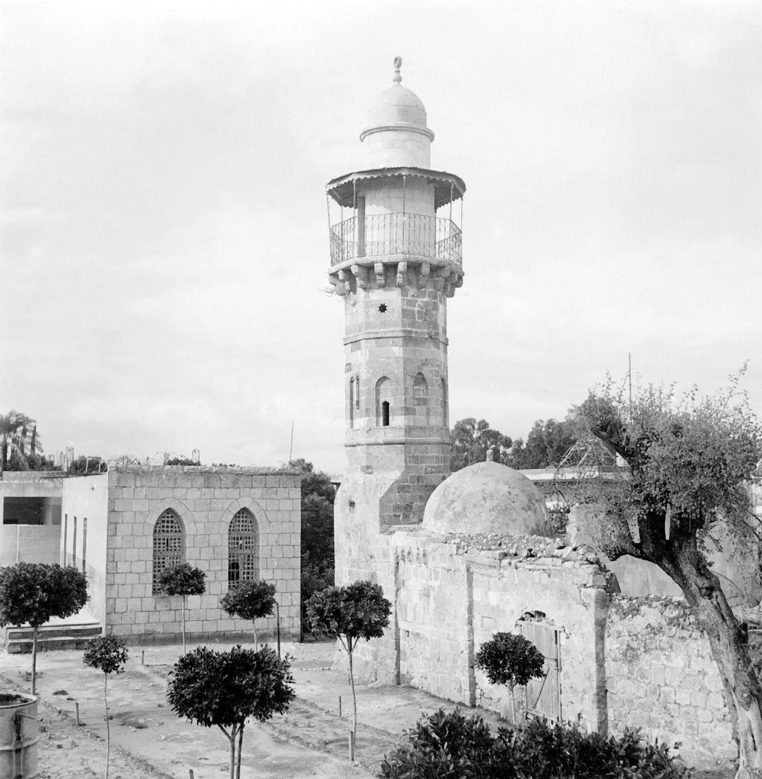
Posted by abu raya - جامع ابو الفضل - قرية ابو الفضل المهجرة قضاء الرملة سنة 1940
- أحد البيوت المتبقية من قرية أبو الفضل (السطرية) المهجرة (قضاء الرملة) --- بروفيسور مصطفى كبها
Want to browse more? 80,000 pictures were grouped in these gallaries:
| Display Name | Clan/Hamolah | Country of Residence |
| Dia'a Abu Siam | أبوصيام السطري | الأردن, الرمثا |
| Inaam . | - | - |
| هبة الشوبكي | الشوبكي | عمان, الأردن |
| شريف ابوسمرة | - | خانيونس, فلسطين |
| وليد عبدالقادر | السطري | قطر, قطر |
| ahmad shobaki | الشوبكي | - |
| m83hmd | - | الاردن |
| hiba.ramla | - | - |
| mansour shoubaki | - | - |
| nawwaf alshowbaki | al-skowbaki | - |
| Marwan Eideh | EIDEH | - |


