| PalestineRemembered | About Us | Oral History | العربية | |
| Pictures | Zionist FAQs | Haavara | Maps | |
| Search |
| Camps |
| Districts |
| Acre |
| Baysan |
| Beersheba |
| Bethlehem |
| Gaza |
| Haifa |
| Hebron |
| Jaffa |
| Jericho |
| Jerusalem |
| Jinin |
| Nablus |
| Nazareth |
| Ramallah |
| al-Ramla |
| Safad |
| Tiberias |
| Tulkarm |
| Donate |
| Contact |
| Profile |
| Videos |
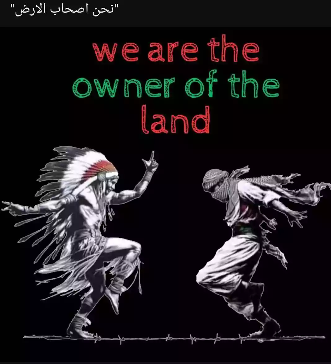
Welcome To Qaryet al-'Inab/Abu Goush - أبو غوش (قرية العنب) (אבו גוש)
|
District of Jerusalem
Occupied days ago |
العربية Google Earth |
 |
Gallery (84) |
- Statistics & Facts
-
Before & After

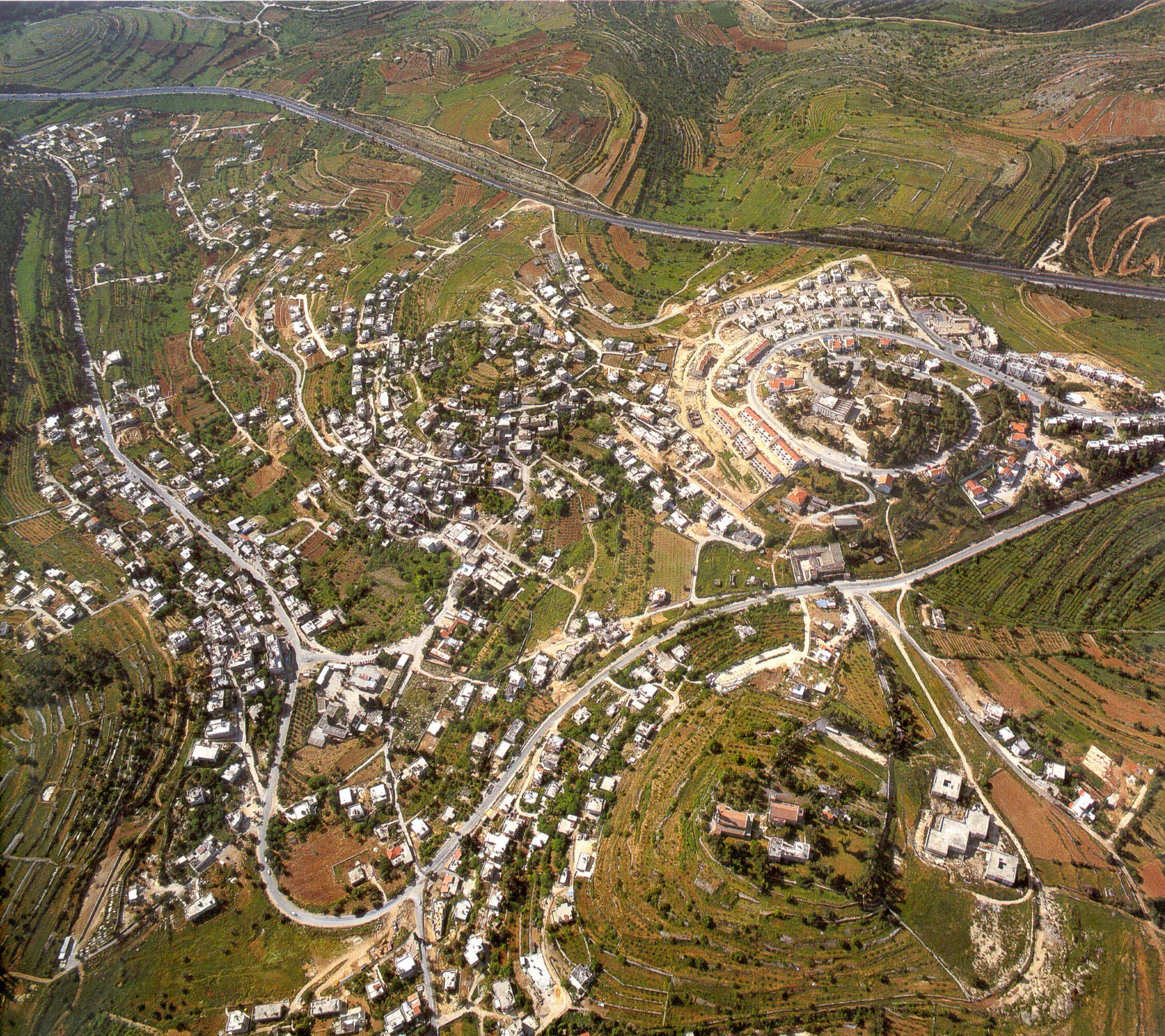
- Satellite View
- Articles 5
- Pictures 84
- Aerial Views 3
- Members 12
- Wikipedia
- Videos 3
- Guest Book 3
- Links
| Statistic & Fact | Value | |||||||||||||||||||||
| Distance From District | 13 km west of Jerusalem | |||||||||||||||||||||
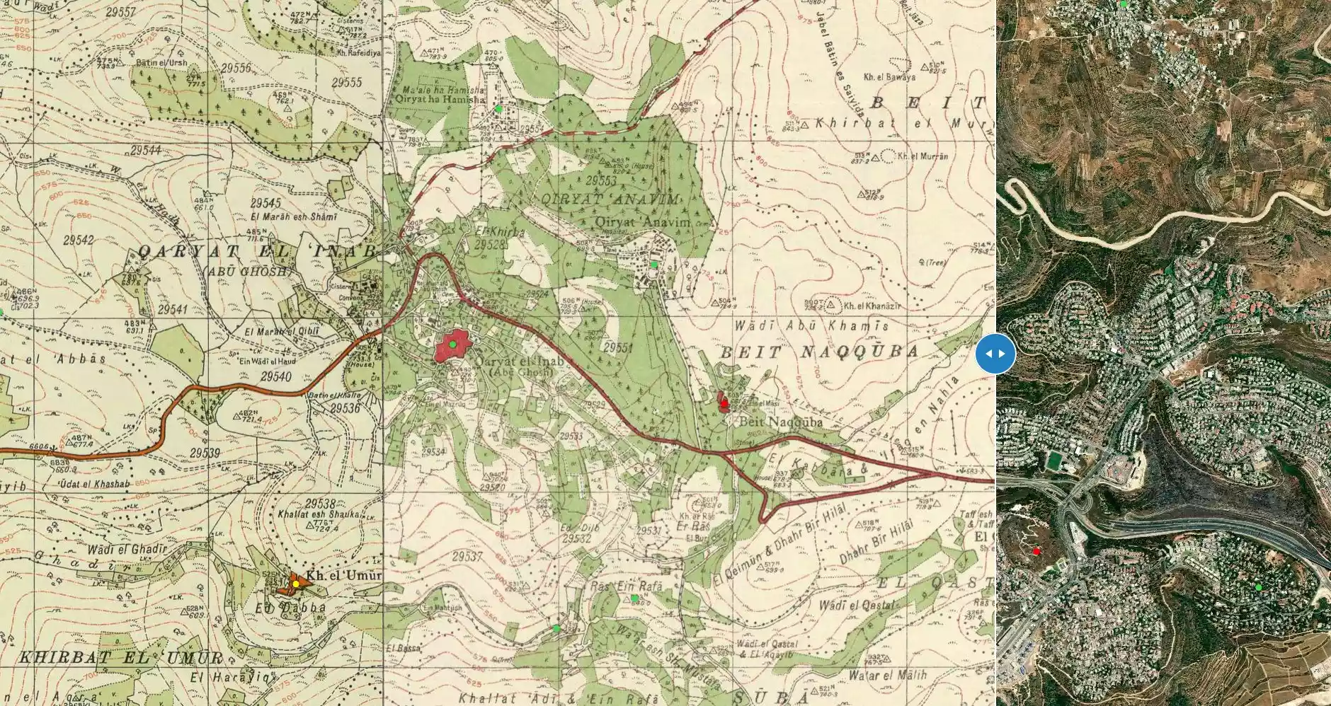
| Before & After Nakba, Click Map For Details |
||||||||||||||||||||||
|
||||||||||||||||||||||
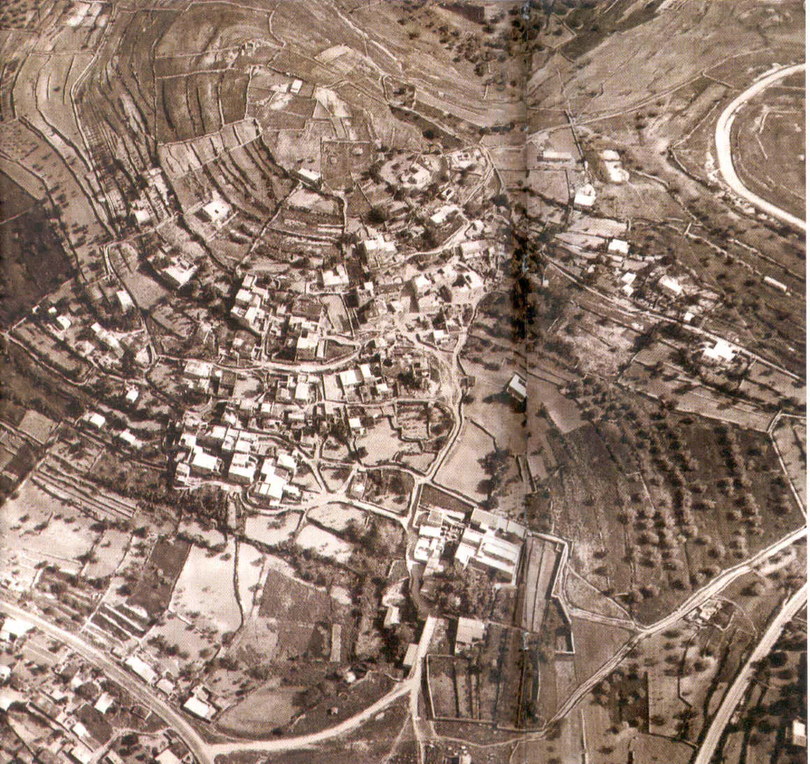
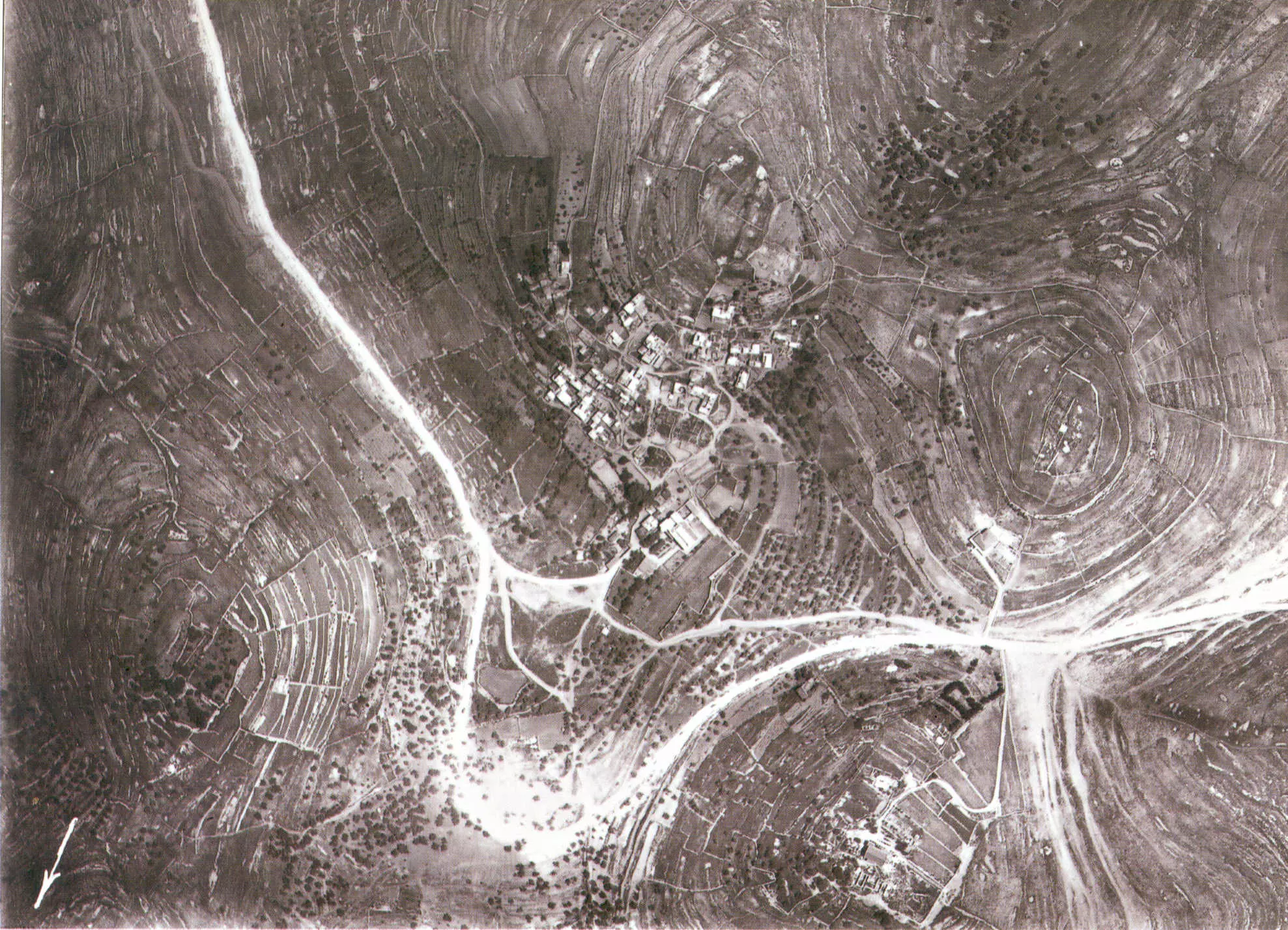
| Pre-Nakba Aerial View |
||||||||||||||||||||||
|
||||||||||||||||||||||
| Land Ownership |
**Town Lands' Demarcation Maps |
|||||||||||||||||||||
| Land Usage As of 1945 |
|
|||||||||||||||||||||
| Population |
|
|||||||||||||||||||||
| Near By Towns |
||||||||||||||||||||||
|
|
||||||||||||||||||||||
| Featured Video | ||||||||||||||||||||||
| Related Maps | Town Lands' Demarcation Maps خرائط للقضاء توضح حدود القرى والاودية View from satellite Town's map on MapQuest Help us map this town at WikiMapia |
|||||||||||||||||||||
| Related Links | Wikipedia's Page Facebook Page Google Search Google For Images Google For Videos في كتاب بلادنا فلسطين المزيد من موقع هوية |
|||||||||||||||||||||
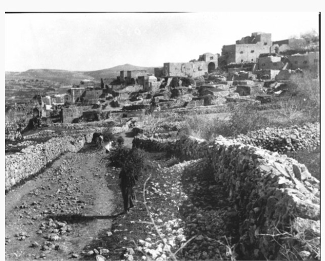
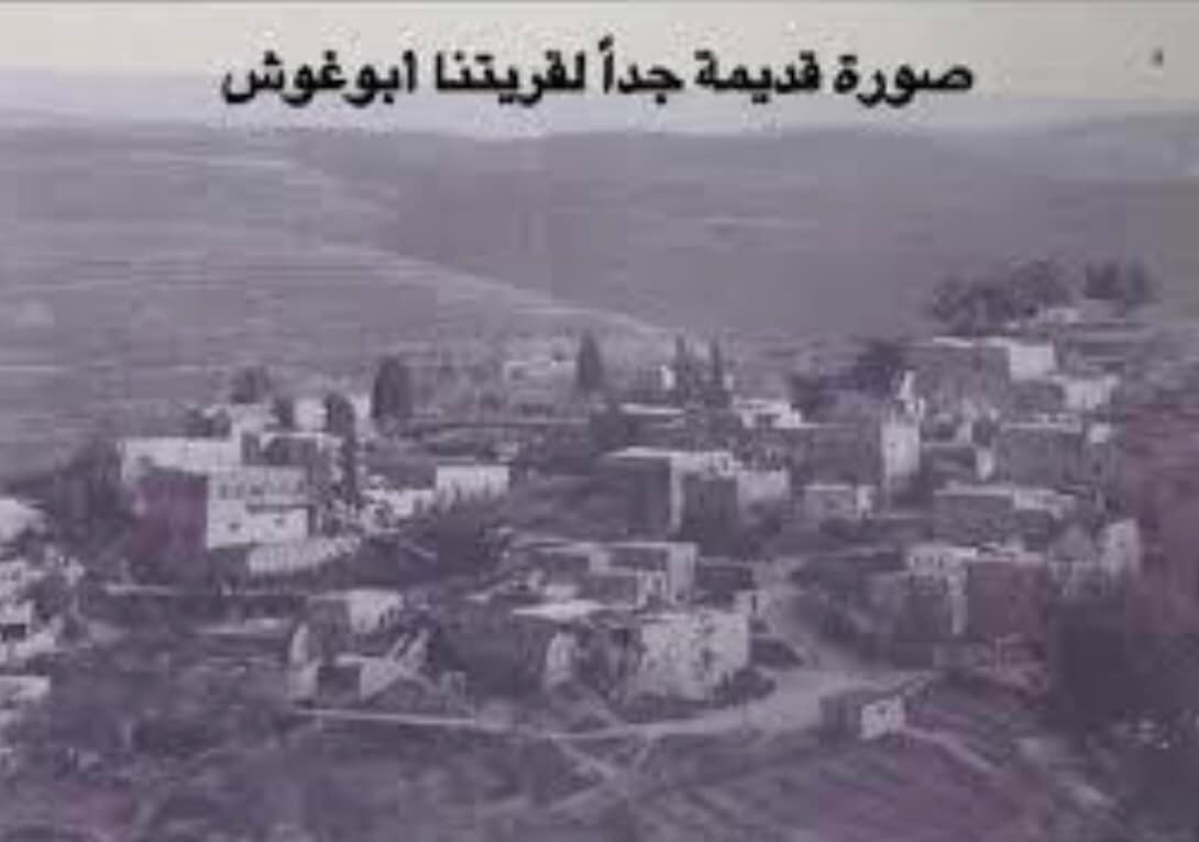
- Undated general view
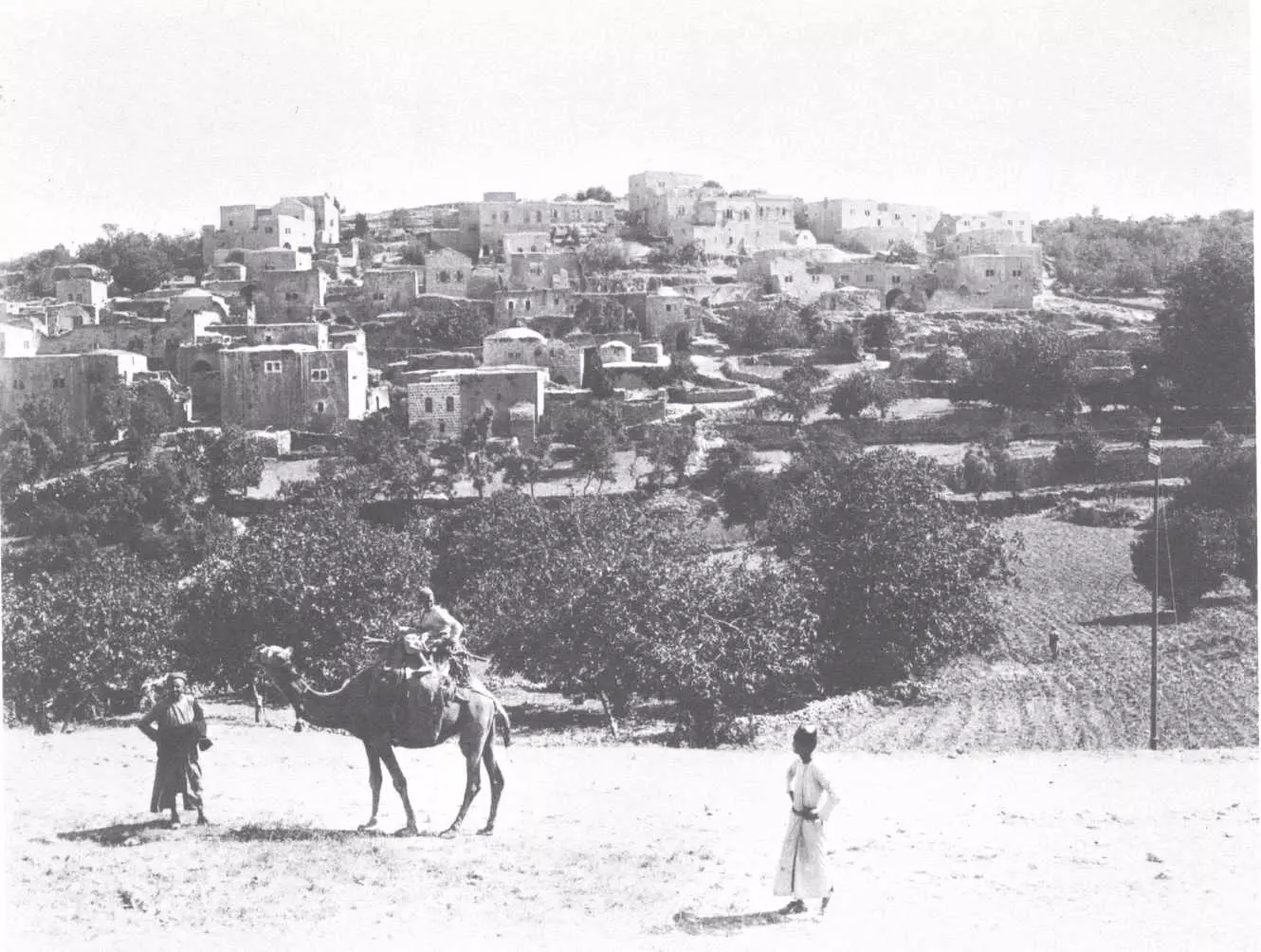
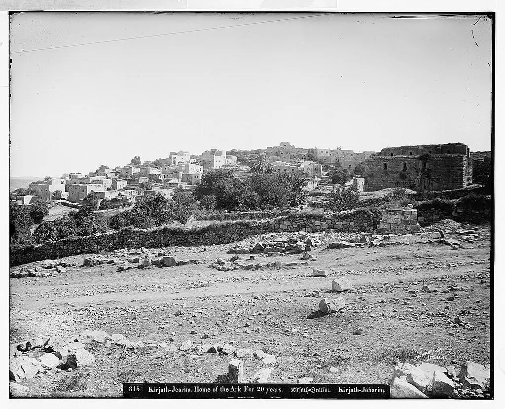
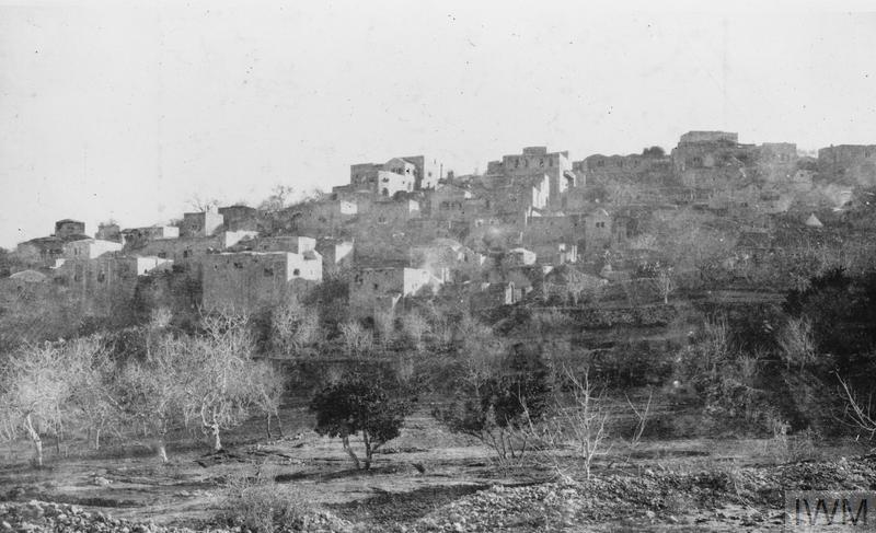
2 - General view, Matson Collection (Before 1914)
1 - Early picture general view #3
12 - General view, Mayson Collection (1900-1920)
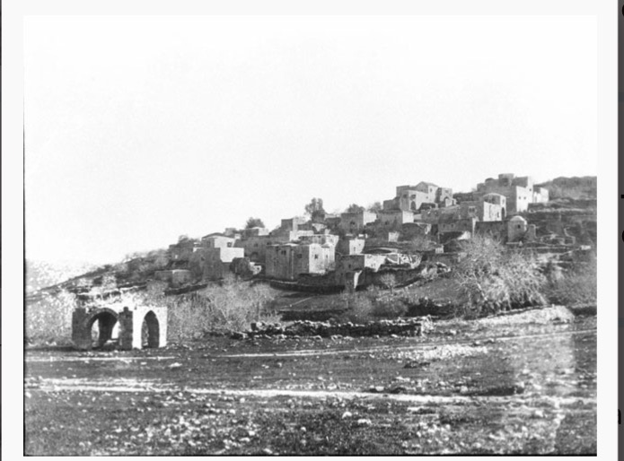
1 - Rare photo in 1918, arrow in the lower hand corner points north!
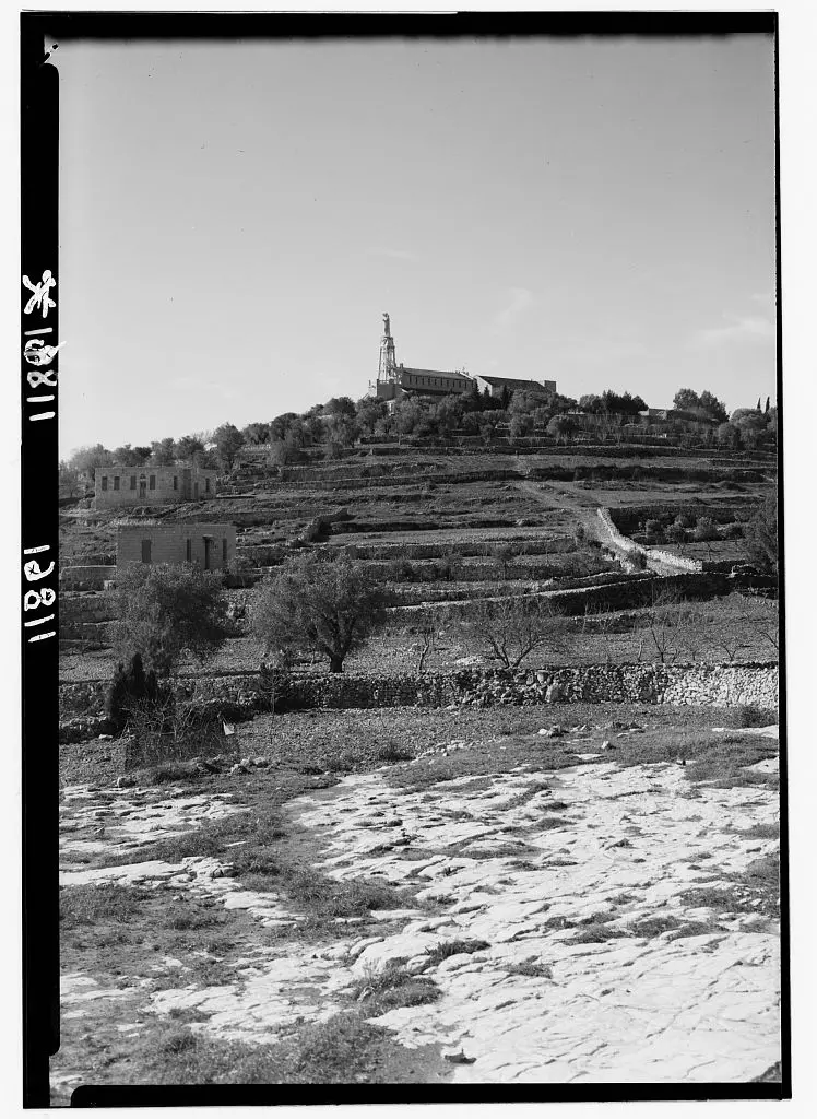
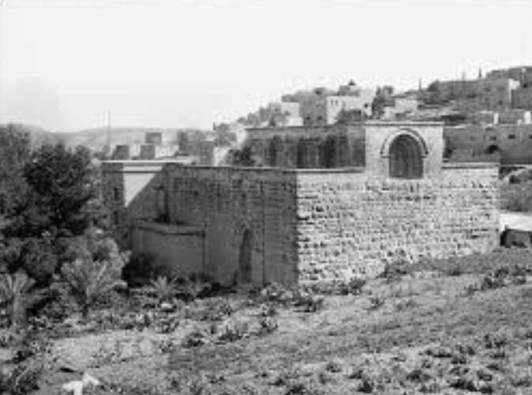
- A view for the nearby monastery, Matson collection. (1941)
- Rare photo in 1948, lower left hand corner points north!
1 - Photo taken in 1994, lower hand corner points north!
1 - General view
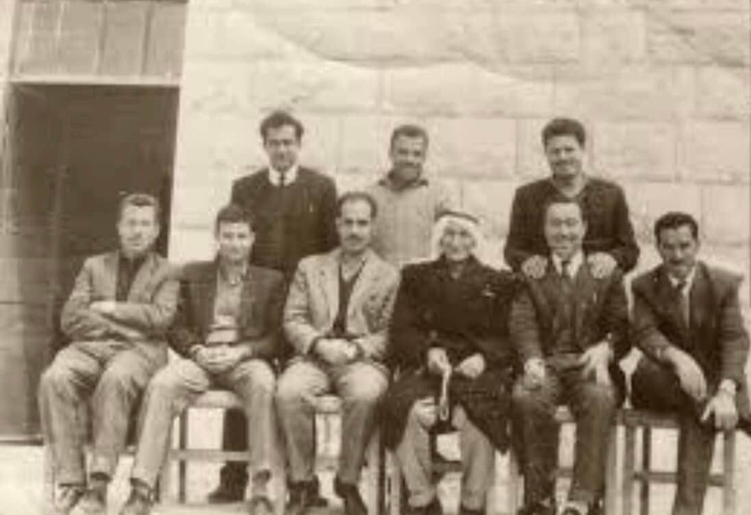
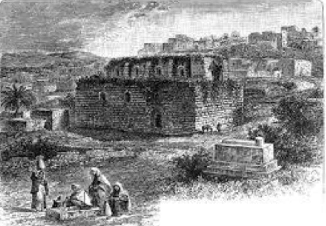
Posted by د.راني ابوغوش 1 - A view for the village famous castle, Mayson Collection (Before 1914)
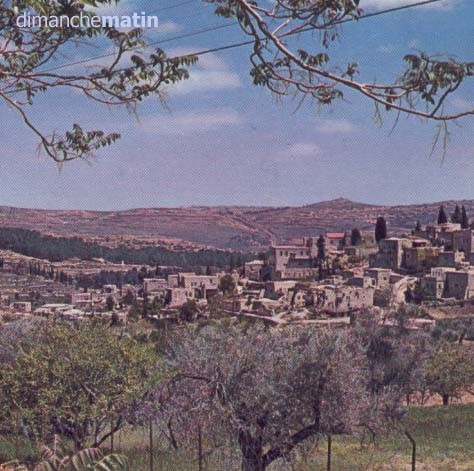
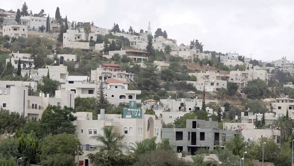
1 - New abu goush 2007
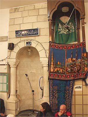
Posted by Nader abu gosh 1 - منبر مسجد العزير
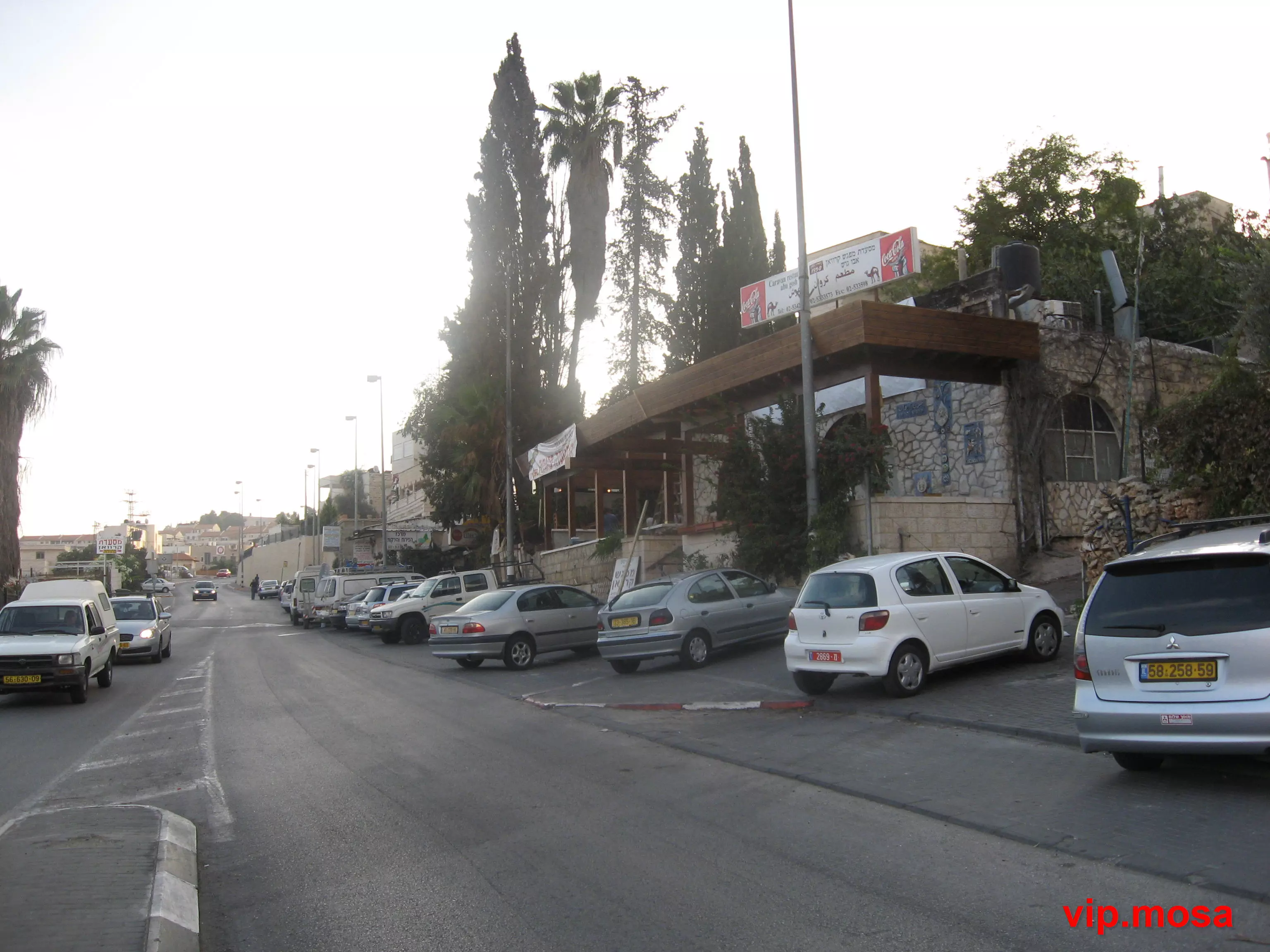
Posted by nafez ibrhiem abu gosh 1 - مطعم ابوغوش
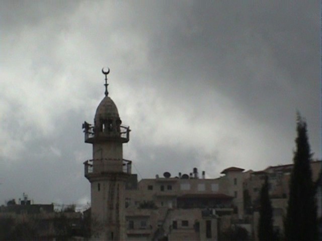
Posted by vip.mosa 3 - مسجد العزير(ابوغوش)
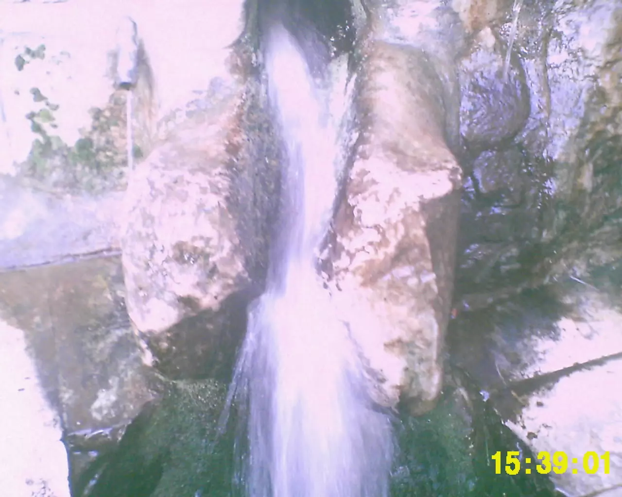
Posted by nafez ibrhiem abu gosh - عين القريه
Posted by nafez ibrhiem abu gosh - ابوغوش:غرب القريه,في الافق شارع القدس-يافاومباني حديثه على انقاض (القسطل)
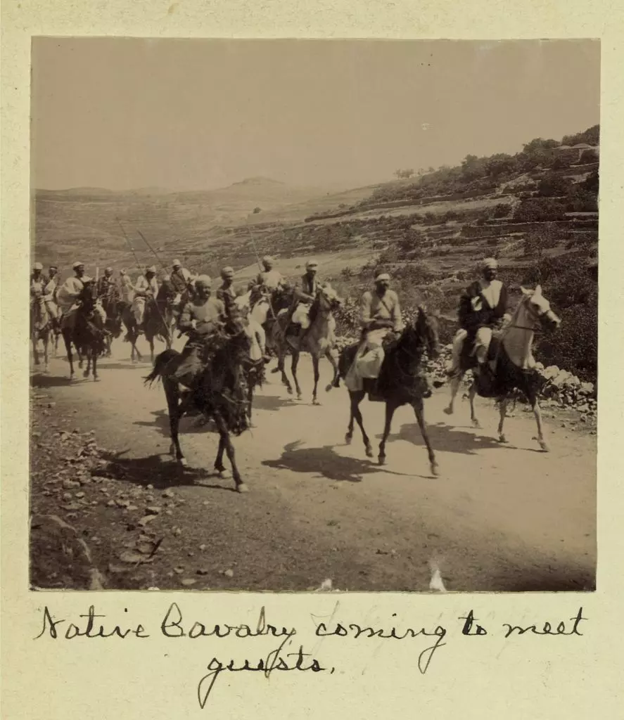
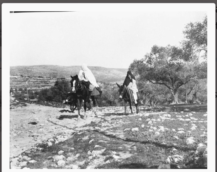
Posted by Nader abu gosh 3 - July, 1904. Native cavalry coming to meet guests.
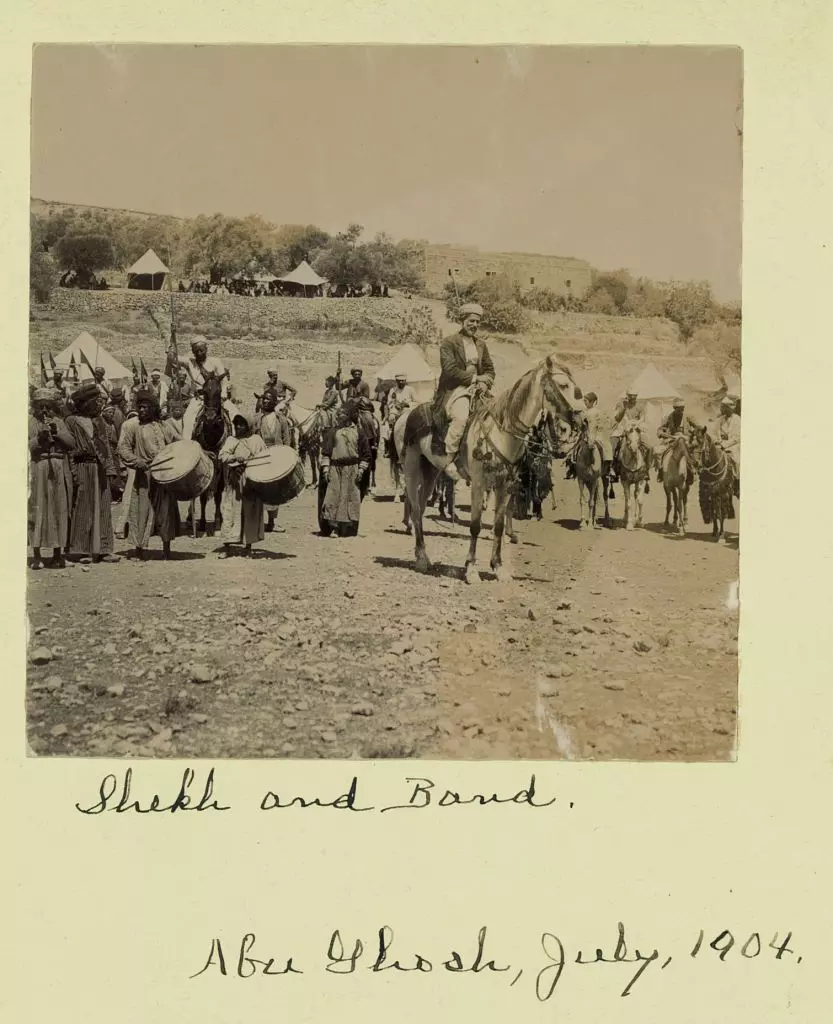
Posted by Joehar Hamdan - July, 1904. Shekh and band.
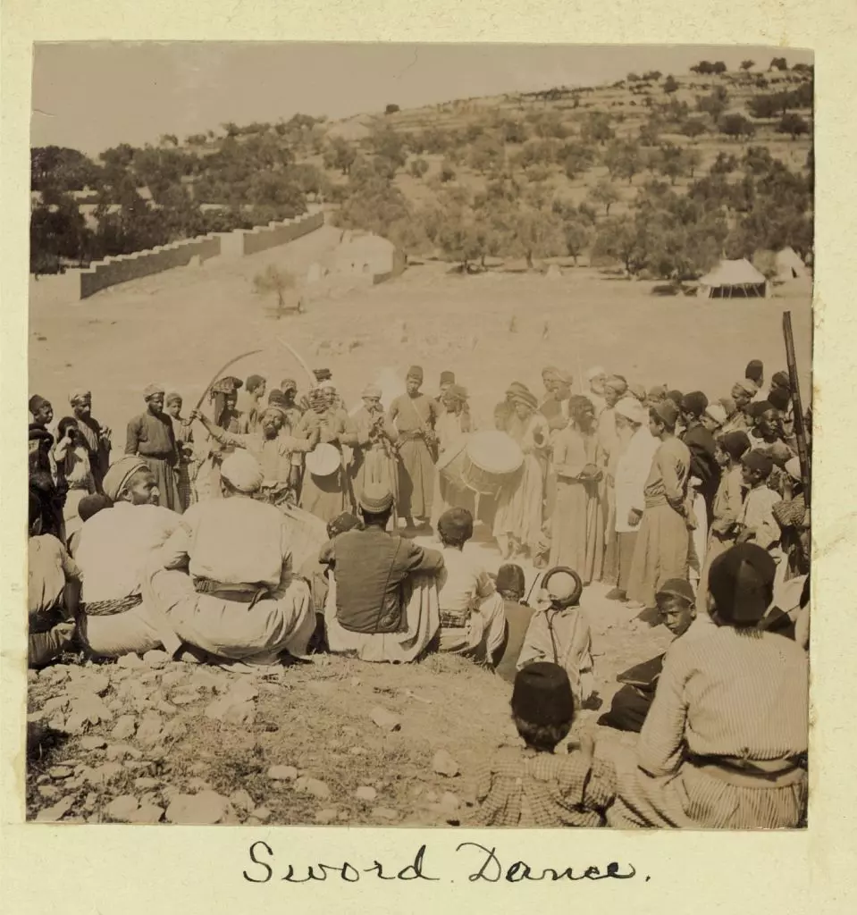
Posted by Joehar Hamdan - July, 1904. Sword dance.
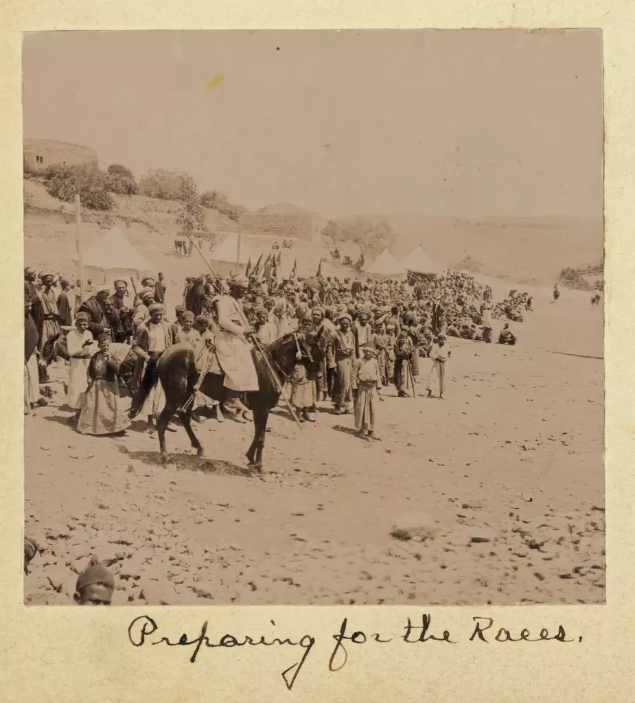
Posted by Joehar Hamdan - July, 1904. Preparing for the races.
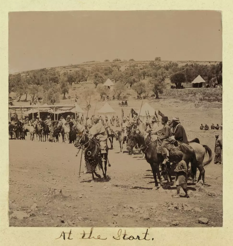
Posted by Joehar Hamdan - July, 1904. At the start.
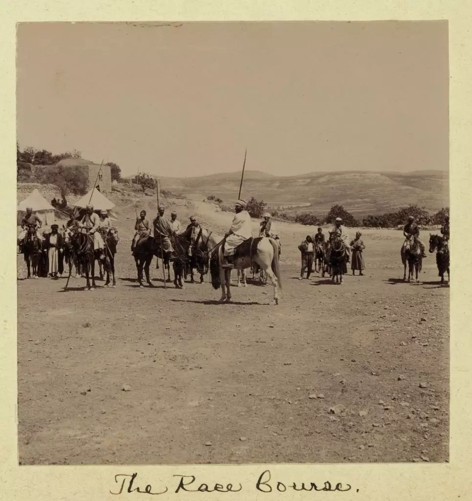
Posted by Joehar Hamdan - July, 1904. The race course
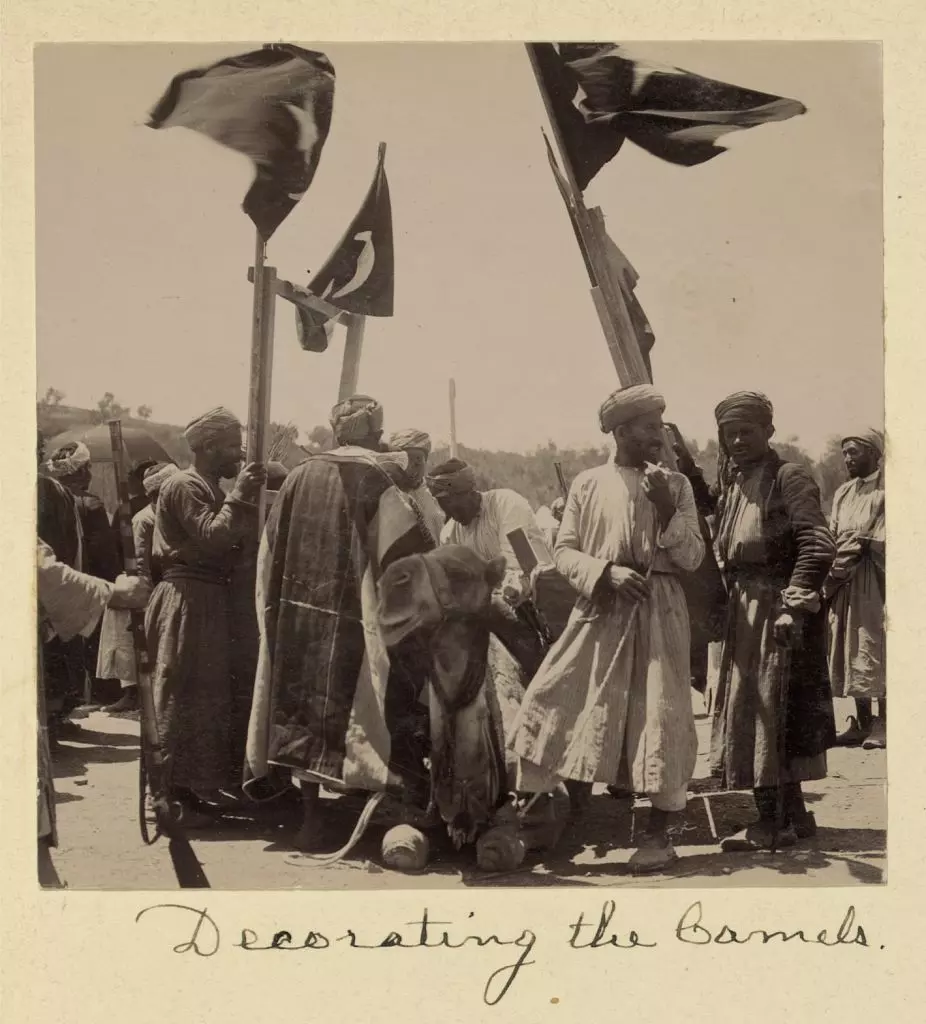
Posted by Joehar Hamdan - Wedding of son of Shekh of Abu Ghosh, July, 1904. Decorating the camels.
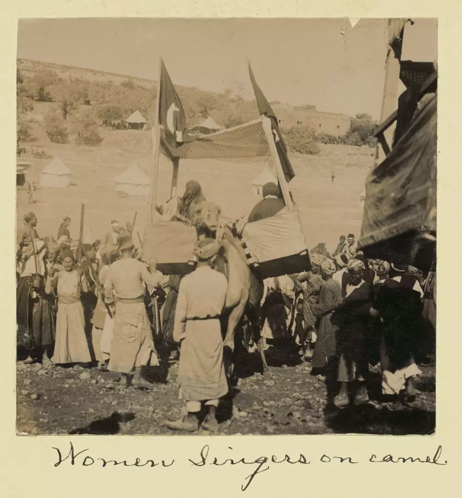
Posted by Joehar Hamdan - Wedding of son of Shekh of Abu Ghosh, July, 1904. Women singers on camel.
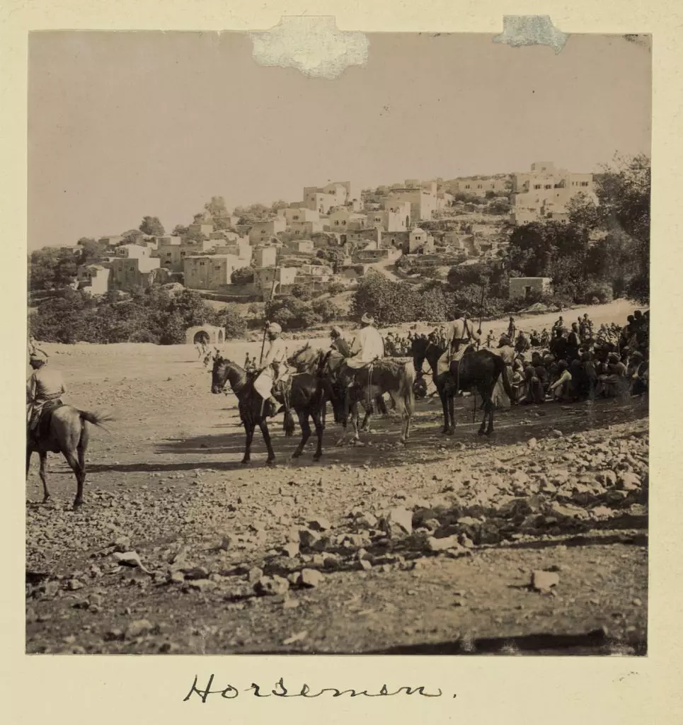
Posted by Joehar Hamdan - Wedding of son of Shekh of Abu Ghosh, July, 1904. Horsemen.
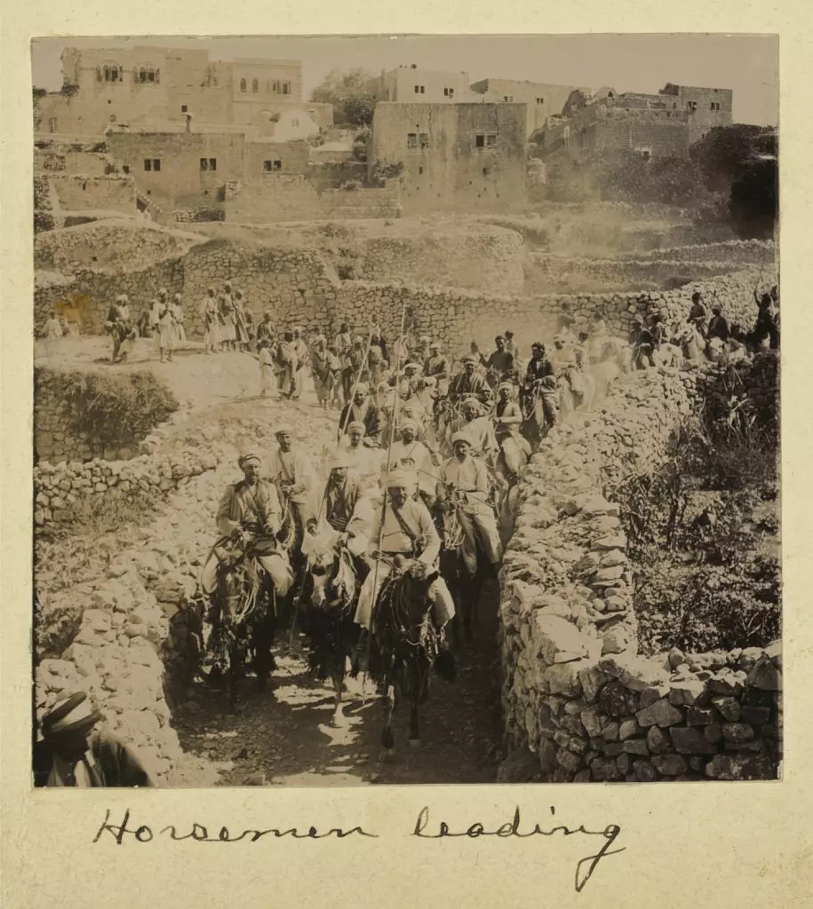
Posted by Joehar Hamdan - Wedding of son of Shekh of Abu Ghosh, July, 1904. Horsemen leading.
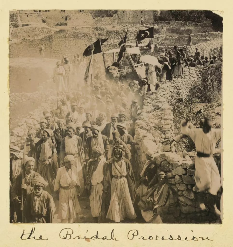
Posted by Joehar Hamdan 1 - Wedding of son of Shekh of Abu Ghosh, July, 1904. The bridal procession.
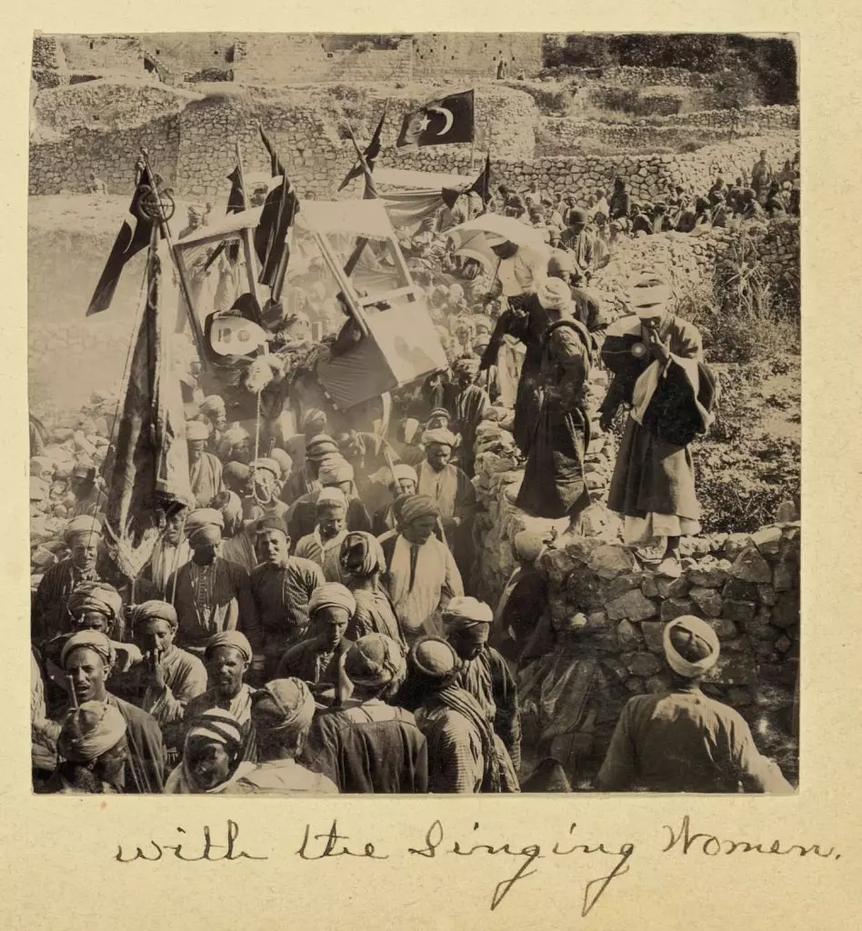
Posted by Joehar Hamdan - Wedding of son of Shekh of Abu Ghosh, July, 1904. [The bridal procession] with the singing women.
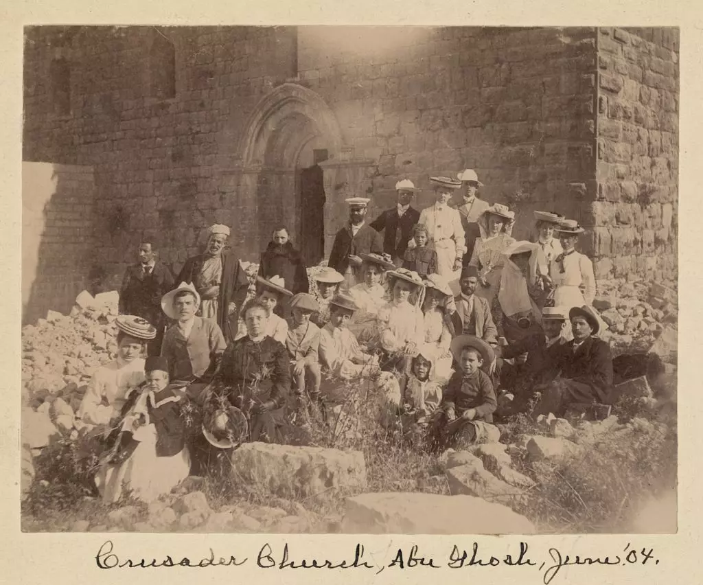
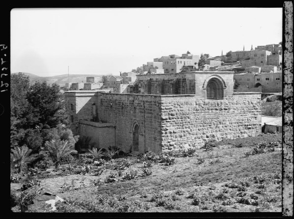
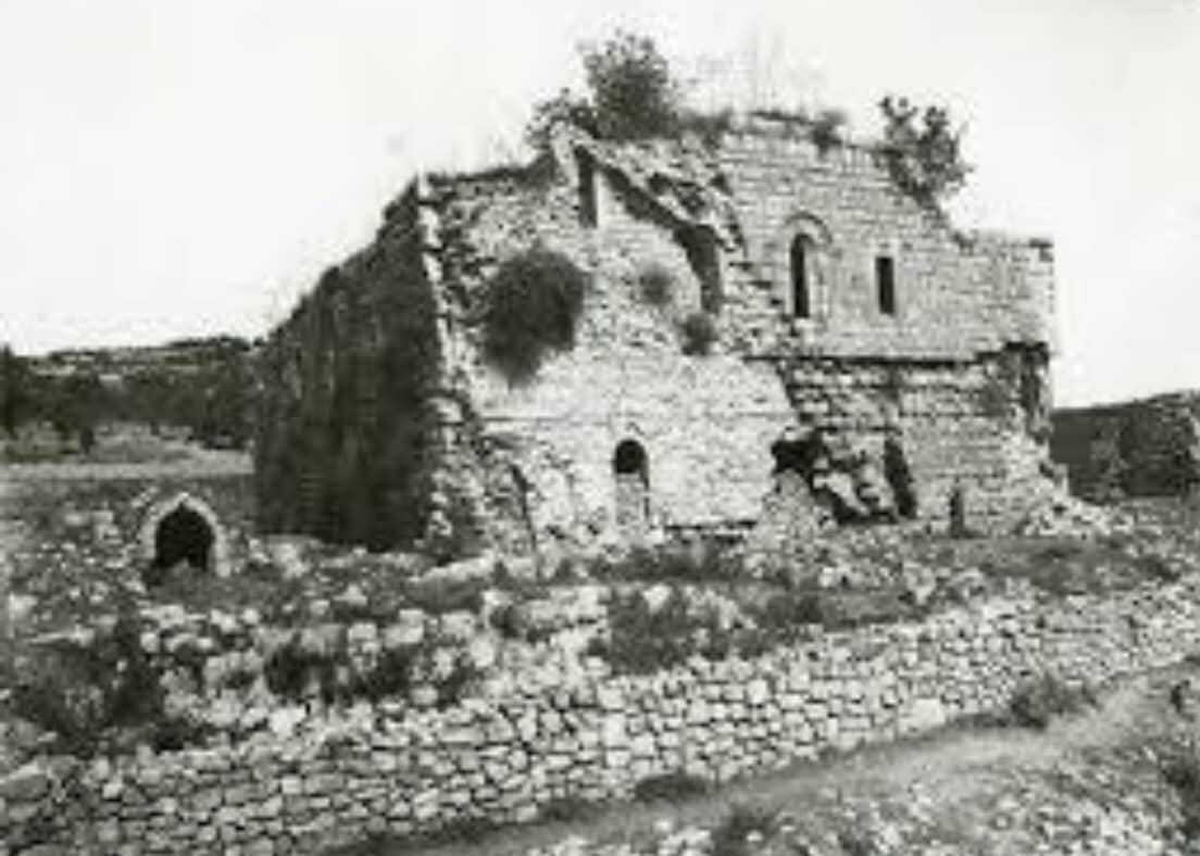
Posted by Joehar Hamdan 2 - Crusader Church, Abu Ghosh, June '04.
Posted by Joehar Hamdan - Abu Ghosh, June, 1904.
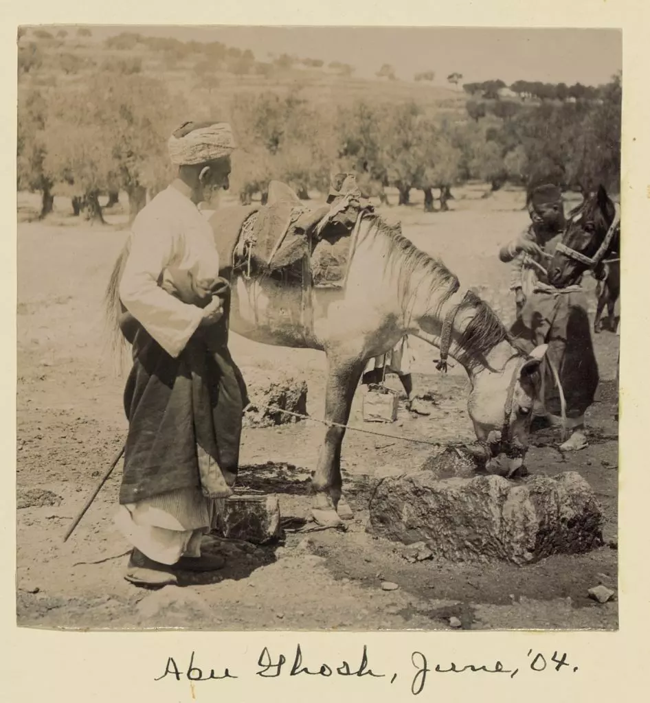
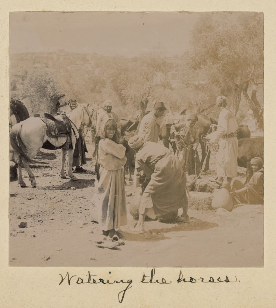
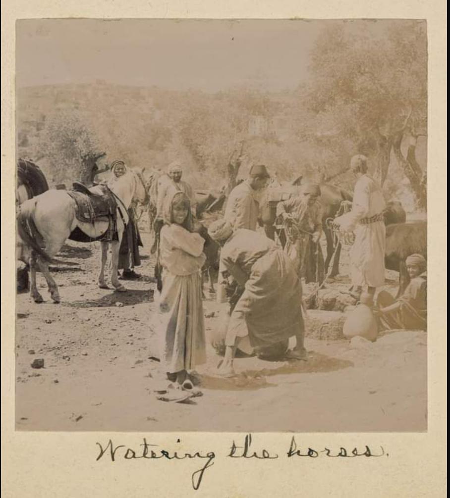
Posted by Joehar Hamdan - Watering the horses. June, 1904
Posted by Joehar Hamdan - من شقة دار العرب من . تظهر المدرسة الاعدادية والمقبرة الجديدة صورة لل2009
Posted by من ابو غوش((الكل بيعرفني)) - آخر شارع البيادر في ابوغوش شقة دار ابو العرب

Posted by من ابو غوش((الكل بيعرفني)) - باب الواد بالقرب من ابو غوش
Posted by من ابو غوش((الكل بيعرفني)) - ابو غوش في الثلوج
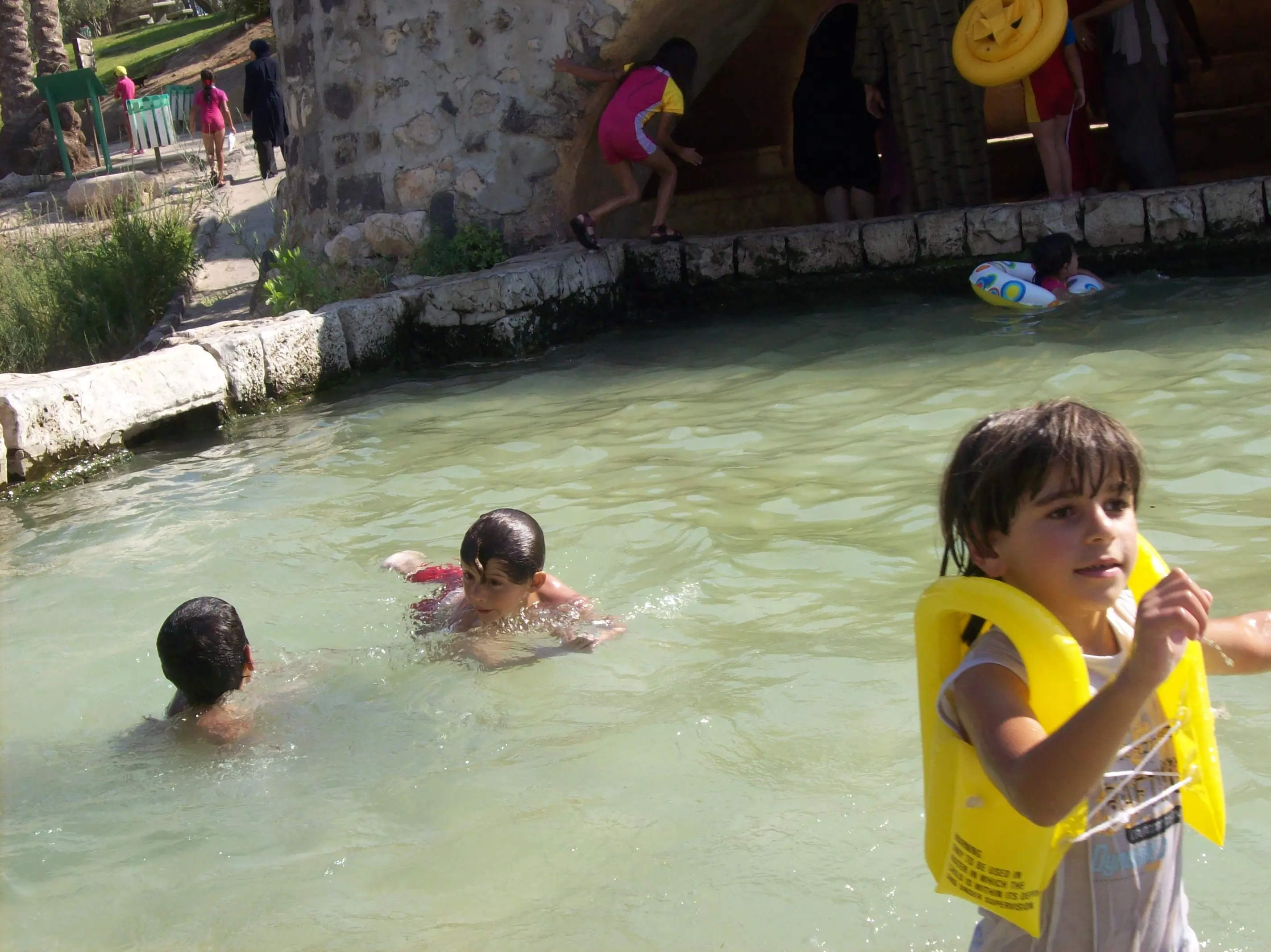
Posted by من ابو غوش((الكل بيعرفني)) - البركة للسباحة وهي برركة طبيعية في الكوبنية
Posted by من ابو غوش((الكل بيعرفني)) - المركز الجماهيري ابو غوش
Posted by من ابو غوش((الكل بيعرفني)) - اول دخلة ابو غوش قبل الدلب عند الدوار.
Posted by من ابو غوش((الكل بيعرفني)) - صورة عامة للقرية من عند المركز ويظهر الشارع الرئيسي تل ابيب القدس.
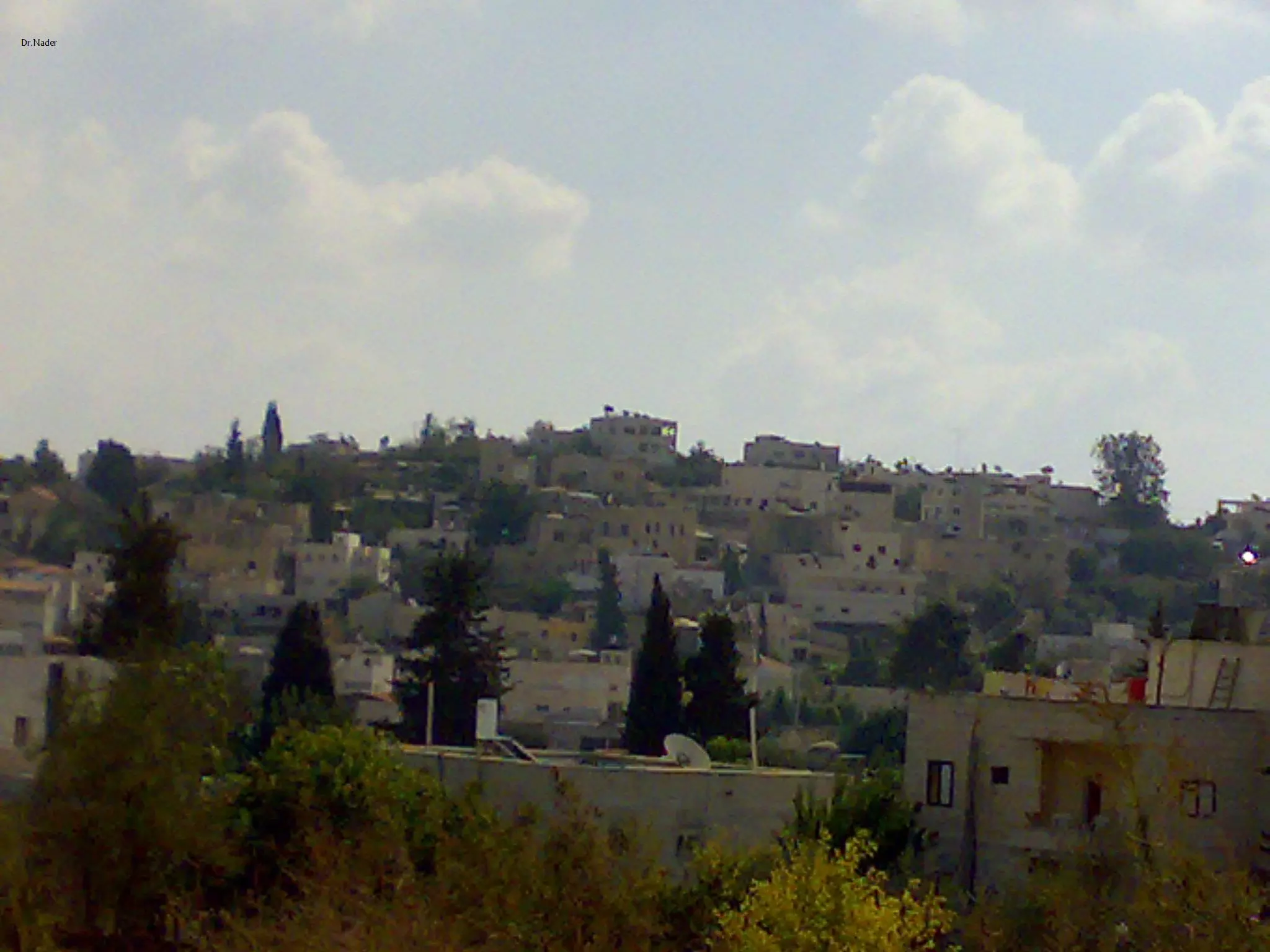
Posted by من ابو غوش((الكل بيعرفني)) 1 - منظر عام للقرية
Posted by من ابو غوش((الكل بيعرفني)) - منظر عام من طريق القدس تل أبيب
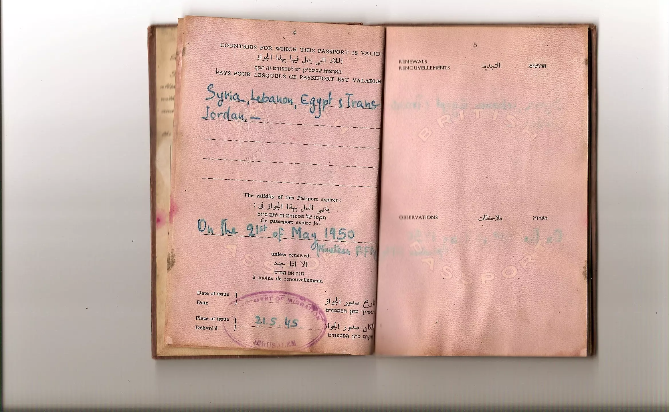
Posted by saher kaddarah - جواز سفر حكومة الانتداب مواطن من ابوغوش
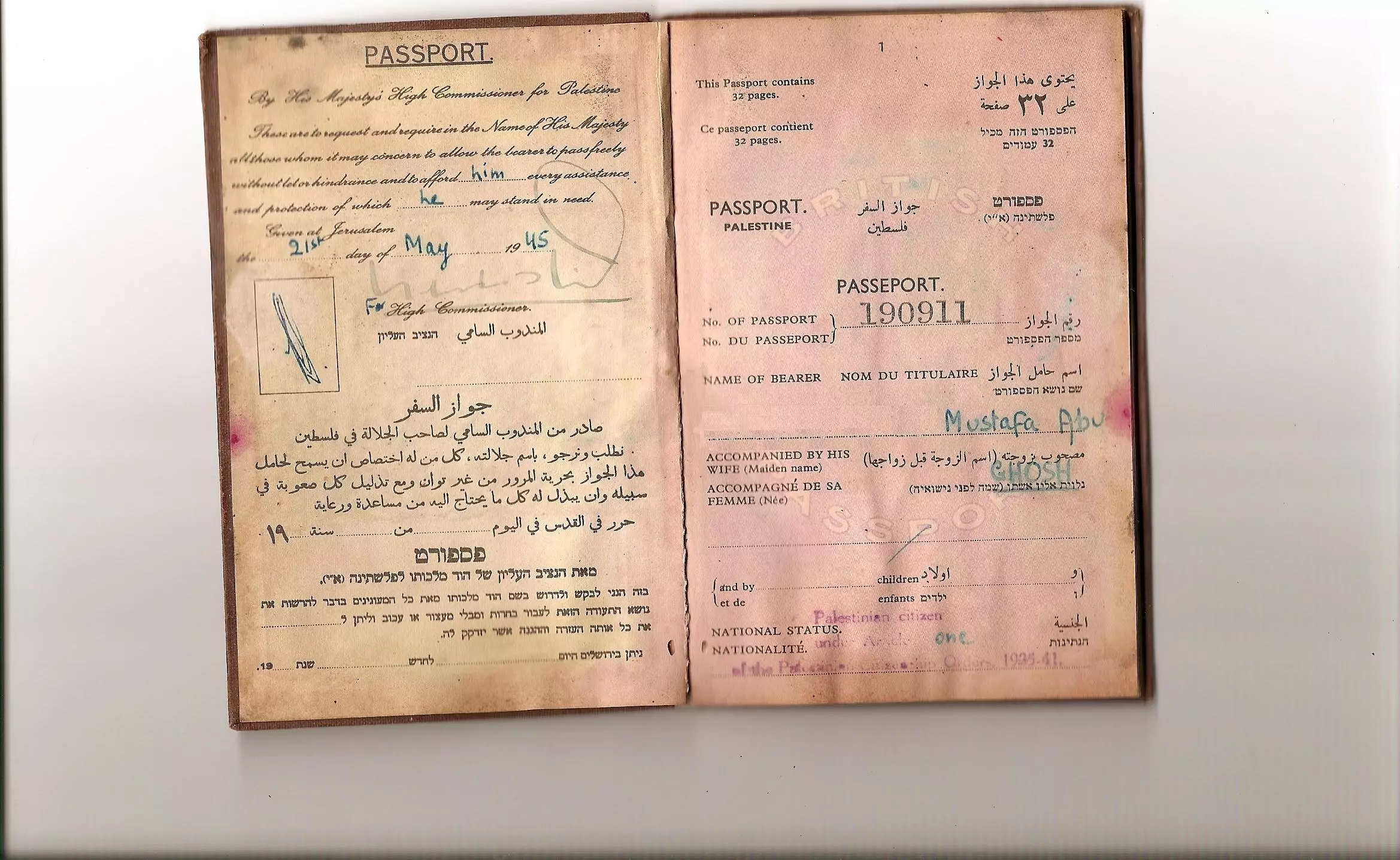
Posted by Nader abu gosh - جواز سفر حكومة الانتداب مواطن من ابوغوش
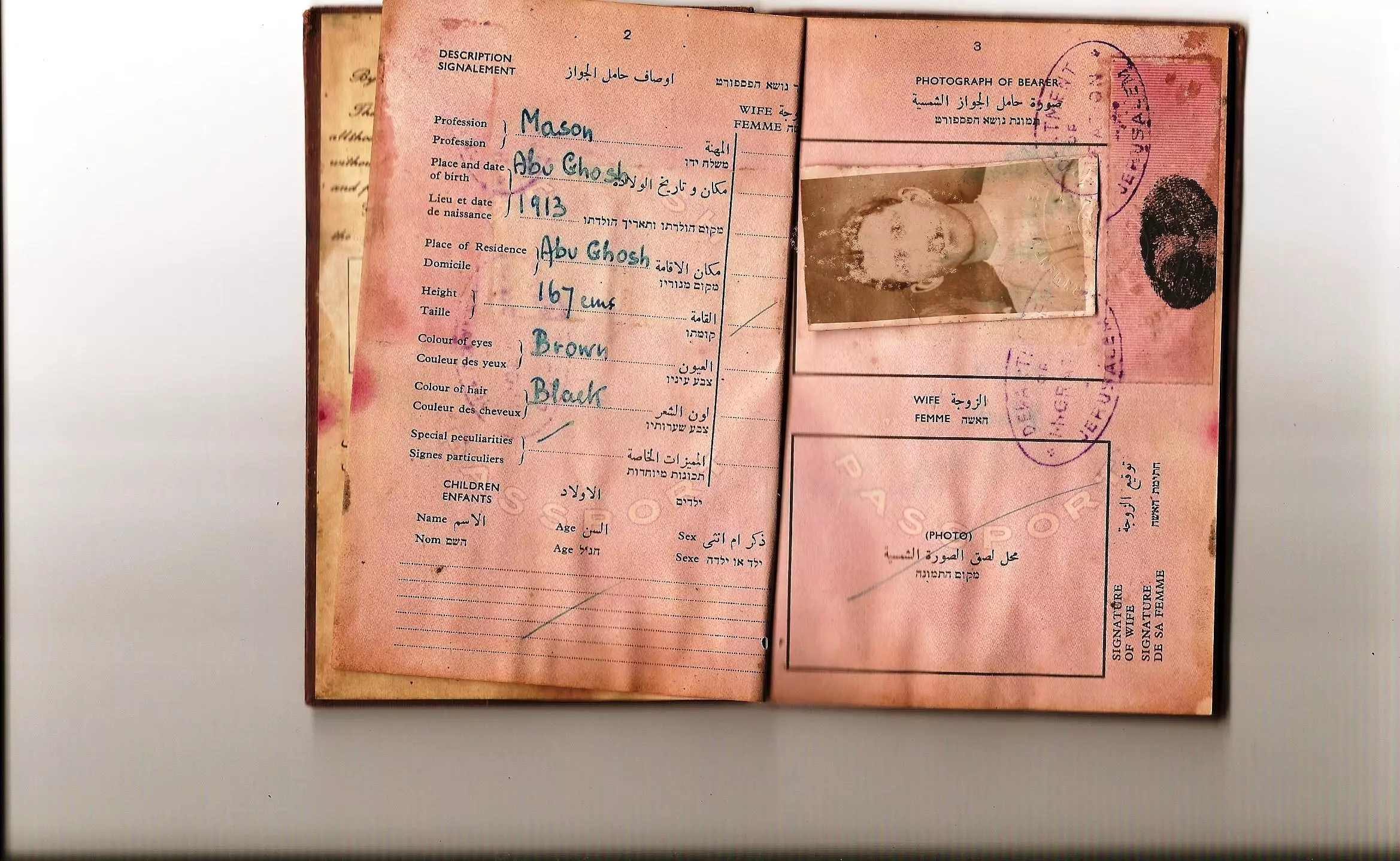
Posted by Nader abu gosh - جواز سفر حكومة الانتداب مواطن من ابوغوش
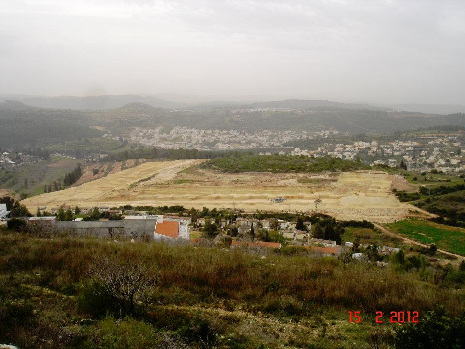
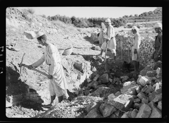
Posted by Nader abu gosh - حفر وتجهيز للاستيطان في ابو غوش
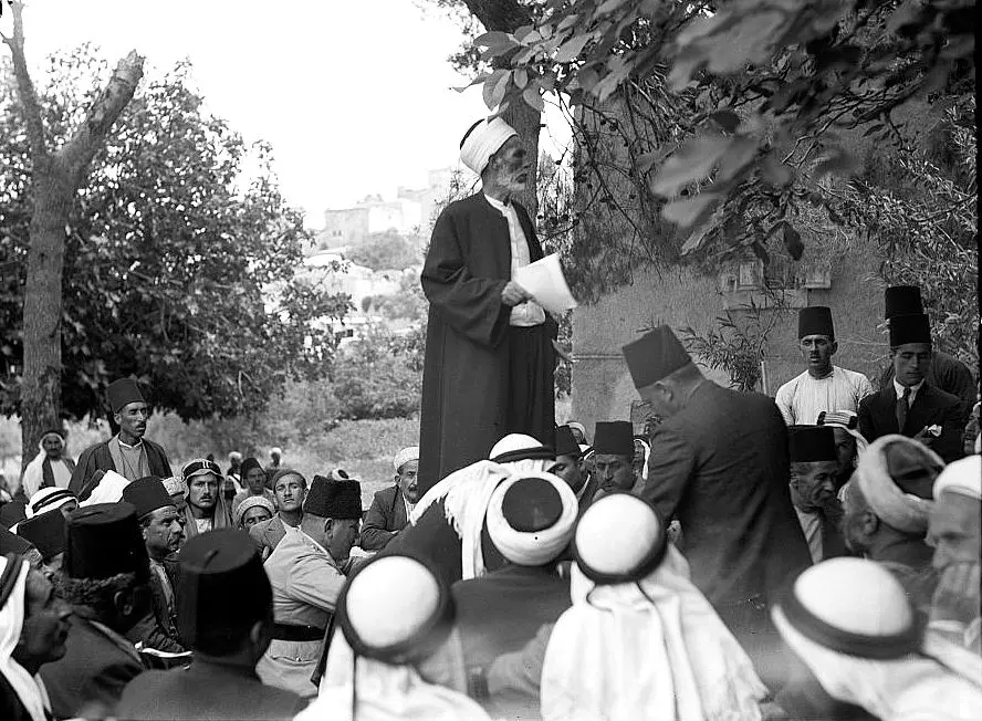
Posted by خالد دويات - The Village of Abu Gosh
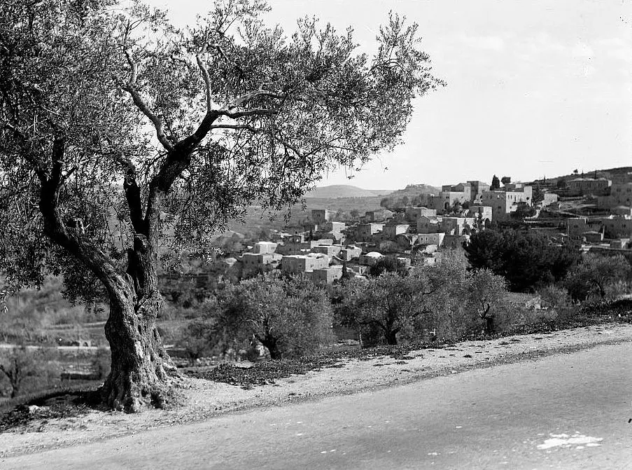
Posted by Umar Abu El-Bararri - The Village of Abu Gosh
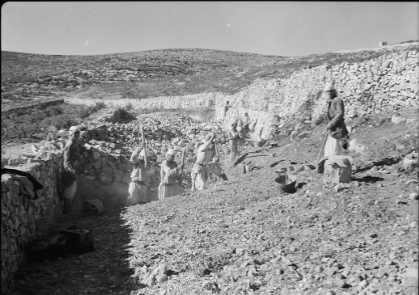
Posted by Umar Abu El-Bararri 1 - The People of Abu Gosh Protesting 1936
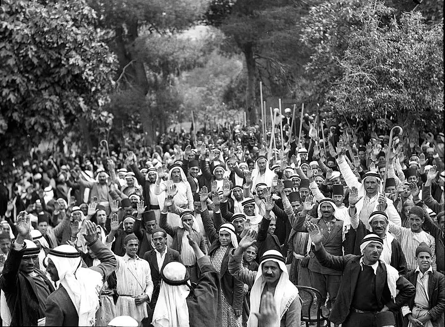
Posted by Umar Abu El-Bararri - The People of Abu Gosh Village Protesting 1936
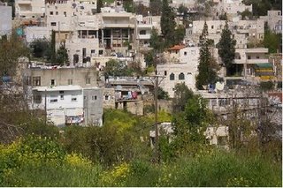
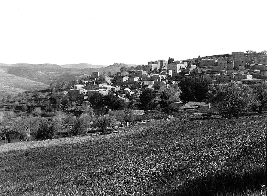
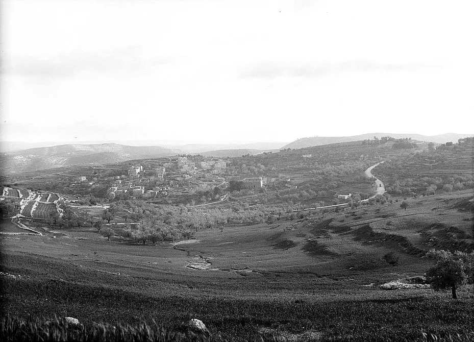
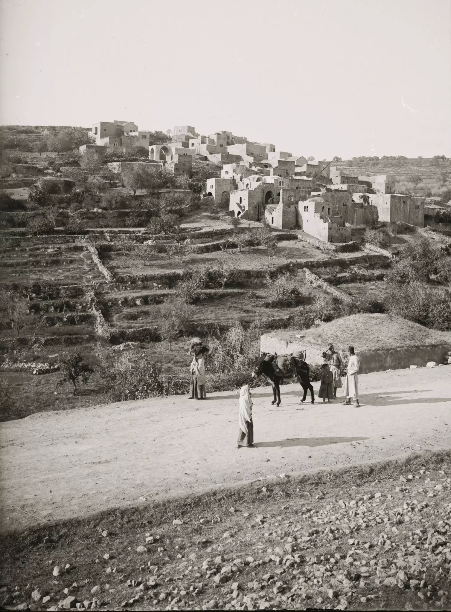
Posted by Umar Abu El-Bararri - Abu Gosh Village with its Terraces, Olive Trees & Grain Fields
Posted by Umar Abu El-Bararri - قريه ابو غوش قبل النكبه
Posted by abu raya - ابوغوش قبل النكبه
Posted by abu raya - ابو غوش قبل النكبه
Posted by abu raya - ابوغوش قبل النكبه
Posted by abu raya - ابو غوش قبل النكبه
Posted by abu raya - ابو غوش قبل النكبه
Posted by abu raya - منظر عام
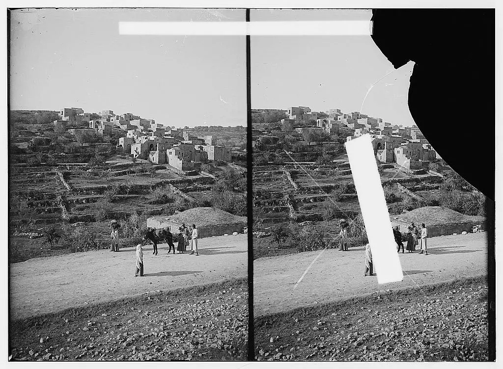
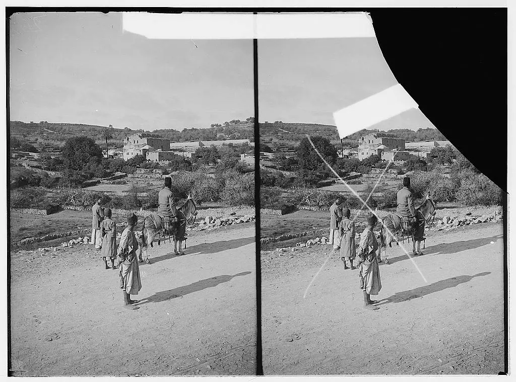
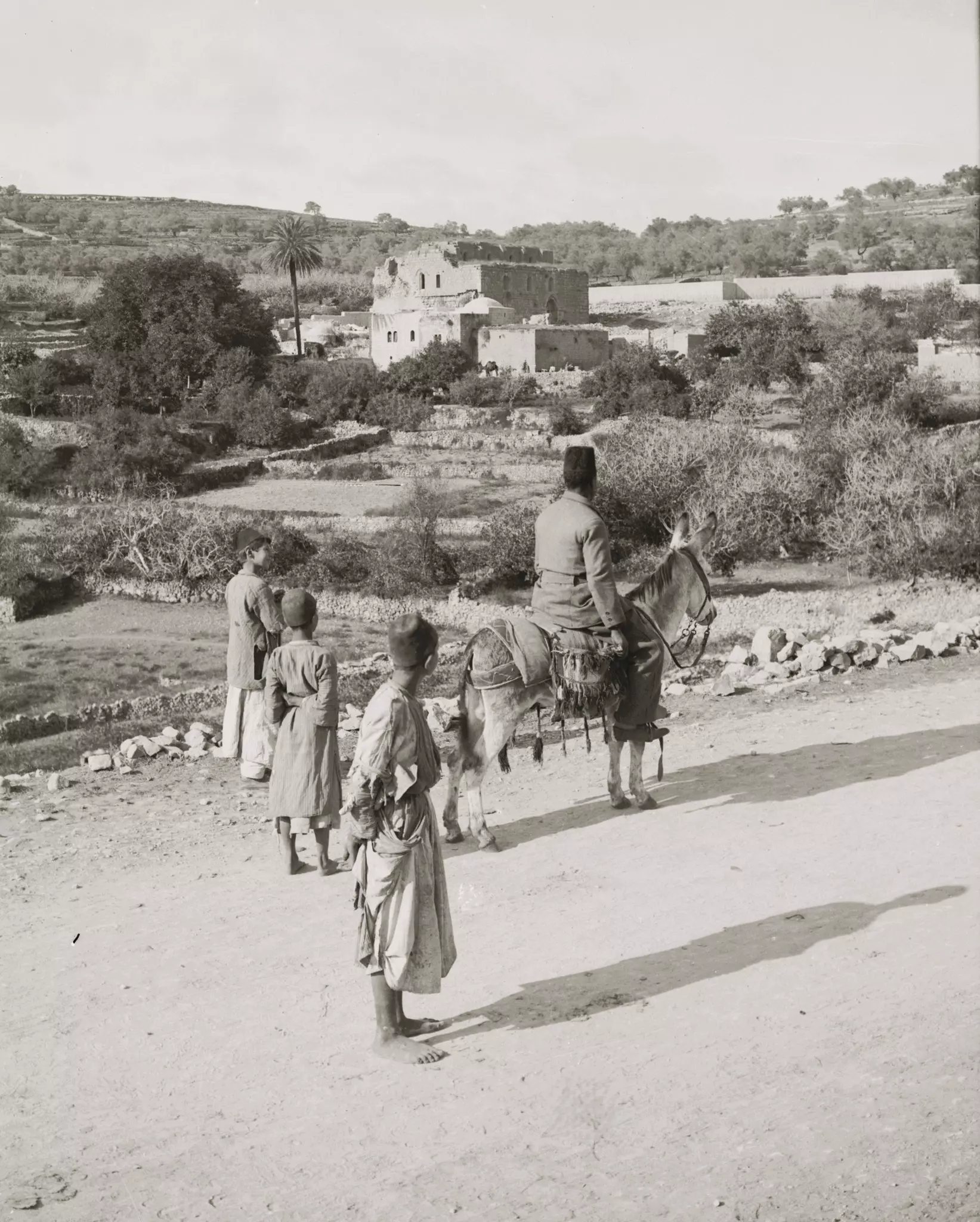
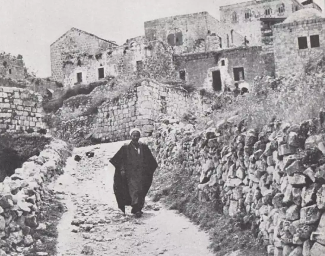
- A general view of the village, 21st November 1917
Posted by palestinehistory - صورة مميزة من نهاية القرن التاسع
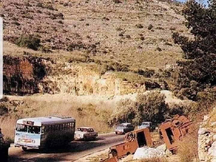
- في أواسط السبعينات، كانت طريق باب الواد المؤدية إلى قرية أبو غوش والقدس تُعد شريانًا حيويًا يربط الساحل الفلسطيني بجبال القدس. امتدت الطريق بين التلال المتراصة التي تكتسي باللون الأخضر خلال فصل الربيع، مما أضفى عليها مشهدًا خلابًا لا يُنسى....المزيد في قسم التعليقات
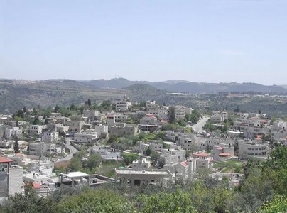
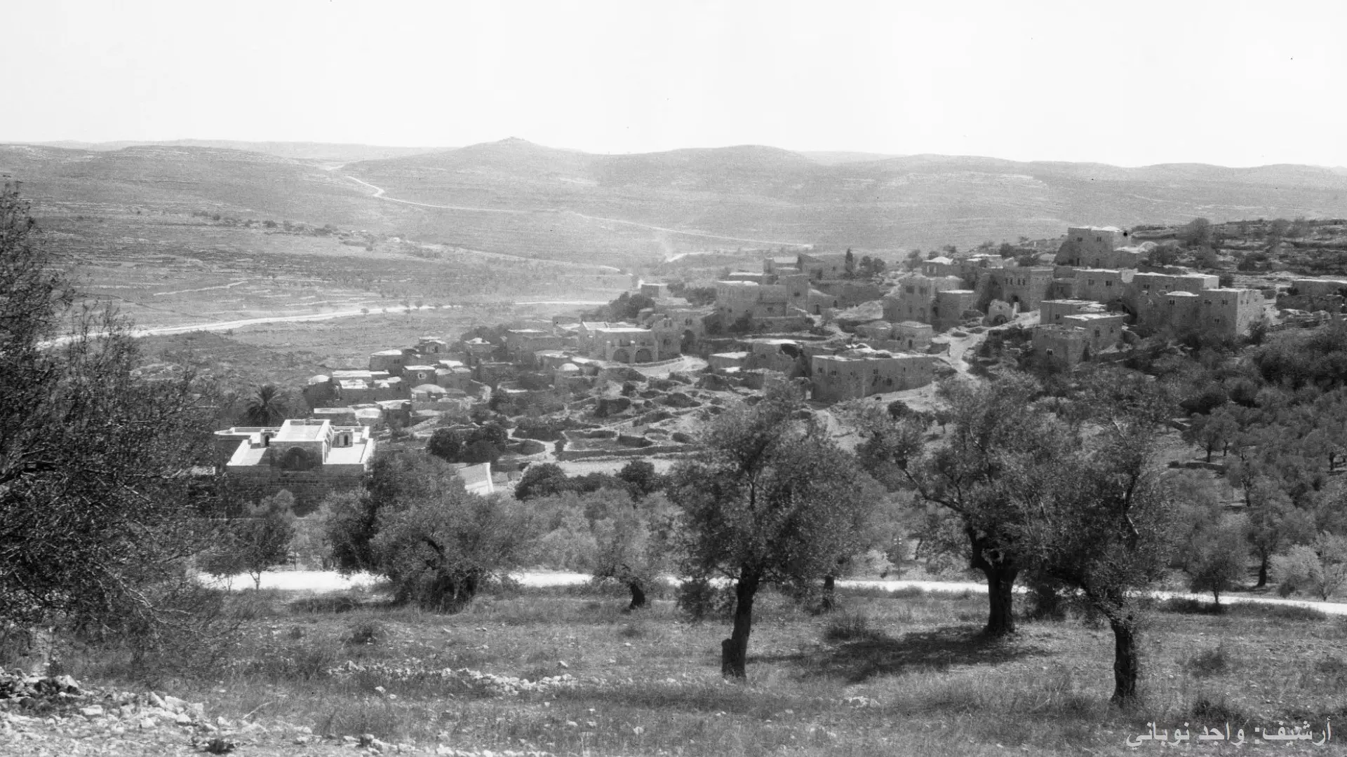
1 - Pre-Nakba General View
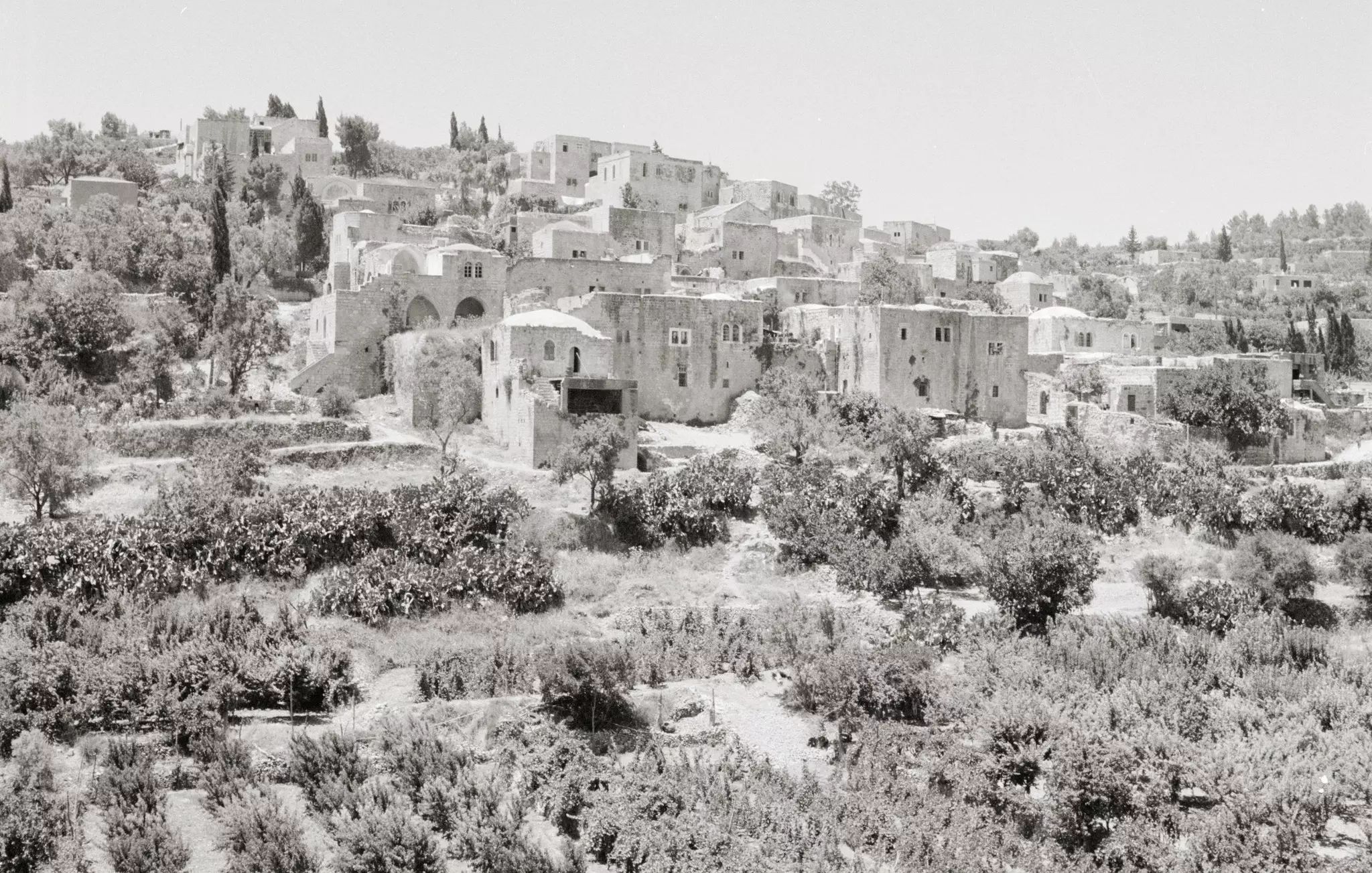
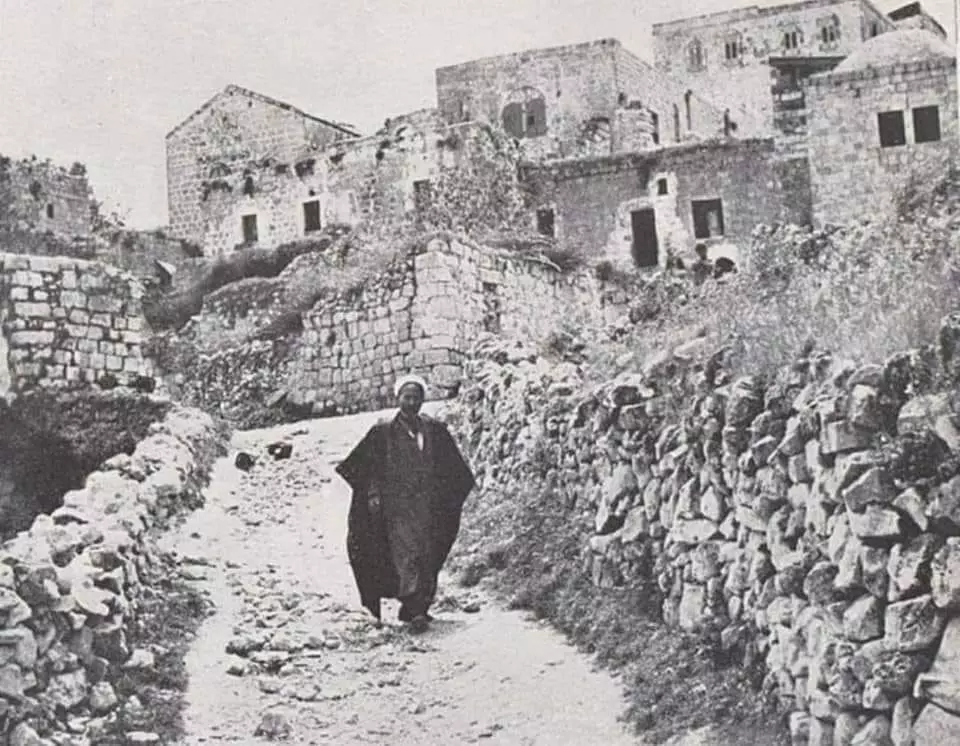
- A street scene during the pre-Nakba period
- A pre-WWI view of Abu Ghoush
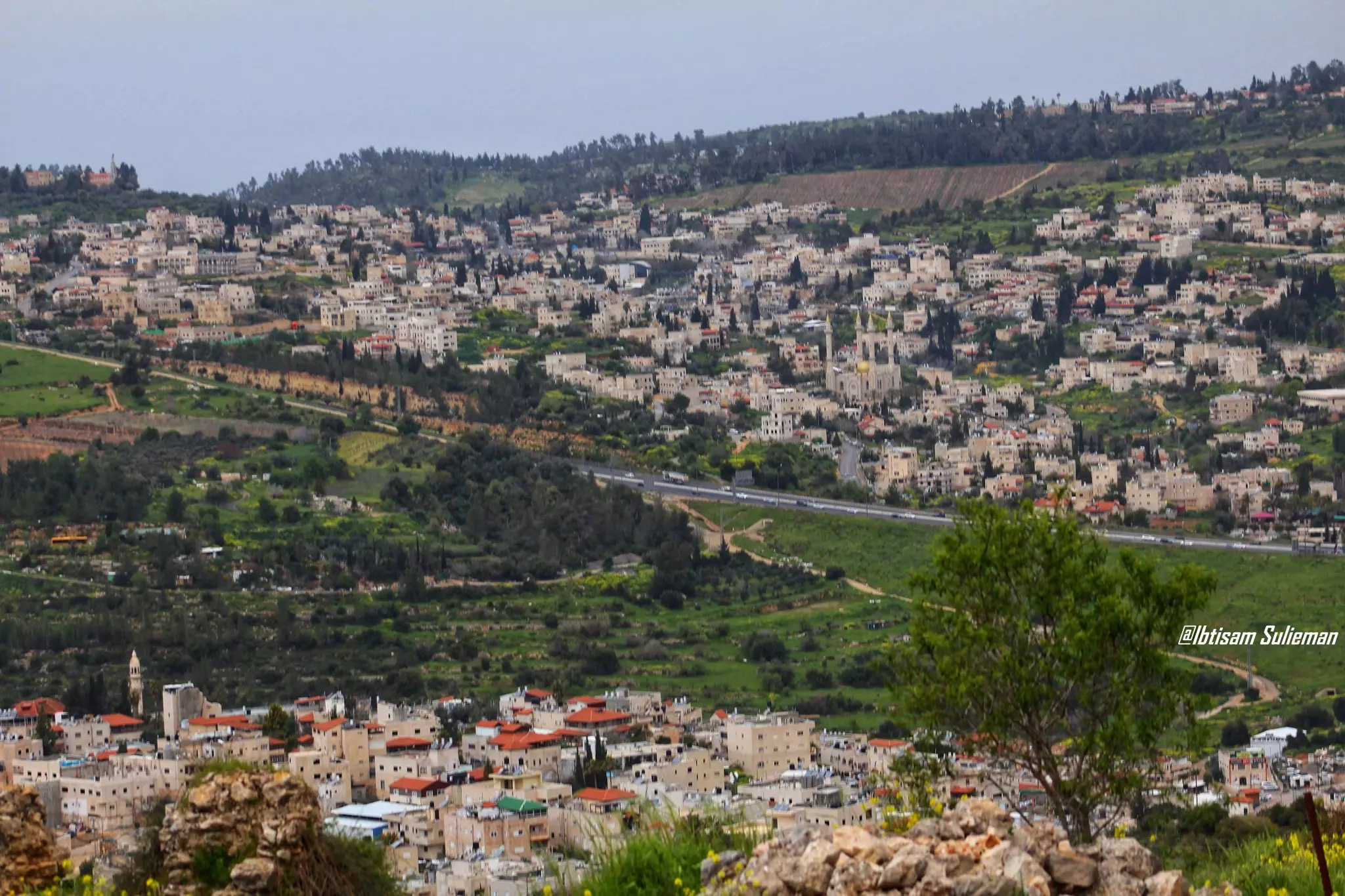
- من ريفنا الفلسطيني ومن قرى القدس على جهة اليمين قرية أبو غوش وعلى الجهة المقابلة قرية عين نقوبا المستحدثة -- Ibtisam Sulieman
- قرية العنب "ابو غوش" قبل 100 عام
-للمصور فرانك شولتن
- A street scene in the early 1920s
- قرية ابو غوش قرية العنب على البير
عام 1904
- مبنى شرطة الانتداب البريطاني في ابو غوش -- إياد جابر

- مبنى شرطة الانتداب البريطاني في ابو غوش -- إياد جابر #2
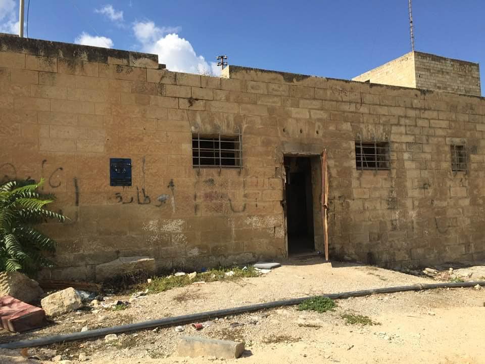
- مبنى شرطة الانتداب البريطاني في ابو غوش -- إياد جابر #3
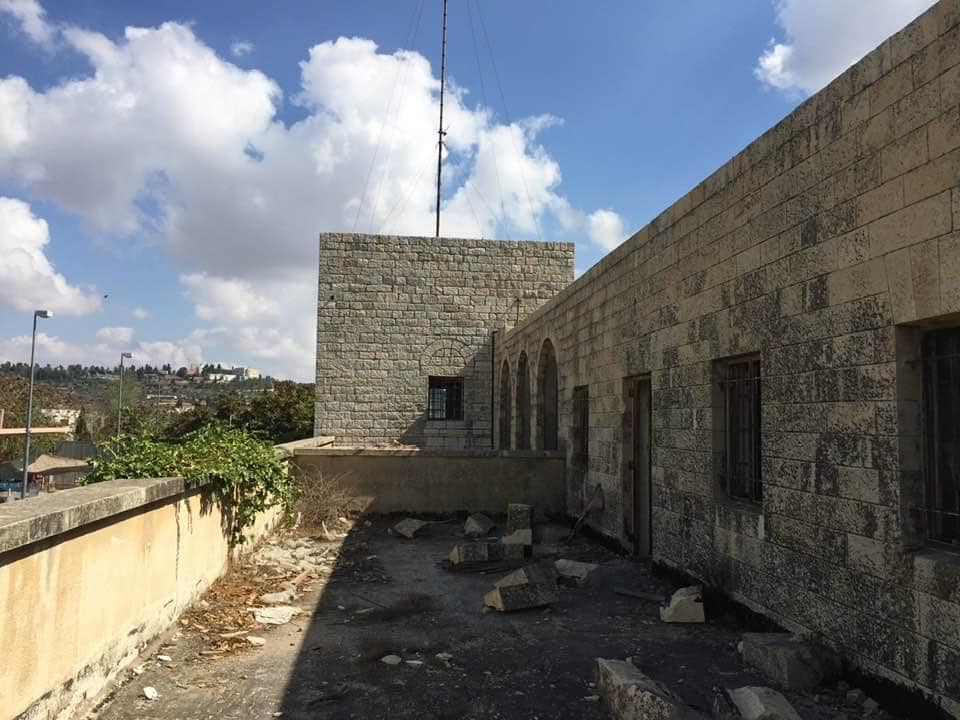
- مبنى شرطة الانتداب البريطاني في ابو غوش -- إياد جابر #4
- مبنى شرطة الانتداب البريطاني في ابو غوش -- إياد جابر #5
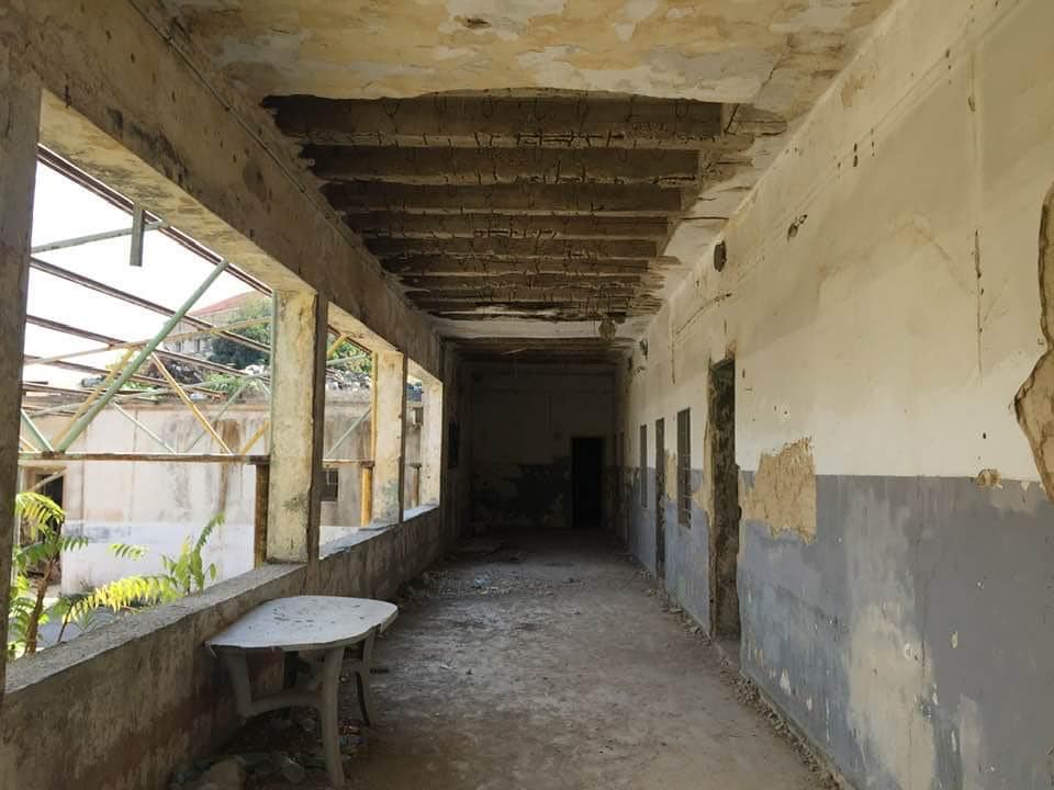
- مبنى شرطة الانتداب البريطاني في ابو غوش -- إياد جابر #6
- مبنى شرطة الانتداب البريطاني في ابو غوش -- إياد جابر #7
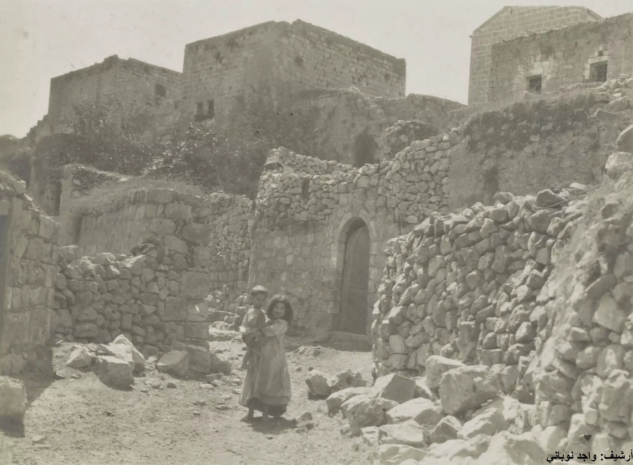
- صور قديمة من الزمن الجميل لقرية ابو غوش.
- صور قديمة من الزمن الجميل لقرية ابو غوش. #2
- صور قديمة من الزمن الجميل لقرية ابو غوش. #3
- صور قديمة من الزمن الجميل لقرية ابو غوش. #4
- صور قديمة من الزمن الجميل لقرية ابو غوش. #5
- صور قديمة من الزمن الجميل لقرية ابو غوش. #6
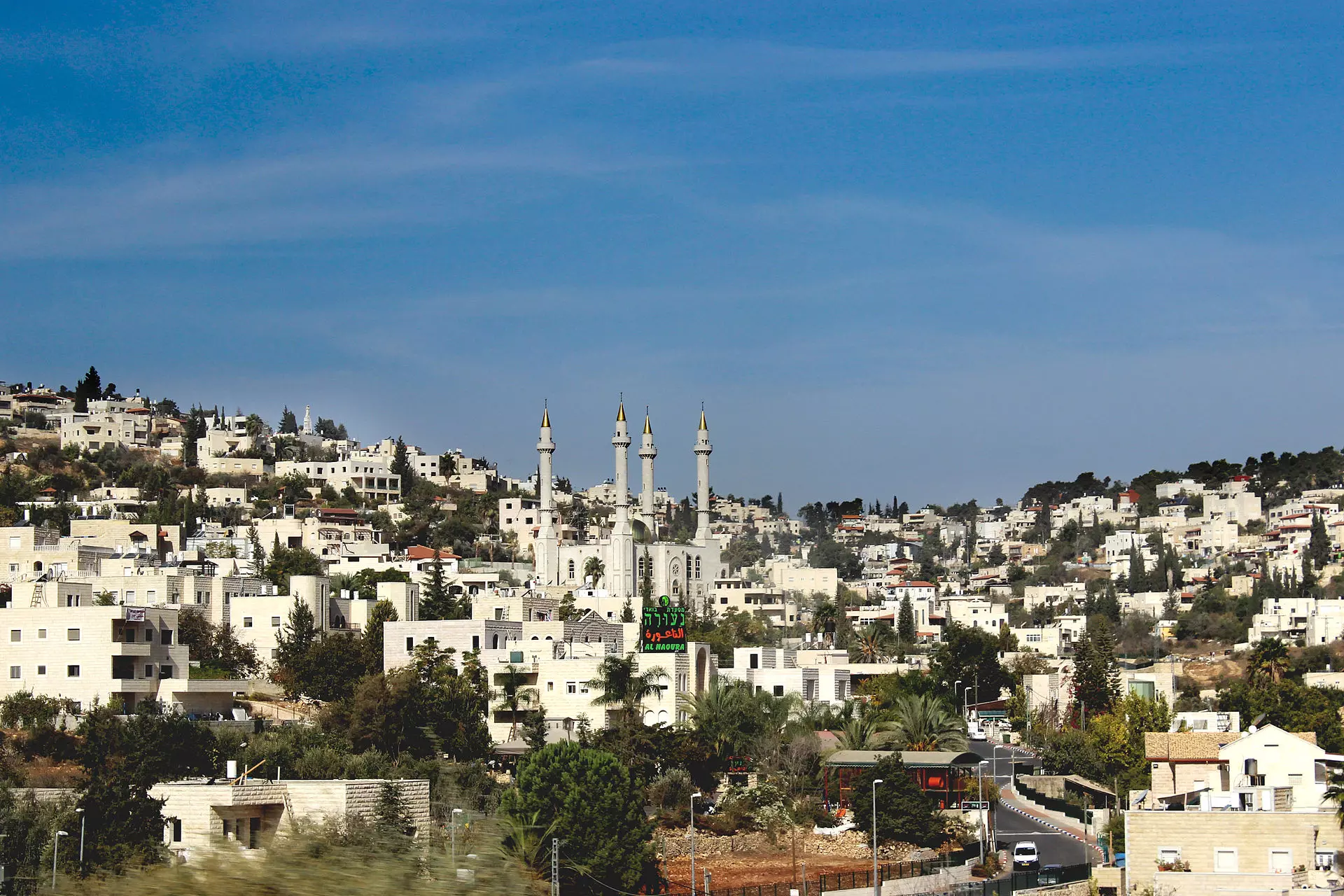
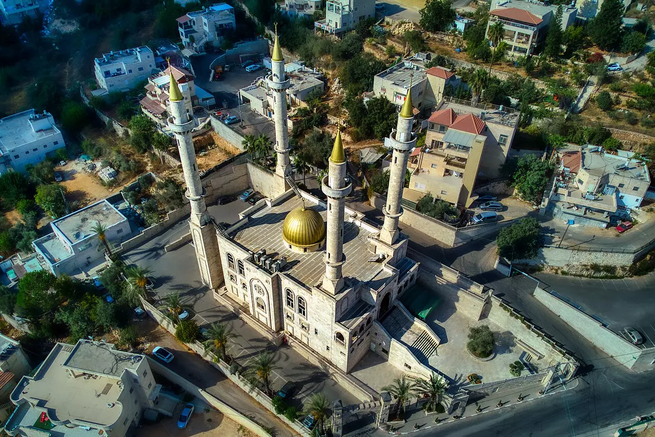
- The new Akhmad Kadyrov Mosque
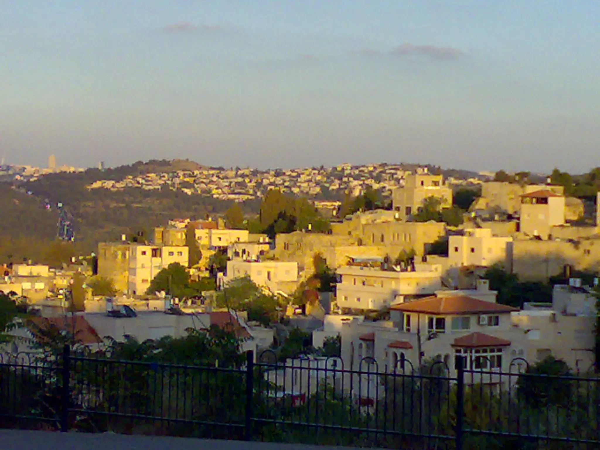
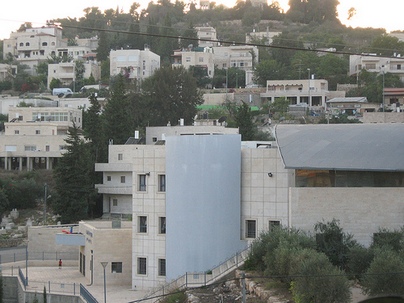
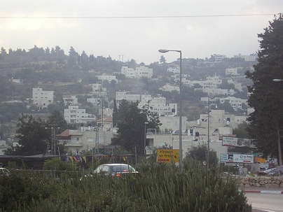
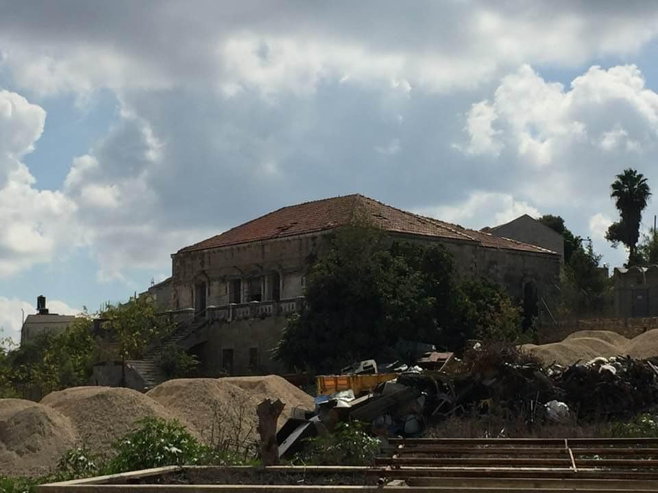
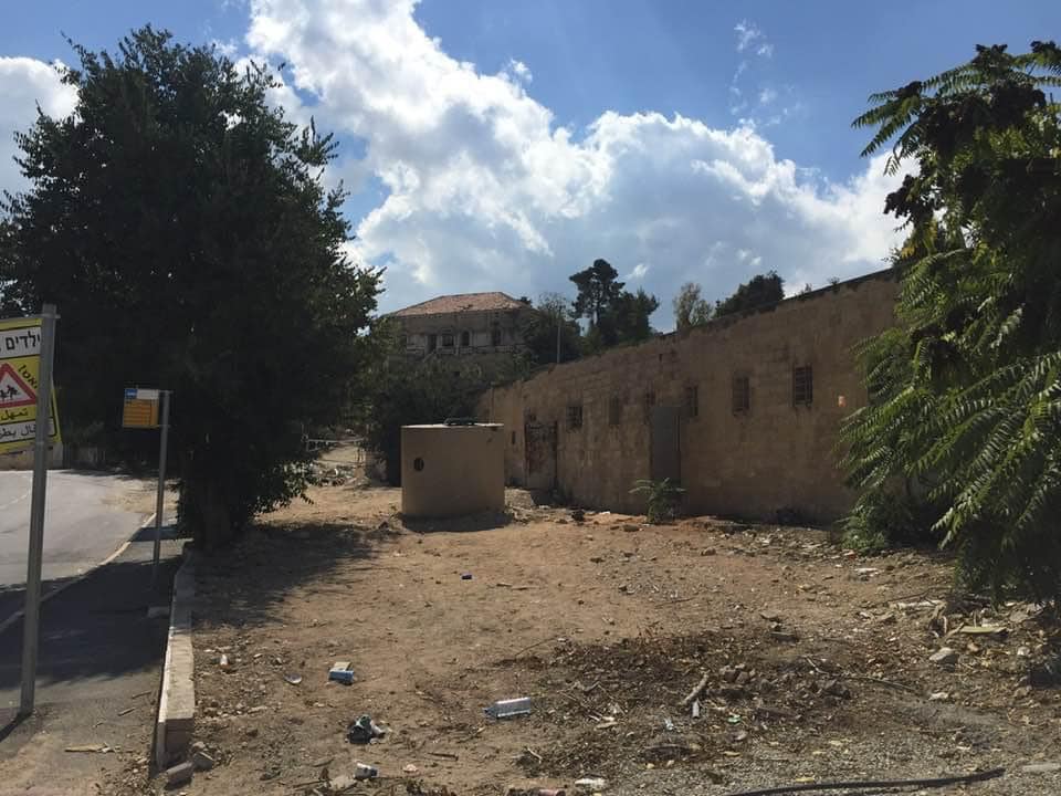
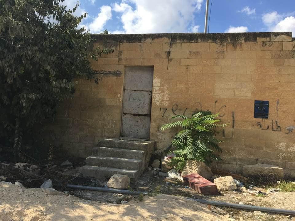
- General view
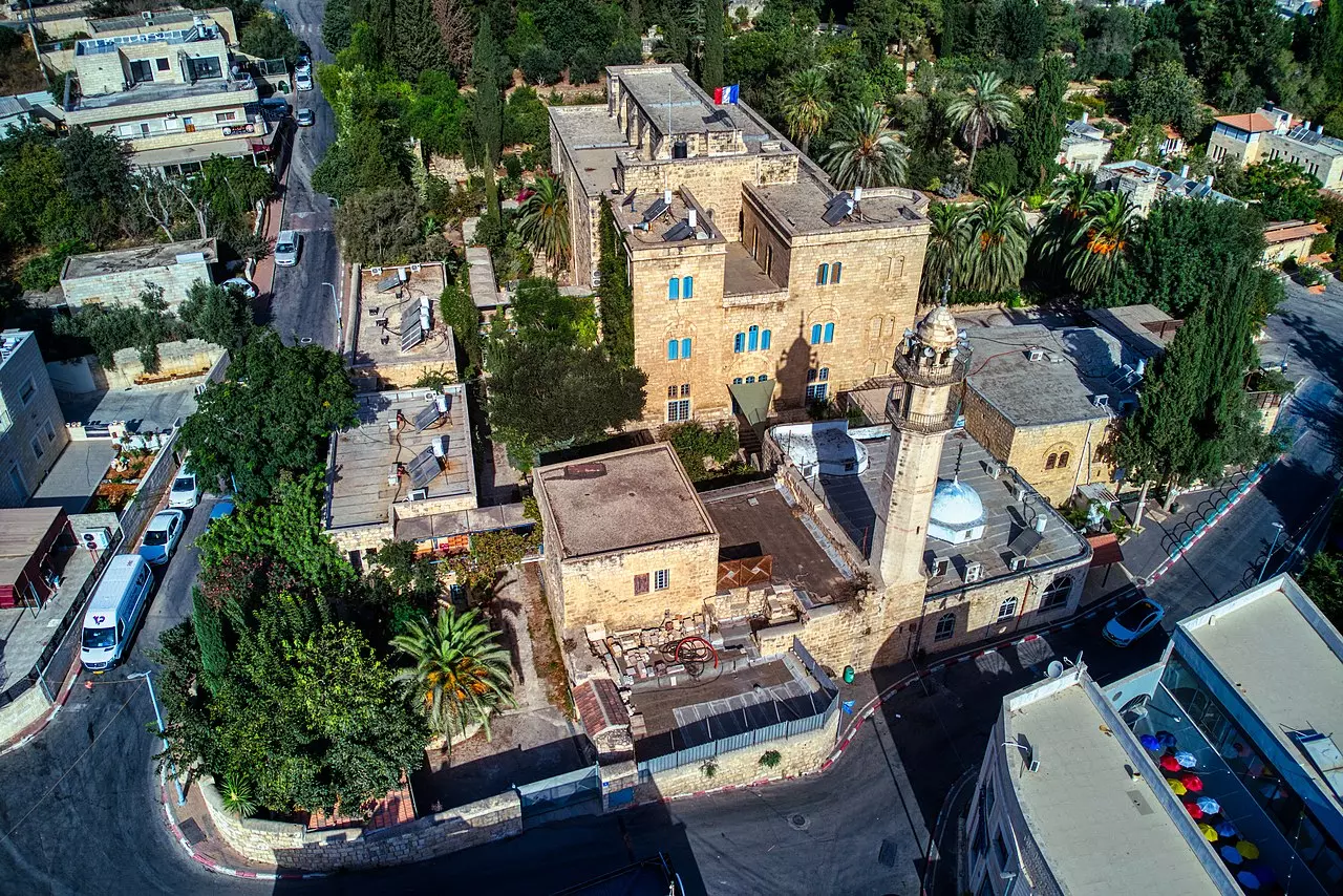
- The historical mosque of Abu Ghosh
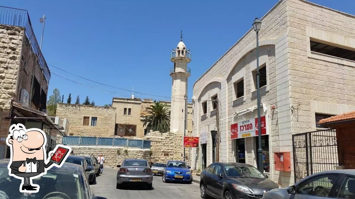
- منظر عام في البلدة القديمة
Want to browse more? 80,000 pictures were grouped in these gallaries:
| Display Name | Clan/Hamolah | Country of Residence |
| bashar hasuneh | abdelrahman | Jerusalem, palestine |
| Samer | - | Sofia, Bulgaria |
| abu-ketaish/abu-gosh | abu-ghosh | amman, jordan |
| moueen abu gohsh | abd elrhman | - |
| Kefah Abu-gosh | Abu-gosh | - |
| وفاء ابوغوش | - | - |
| vip.mosa | - | abu ghosh |
| علوش | - | روسيا |
| thunder | - | - |
| د.راني ابوغوش | - | - |
| nafez ibrhiem abu gosh | - | - |
| Nader abu gosh | abugosh | - |
- جولة في قرية ابو غوش وملامحها في الشهر الفضيل ،الكاملة،جولة رمضانية،2019 Duration: 21 min 49 sec
- قرية العنب هي بلدة أبو غوش.. بنتعرف عليها مع يارا أبو هلال - مشوار فلسطين - حلوة يا دنيا Duration: 13 min 13 sec
- عين العمور في عين رافة وقريبة من ابو غوش ووادي كسلا wazeעין לימון Duration: 19 sec
No links have been shared yet, be free to the first to share the first link.
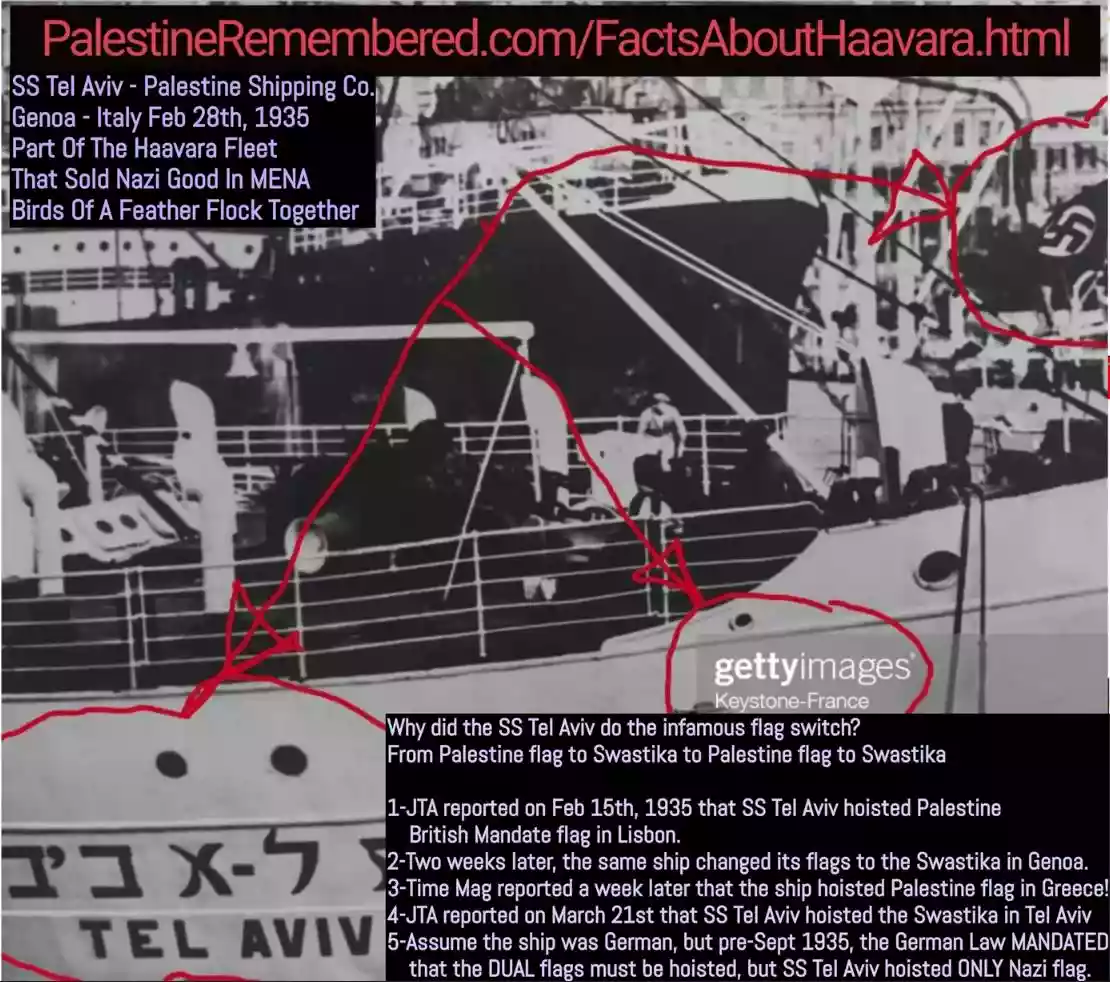 Fake Valor: Why Did Zionist Jews Hoist Nazis Flag on Their Ships in the 1930s?
What is new?
-
Facts About Oct. 7th Gaza Raid
-
Remined Us Please:: Who Did Rape Who? Palestinians Raped Israelis? Or, was the other way around?
-
When Prof. Edward Said was invited to debate Bibi Netanyahu in the 1980s, watch what happened!
-
Ezra Klein of the NY Times on the "Jewish Race".
-
Abusing Blood Libel!
-
Did Israeli Soldiers Activate The Hanniba Direective On Oct. 7th? You Be The Judge
-
Zionist FAQ: Isn't it true that Palestinians don't want peace? Palestinians never accepted the two-state solution
- Facts about Haavara (Transfer) Agreement between Ben-Gurion & Hitler
-
Haavara FAQs: Why Did Zionist Jews Hoist Nazis' Flags on Their Ships in the 1930s?
- Haavara FAQs: When Chaim Weizmann met FDR in mid-1943, why was he silent about rescuing European Jewry?
-
Dear ChatGPT: How did Palestinians resist Napoleon's invasion of their country in 1799?
-
Dear ChatGPT: Gaza had a vibrant Jewish community in the mid-17th century. What happened to them?
-
Dear ChatGPT: Why did the Jewish Agency suppress news of the Holocaust during WWII?
-
Video Playlist: Jews share their DNA tests to end the conflict for good.
-
A Tale of Two Conflicts: Examining the Definition of Genocide
-
Prof. Abraham Polak And The Suppressed History of the Khazars and European Jewry
-
How Ronald Reagan would have framed the genocide in Gaza if he were still alive?
-
Haavara FAQs: Let us do the math: how many German Jews did The Haavara Agreement save?
-
Zionist FAQs: The Hebron Massacre of 1929, "clearly proves" that Palestinians are antisemitic, how could you deny it?
-
Zionist FAQs: Why Anti-Zionist Is Not Antisemitism?
-
Zionist FAQs: Isn't it true that the KGB created Palestinian Nationalism in the early 1960s?
- Zionist FAQs: Muslims are killing Muslims all the time; why are Israeli Jews being singled out in the media?
- Zionist FAQs: How is Israel an apartheid state when 20% of its citizens are Arabs who enjoy full rights?
-
Haavara FAQs: Why Did Dorothy Thompson Flip From A Zionist Advocate to A Silenced Dissenter?
-
Haavara FAQs: Analysis of Herzl's Uganda Scheme and how it could have saved millions of Jews.
-
Haavara FAQs: Why did Hayim Greenberg describe American Jewry as "morally bankrupt" in early 1943?
-
Haavara FAQs: What if the Evian Conference was a resounding success? What would have been the impact of saving European Jewry on Zionism?
- Haavara FAQs: What if the six million were saved, how that would have impacted the Zionist project?
-
Haavara FAQs: How did Zionist leaders react when Europe's Jews lingered in the DP camps after WWII ended?
-
Why does the American Jewish community repeat lies that David Ben-Gurion had debunked before he died?
-
Who has the power to rename the Tatar/Khazar Gene Marker to Jewish IV?
-
Zionist FAQs: Why won't Egypt, Syria, and Jordan take their people back? Jews are indigenous to Palestine, and Arabs immigrated after Jews developed the country. Arabs should leave.
-
Haavara FAQs: Did Hitler and the Nazis conflate between Judaism and Zionist? If that wasn't case, then why?
-
Haavara FAQs: Winston Churchill and antisemitism, a collection of articles written Churchill.
-
Haavara FAQs: Broken by country, how many Jews survived vs. killed during the Holocaust?
-
Haavara FAQs: Why did European Jews vote with their feet and to immigrated to the Americas, not Palestine, after WWII?
-
Watch this American Jewish Girl describing Israeli Jews' cognitive dissonance like no other in under two minutes
-
Haavara FAQs: When the Nazis went out of their way to hide the Holocaust, Israeli Jews did the exact opposite by broadcasting their genocide of Gazans. But why?
-
Haavara FAQs: How Zionist Jews went out of their to show their appreciation to Nazism and Fascism?
- Haavara FAQs: Why Zionist leaders were against bombing the death camps & the Railroads leading to them?
-
Haavara FAQs: Hitler's message to the British and American people: If Jews are such noble citizens and you care about them, how come you're not letting them in? I will gladly ship them to you at my expense, even on luxury liners!
-
A shortlist of Zionist and Israeli false flag operations in the name Jews.
-
The Most Moral Army
- The Land of Kapos (Israel): Where the brave are boycotted and Kapos walk free.
- Why did early Zionists often named their communal enterprises "colonial"?
- Zionist Relations with Nazi Germany by Faris Glubb
-
Two NY Times advertisements by Zionists in the early 1943 that exposes Zionists' treason at the height of the calamity
- Facts Not Lies about the Palestinian-Israeli Conflict.
- Site's pictures have been categorized
- Campgain Against Lice
- A Survey of Palestine, the official source about Palestine before Nakba produced by the British Mandate; over 1200 pages.
- Satellite View & Google Earth: Over 6,000 placemarks identifying all destroyed towns, W. Bank & Gaza Strip Towns, & refugee camps.
- PalestineRemembered.com and its Nakba Oral History Project were featured on al-Jazeera Satellite TV.
- Nakba Oral History Video Podcast:
 Over 700 Oral History interviews (including 3,500+ hours of recording) can be viewed online.
 - Palestine Village Statistics Project
- Gaza Jail Break
- النسخة العربية للموقع الان متوفرة
- Videos: Documenting the destroyed villages in video: Tracing all that remains since Nakba.
- Videos: Responding to Zionist Propaganda
- Interview: The ethnic cleansing of Palestine: George Galloway interviews Israeli Historian Ilan Pappe.
- For Palestinians, memory matters. It provides a blueprint for their future By George Bisharat.
- Zionist FAQ now available in Hebrew שאלות שציונים שואלים, עכשיו בעברית
- Video: The Stephen Walt and John Mearsheimer report on the influence of the Israel Lobby on U.S. Foreign Policy
- The Palestinian-Israeli conflict for beginners