| PalestineRemembered | About Us | Oral History | العربية | |
| Pictures | Zionist FAQs | Haavara | Maps | |
| Search |
| Camps |
| Districts |
| Acre |
| Baysan |
| Beersheba |
| Bethlehem |
| Gaza |
| Haifa |
| Hebron |
| Jaffa |
| Jericho |
| Jerusalem |
| Jinin |
| Nablus |
| Nazareth |
| Ramallah |
| al-Ramla |
| Safad |
| Tiberias |
| Tulkarm |
| Donate |
| Contact |
| Profile |
| Videos |
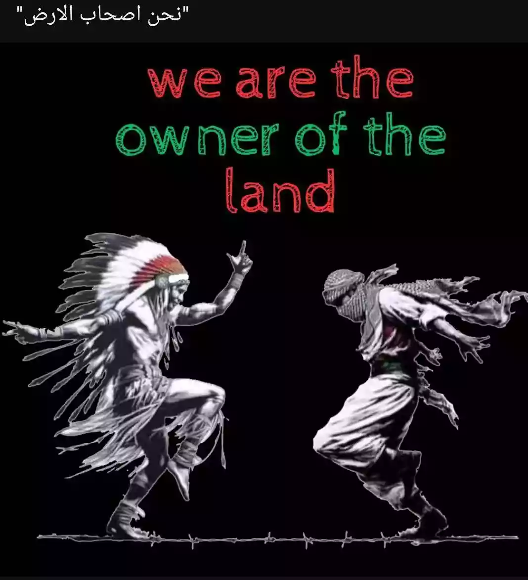
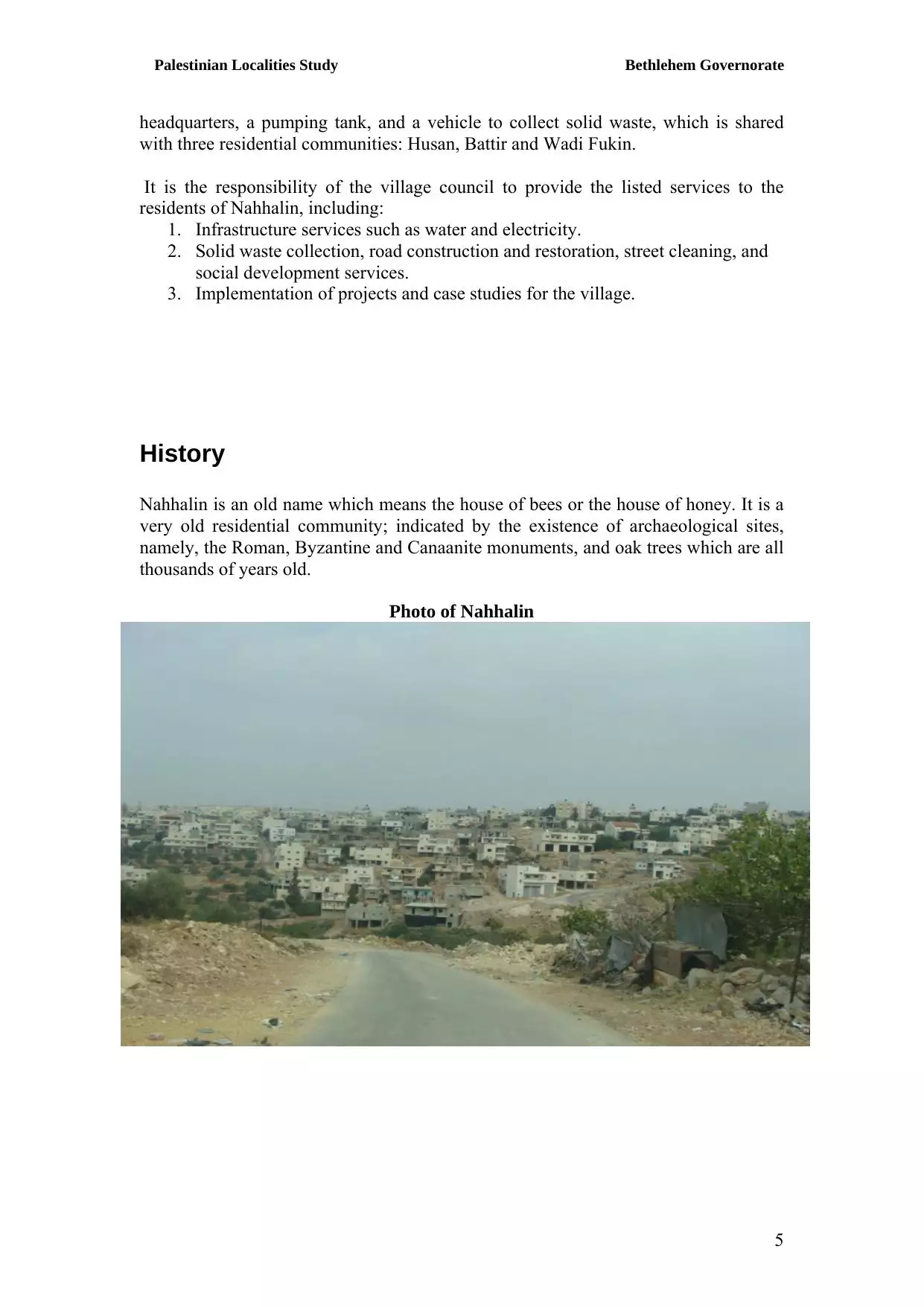
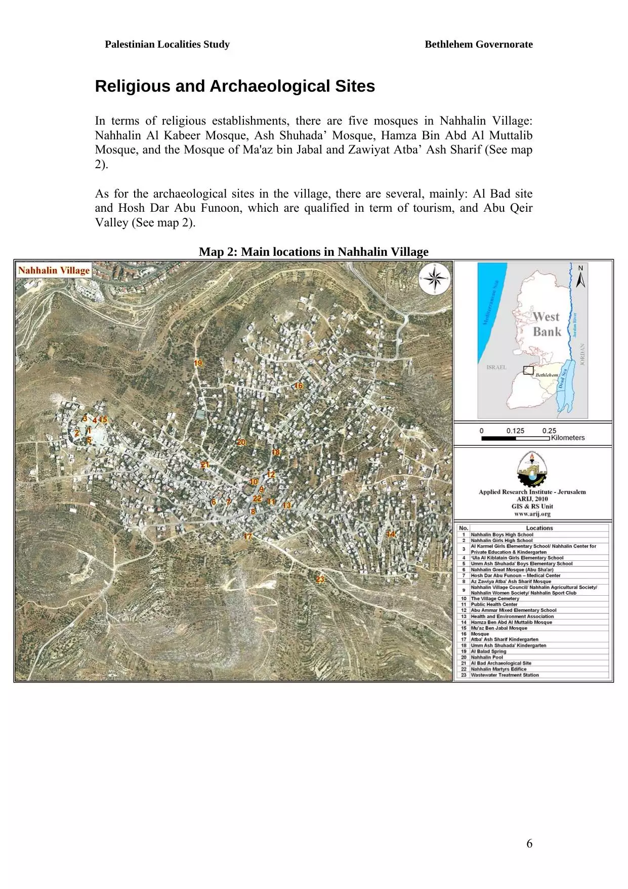
Welcome To Nahhalin - نحّالين (נחאלין)
|
District of Bethlehem
Occupied days ago |
العربية Google Earth |
 |
Gallery (38) |
- Statistics & Facts
-
Before & After

- Satellite View
- Articles 38
- Pictures 38
- Land Deeds 1
- Members 11
- Families
- Wikipedia
- ARIJ Guide
- Videos 2
- Guest Book 39
- Links
| Statistic & Fact | Value | ||||||||||||||||||||||
| Distance From District | 14 km southwest of Bethlehem | ||||||||||||||||||||||
| Elevation | 620 meters | ||||||||||||||||||||||
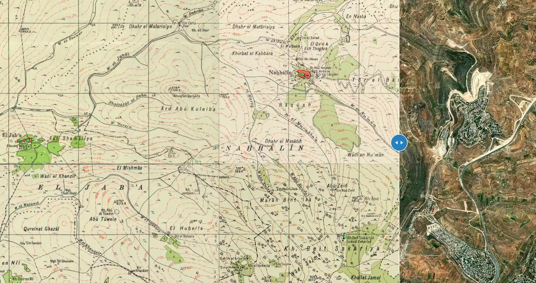
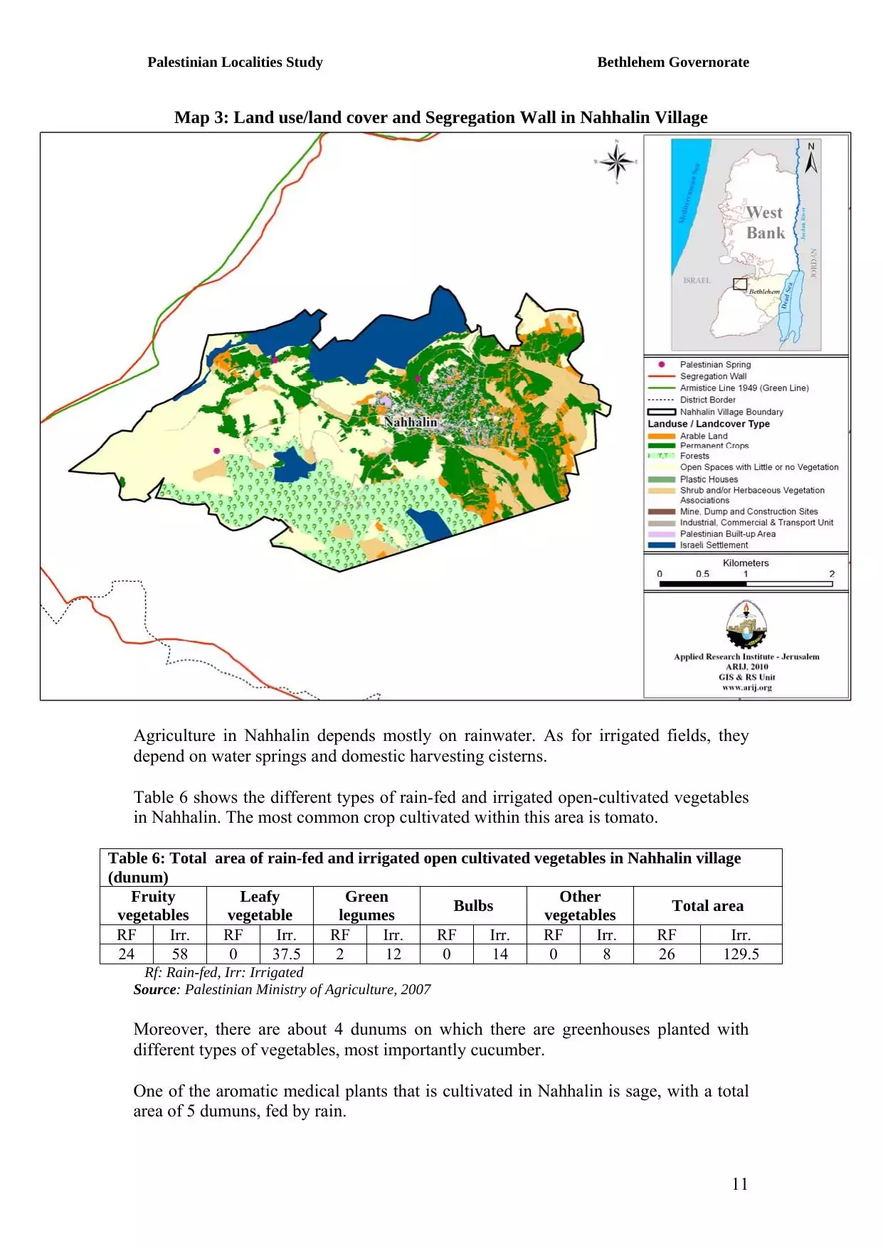
| Before & After Nakba, Click Map For Details |
|||||||||||||||||||||||
|
|||||||||||||||||||||||
| Land Ownership |
**Town Lands' Demarcation Maps |
||||||||||||||||||||||
| Land Usage As of 1945 |
|
||||||||||||||||||||||
| Population |
|
||||||||||||||||||||||
| Near By Towns |
|||||||||||||||||||||||
|
|||||||||||||||||||||||
| Featured Video | |||||||||||||||||||||||
| ARIJ Guide | |||||||||||||||||||||||
3.
4. 
5. 
6. 
7. 
8. 
9. 
10. 
11. 
12. 
13. 
14. 
15. 
16. 
17. 
18. 
19. 
20. 
21. 
Click here to browse online. |
|||||||||||||||||||||||
| Related Maps | Town Lands' Demarcation Maps خرائط للقضاء توضح حدود القرى والاودية View from satellite Town's map on MapQuest Help us map this town at WikiMapia |
||||||||||||||||||||||
| Related Links | Wikipedia's Page Facebook Page ARIJ Guide Google Search Google For Images Google For Videos في كتاب بلادنا فلسطين دليل أريج المزيد من موقع هوية |
||||||||||||||||||||||
- نحالين بين اليوم والامس
- Nahalin, General Information
- نحالين بلدي اصلي وفصلي
- نحالــــــــــــين
- تأسيس ديوان لنحالين في الاردن\ياجوز
- بطاقة تهنئة بمناسبة عيد الفطر السعيد
- الـــى امـــــــي
- الشوق والحنين
- دعوة للمشاركة
- من قال اننا كبرنا
- ورشة عمل في قرية نحالين حول العنف ضد النساء
- الحياة البرية
- قطف ثمار الزيتون في نحالين
- نحالين
- كنز ادهش المنقبين في نحالين
- رحيـــــــــل
- على طريق التقدم والنجاح
- عيد الاضحى المبارك
- ارحموا هذا البلد
- قناعــــــــــــــــــــــــات
- [email protected]
- البعض نحبهــــــــــــــم
- يحدث في رمضان
- يحدث في ايـــــــلول
- نحالين في سطور
- السياحة البيئية وأثرها على التنمية الاقتصادية في المناطق الريفية
- من الذي سيدفع الثمن
- الحب والكراهية
- القـــــــــــــــــــراءة
- همســــــــــــــات
- التوجيهي
- ترنيمة ............................... الروح
- الراي والراي الاخر............................................ في زمن العولمة
- رجب...................................طيب
- قديسة عشق ........................................ امي
- اسرج رفاتك .......................................... غمدا للسيف
- على طريق الفشــــــــــــــــــــــــــل
- عائلة ابو مصطفى الادهمــــــــــــــــــــــــــــــــي
- نحالين كما تبدو من بانياس
Posted by Safwat Safi - اول مدرسة تنشء في نحالين
Posted by خليلية 3 - منظر عام
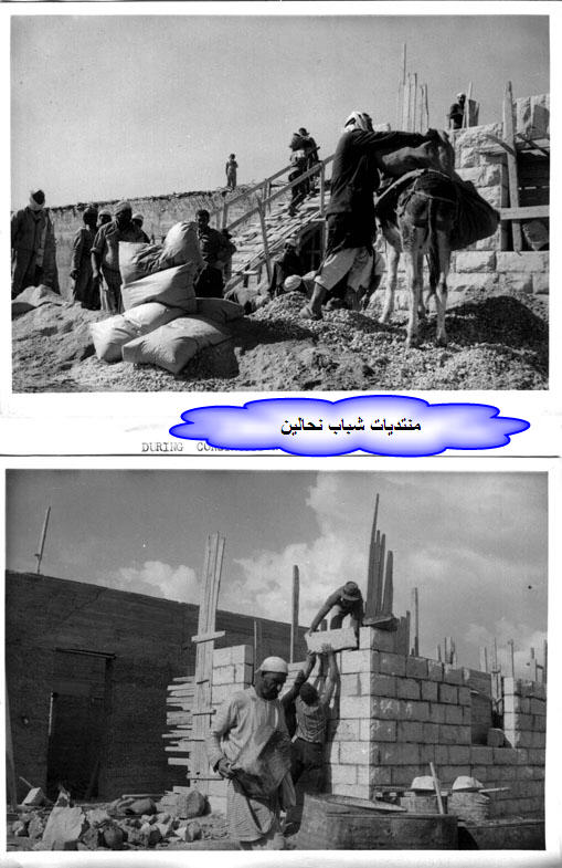
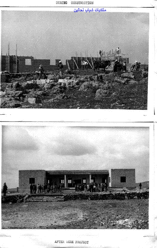
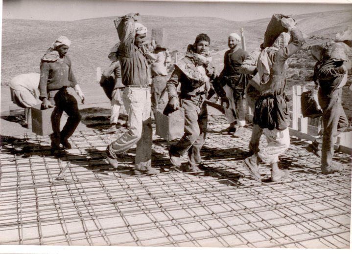
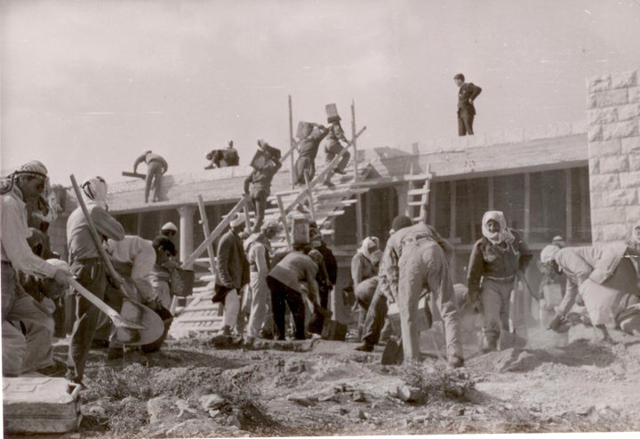
Posted by خليلية 9 - بناء اول مدرسة في قرية نحالين في الستينات

Posted by خليلية 3 - اول مدرسة في نحالين
Posted by خليلية 3 - منظر عام
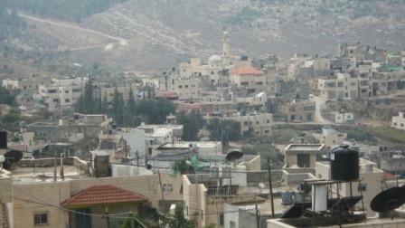
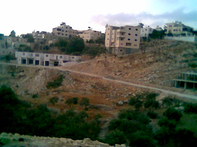
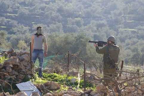
Posted by خليلية 3 - منظر عام تظهر فيه مغتصبة بيتار عليت

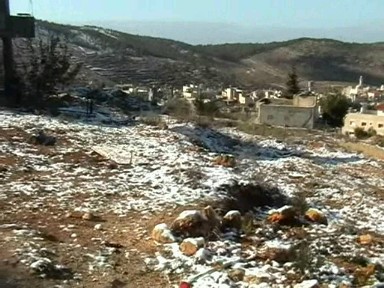
Posted by خليلية 5 - نحالين تكسوها الثلوج
Posted by خليلية 3 - نحالين منطقة شويحه والقاعه
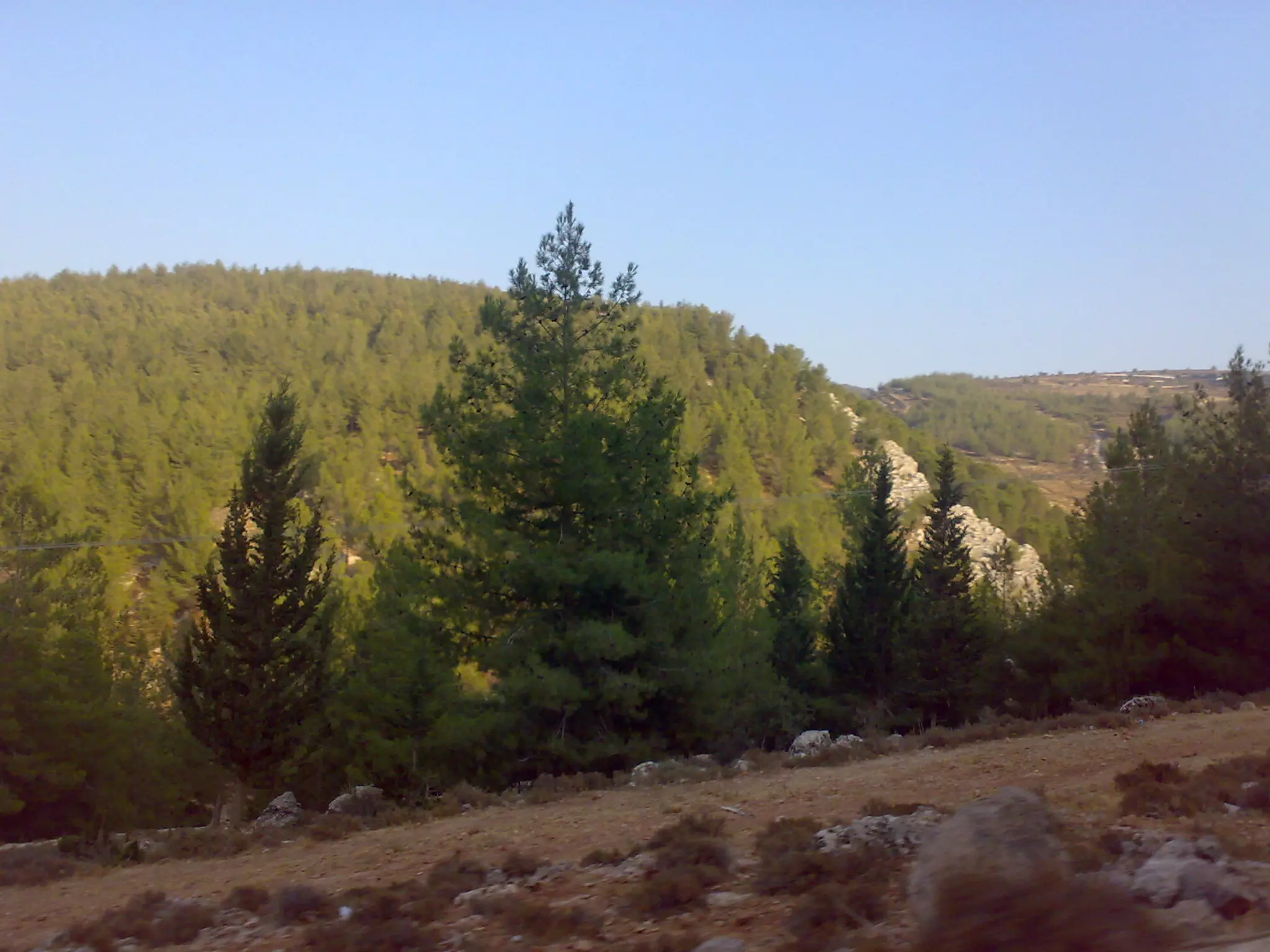
Posted by Mukhles Najajreh 4 - أحراج القرية
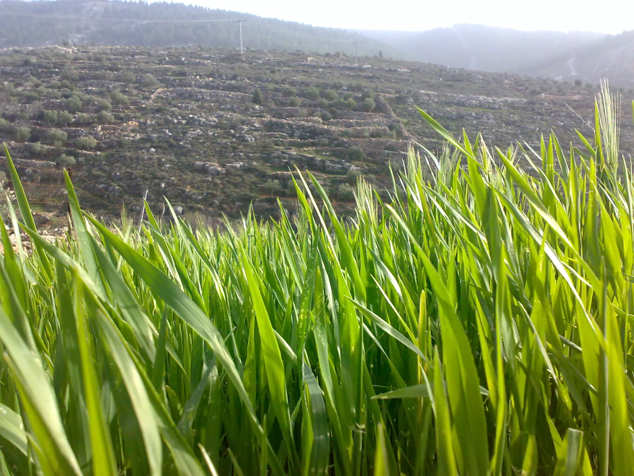
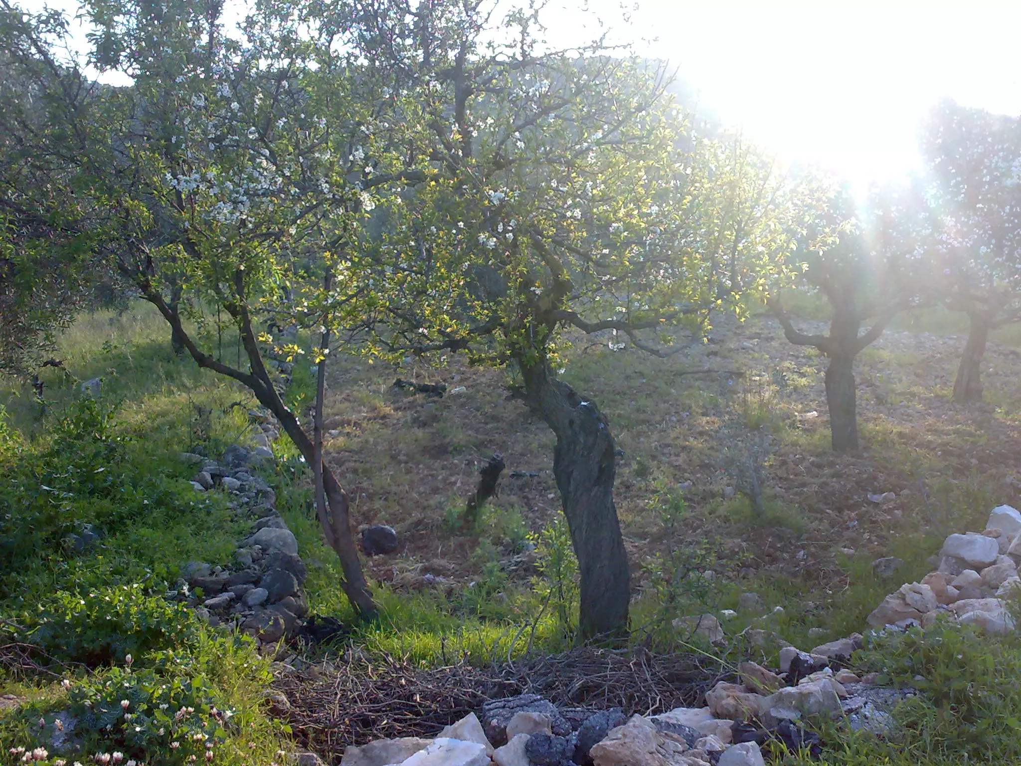
Posted by BlueSky 1 - الربيع في القرية
Posted by BlueSky 1 - منطقة عين فارس
Posted by BlueSky 1 - شعب العرب
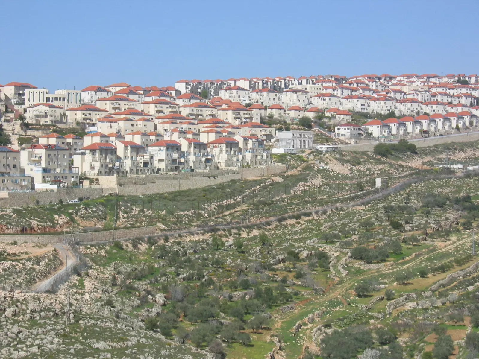
Posted by نحاليني 2 - مستوطنة بيتار المقامة على أراضي نحالين ,حوسان ووادي فوكين
Posted by نحاليني 4 - غرب القرية

Posted by نحاليني 1 - غرب القرية 2
Posted by نحاليني 1 - افتتاح حوش ابو فنون
Posted by ابو النور 2 - Nice vew

Posted by Mukhles Najajreh 1 - قرية نحالين
Posted by ابن قرية نحالين 2 - Nahalin 1964
Posted by Mukhles Najajreh - Nahalin school 1964
Posted by Mukhles Najajreh - Nahaleen

Posted by A. Najajreh - Nahaleen
Posted by A. Najajreh - Nahaleen
Posted by A. Najajreh - Nahaleen
Posted by A. Najajreh - Nahaleen
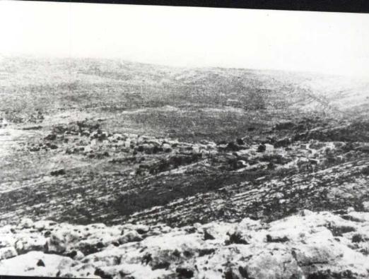
Posted by A. Najajreh - نحالين : صورة لقرية نحالين عام 1947 - مشاركة صفافي
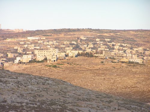
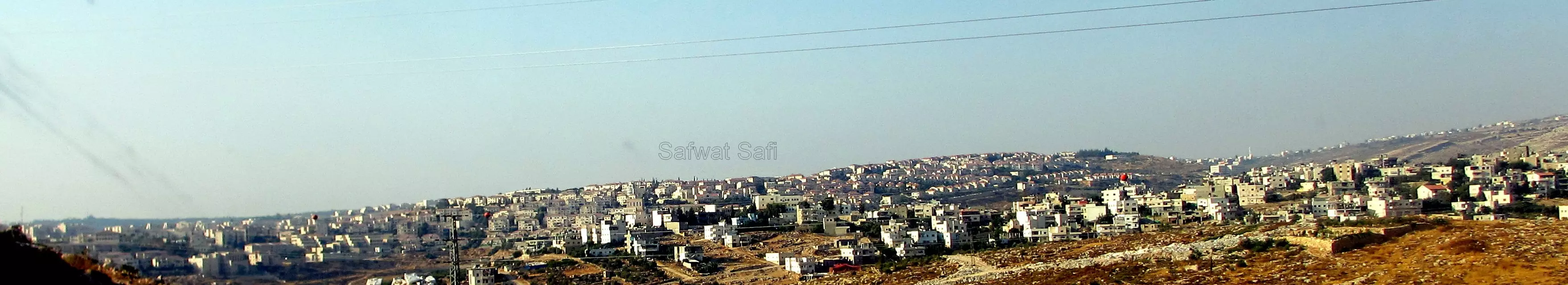
Posted by صفافي أصيل - منظر عام لقرية نجالين من الجنوب، وتظهر على اليسار في الصورة مستعمرة بيتار عيليت
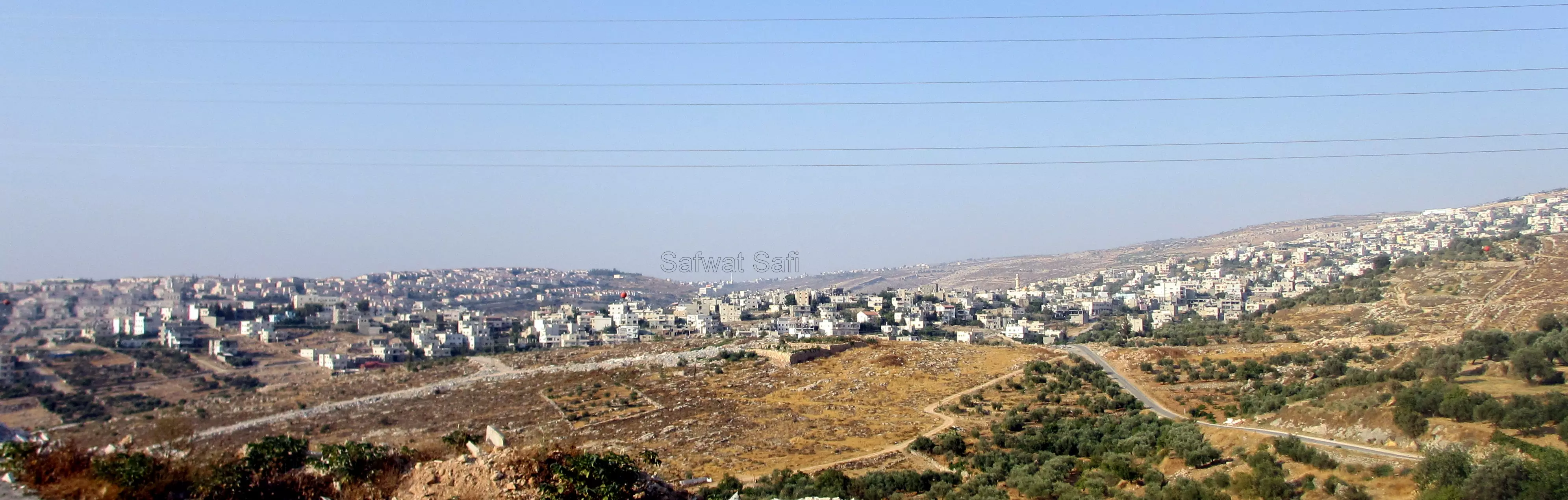
Posted by Safwat Safi - صورة لنحالين من الجنوب
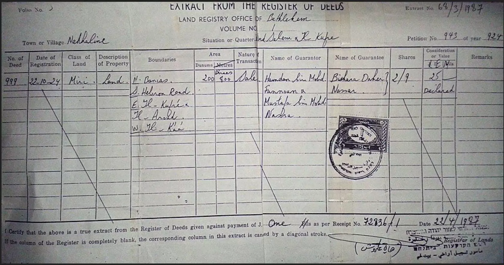
Posted by Safwat Safi - The land deed that belongs to Daher Nassar which his family owned for over 100 year, the details from BBC in the comments section
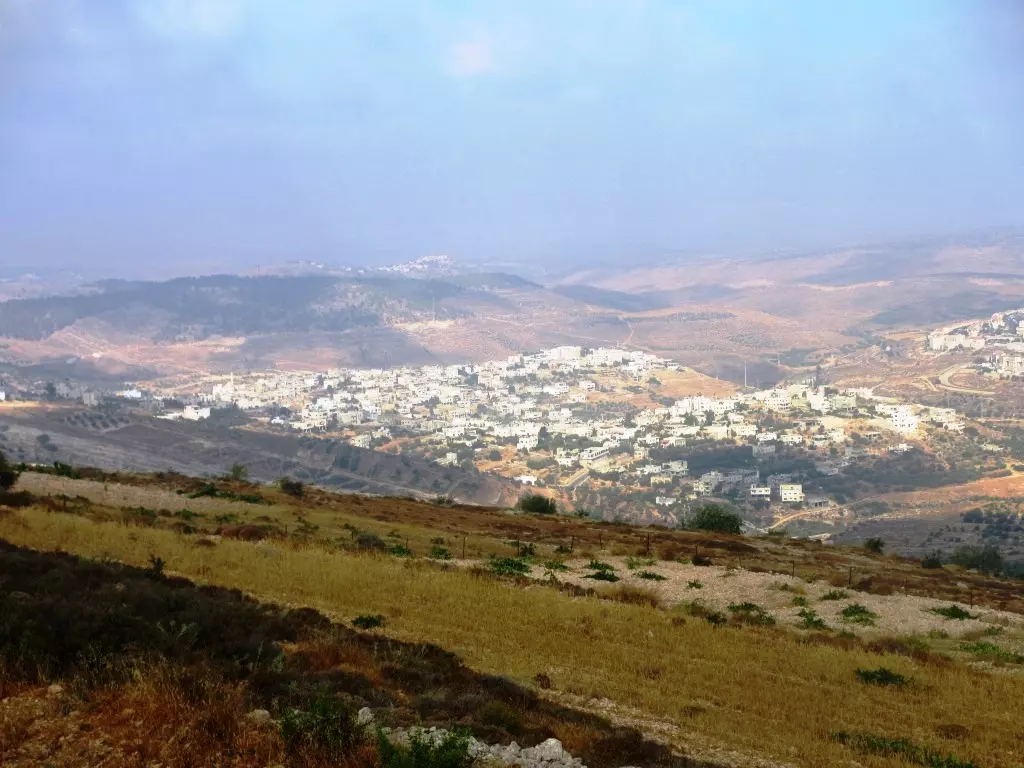
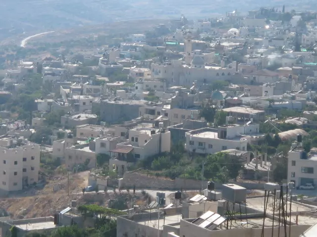
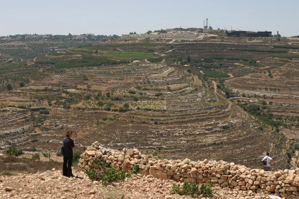
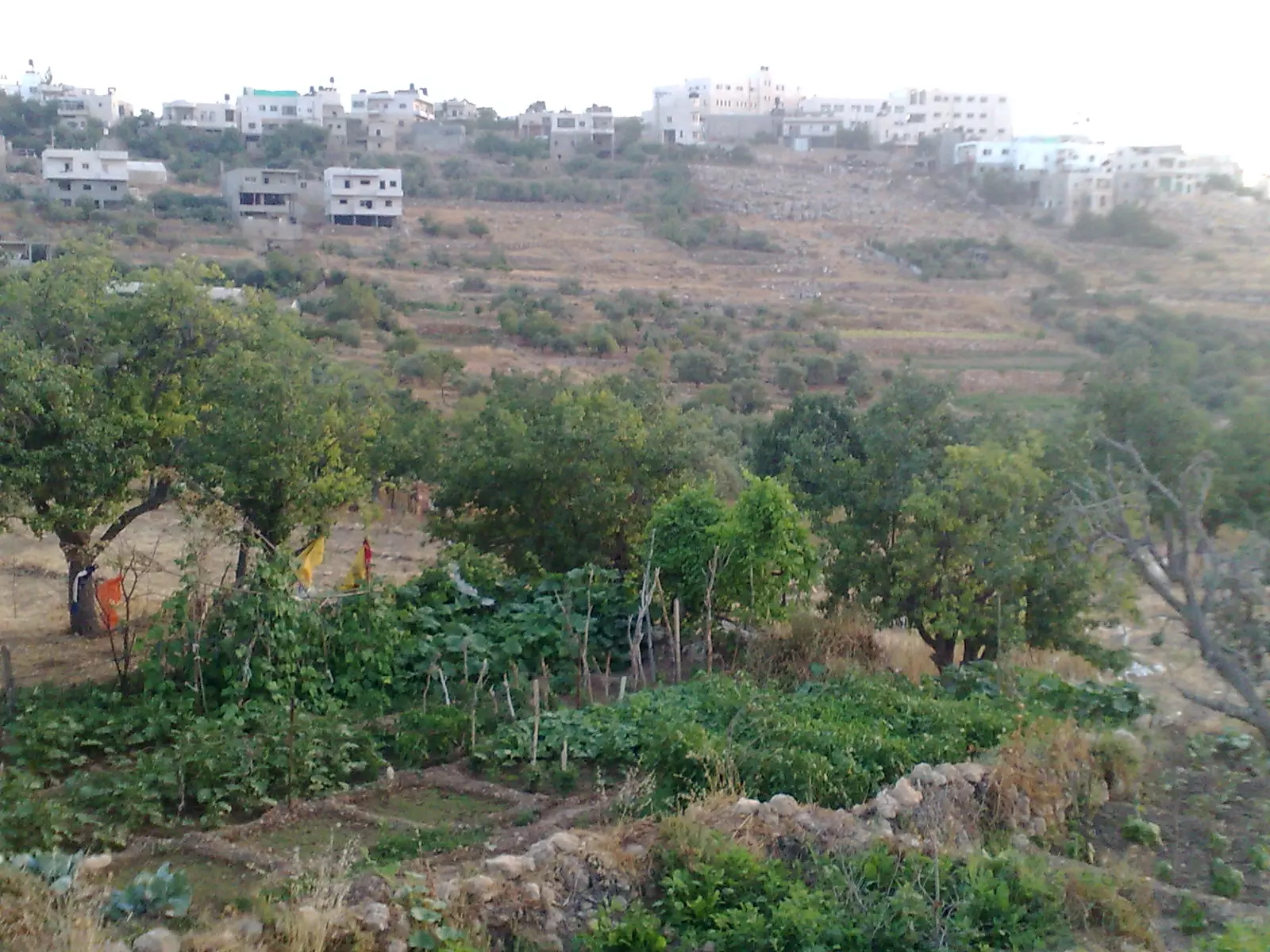
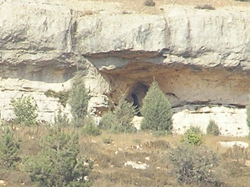
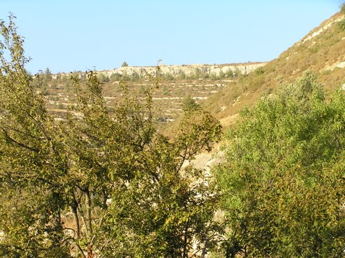
1 - General view of the town -- منظر عام
- General view of the town -- منظر عام #2
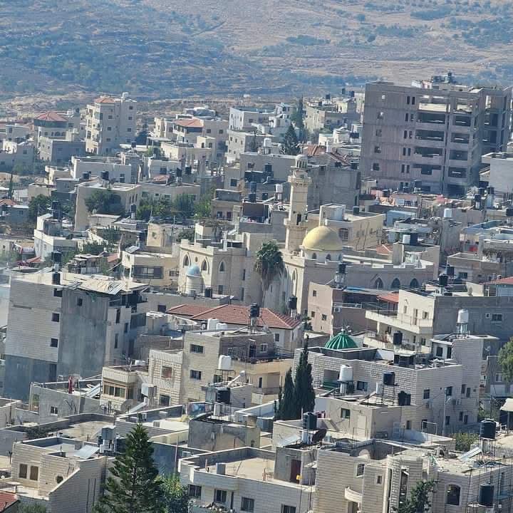
- General view of the town -- منظر عام #3
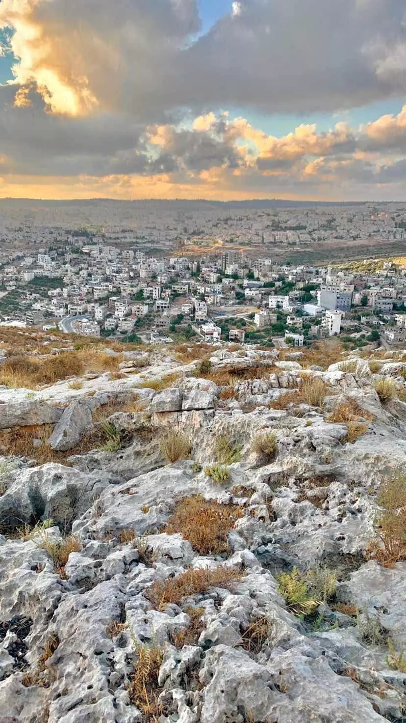
- General view of the town -- منظر عام #4
- منظر عام

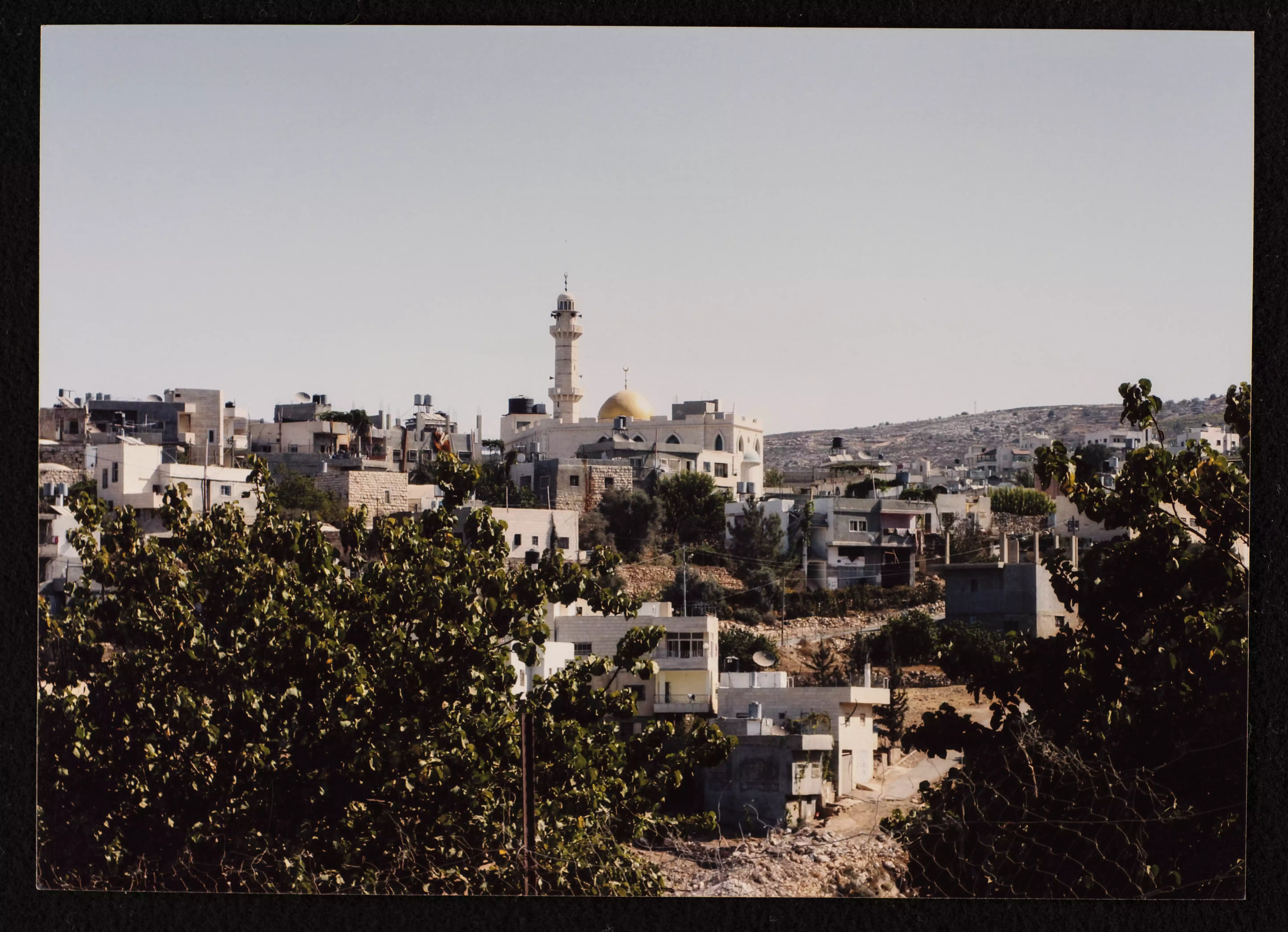
- مسجد نحَّالين الكبير -- 1990 - 1999
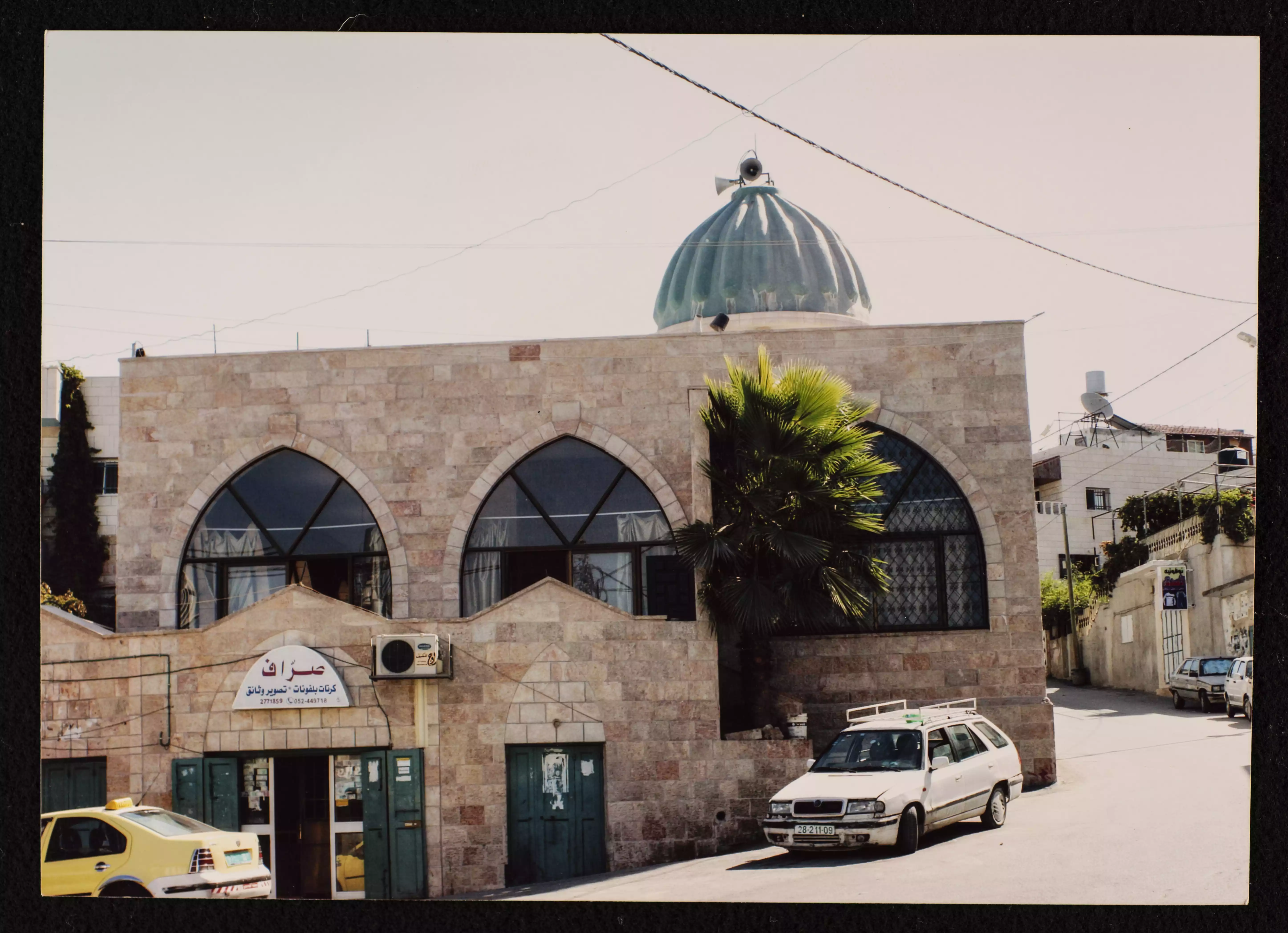
- مسجد زاوية نحَّالين في قرية نحَّالين بالقرب من بيت لحم والتي أسسها الشيخ محمد حسني الدين القاسمي عام 1942. وُجدت الصورة ضمن مجموعة مركز السنابل للدراسات والتراث الشعبي. -- 1990 - 1991
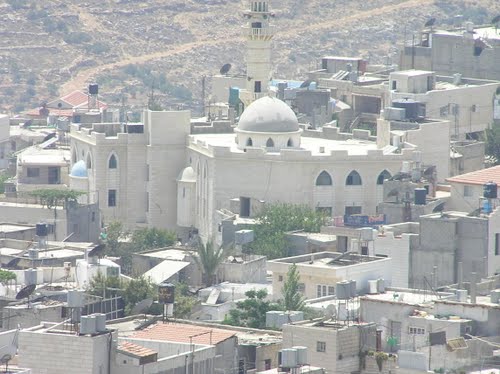
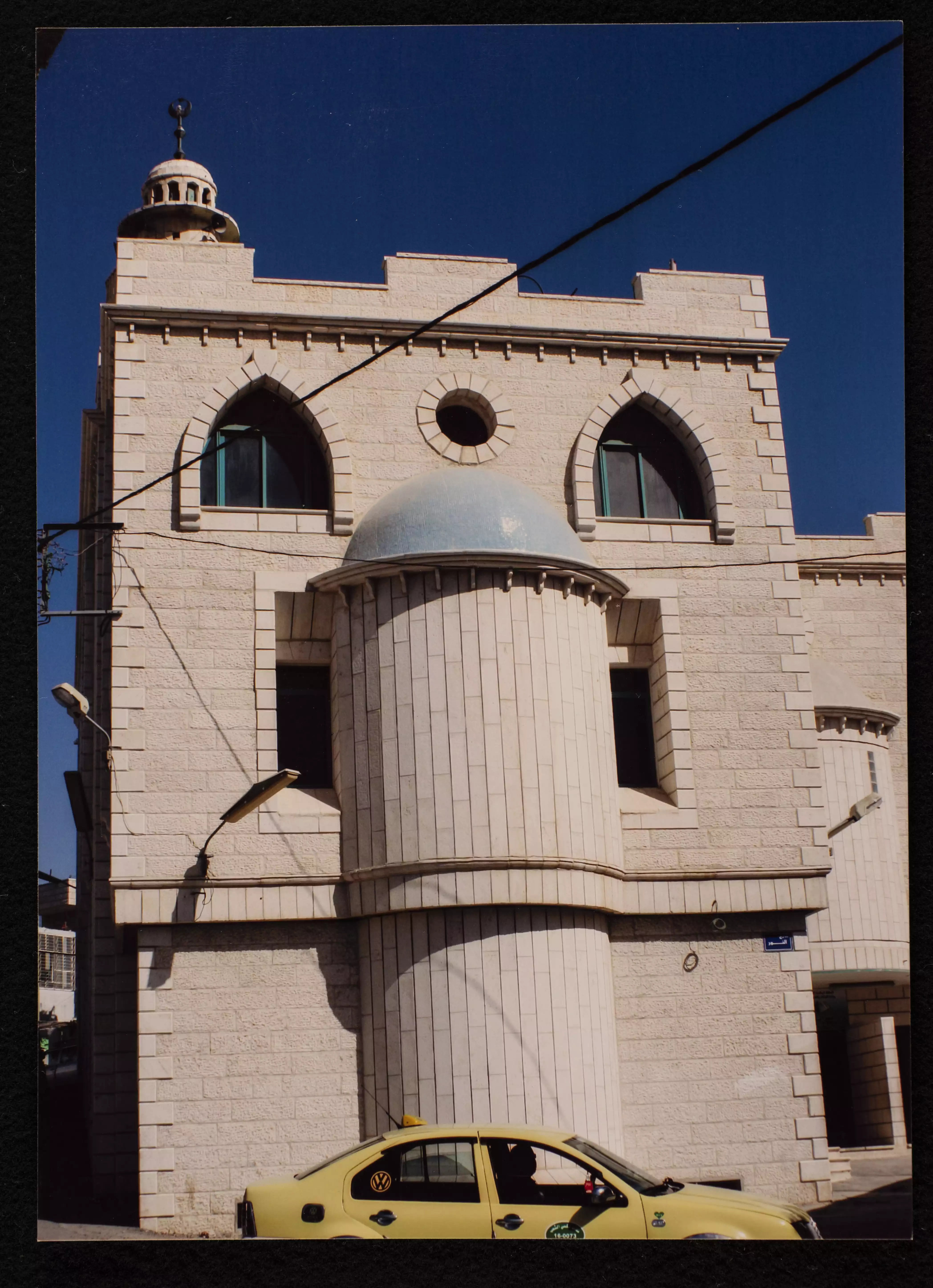
- مسجد نحالين الكبير في شارع الجرون في قرية نحالين، بُني المسجد عام 1979 وتمت توسعته عام 2003. وُجدت الصورة ضمن مجموعة مركز السنابل للدراسات والتراث الشعب
Want to browse more? 80,000 pictures were grouped in these gallaries:
| Display Name | Clan/Hamolah | Country of Residence |
| Safwat Safi | - | - |
| موسى نجاجرة | نجاجرة | الاردن , الاردن |
| Abu Thaer | - | - |
| ابو النور | - | - |
| BlueSky | - | Bethlehem, Palestine |
| فادي | - | - |
| Mukhles Najajreh | - | Bethlehem |
| abu amar | شكارنة | بيت لحم, نحالين |
| khaled musallam | نجاجرة | الاردن, الاردن |
| اولك | - | بيت لحم |
| د.نايف عمر لافي | لافي | الدوحة, قطر |
No links have been shared yet, be free to the first to share the first link.
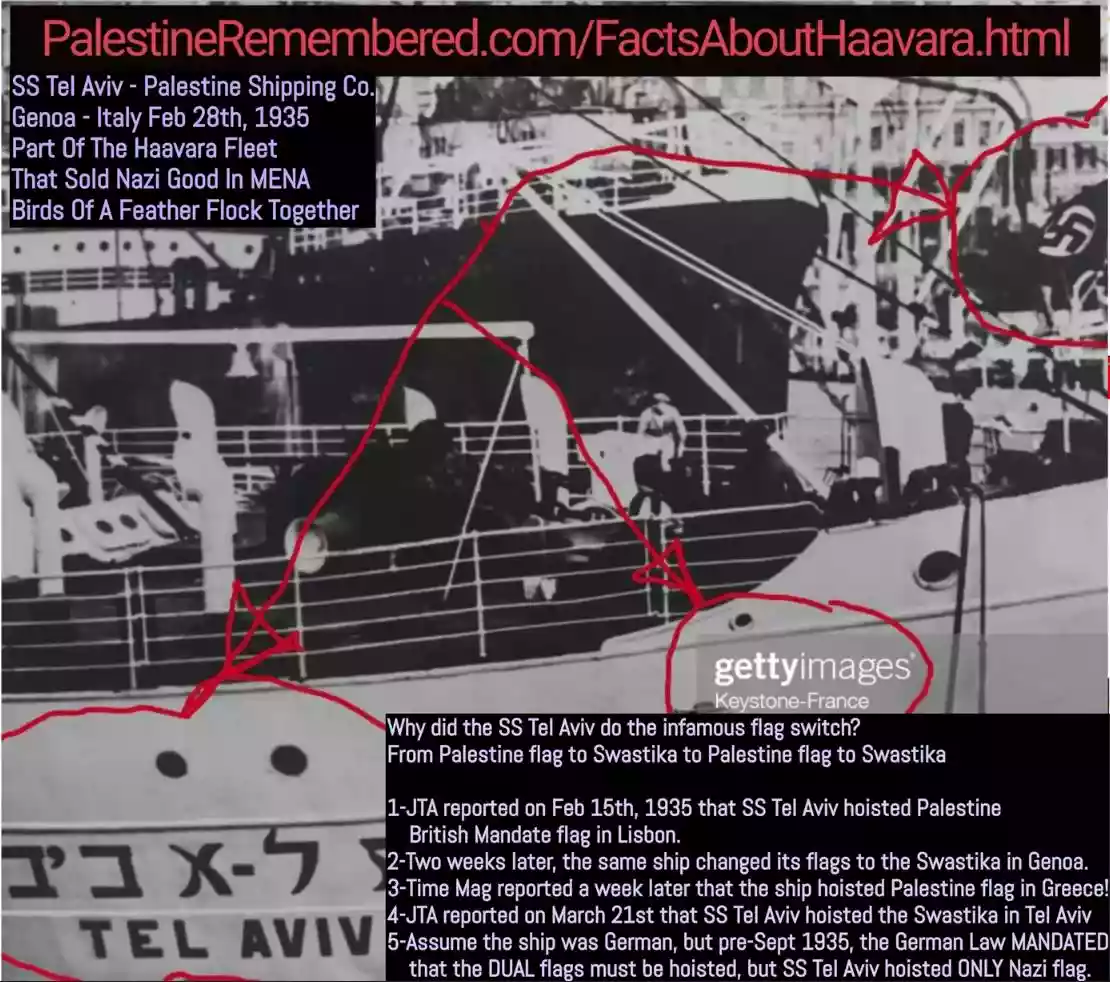 Fake Valor: Why Did Zionist Jews Hoist Nazis Flag on Their Ships in the 1930s?
What is new?
-
Facts About Oct. 7th Gaza Raid
-
Remined Us Please:: Who Did Rape Who? Palestinians Raped Israelis? Or, was the other way around?
-
When Prof. Edward Said was invited to debate Bibi Netanyahu in the 1980s, watch what happened!
-
Ezra Klein of the NY Times on the "Jewish Race".
-
Abusing Blood Libel!
-
Did Israeli Soldiers Activate The Hanniba Direective On Oct. 7th? You Be The Judge
-
Zionist FAQ: Isn't it true that Palestinians don't want peace? Palestinians never accepted the two-state solution
- Facts about Haavara (Transfer) Agreement between Ben-Gurion & Hitler
-
Haavara FAQs: Why Did Zionist Jews Hoist Nazis' Flags on Their Ships in the 1930s?
- Haavara FAQs: When Chaim Weizmann met FDR in mid-1943, why was he silent about rescuing European Jewry?
-
Dear ChatGPT: How did Palestinians resist Napoleon's invasion of their country in 1799?
-
Dear ChatGPT: Gaza had a vibrant Jewish community in the mid-17th century. What happened to them?
-
Dear ChatGPT: Why did the Jewish Agency suppress news of the Holocaust during WWII?
-
Video Playlist: Jews share their DNA tests to end the conflict for good.
-
A Tale of Two Conflicts: Examining the Definition of Genocide
-
Prof. Abraham Polak And The Suppressed History of the Khazars and European Jewry
-
How Ronald Reagan would have framed the genocide in Gaza if he were still alive?
-
Haavara FAQs: Let us do the math: how many German Jews did The Haavara Agreement save?
-
Zionist FAQs: The Hebron Massacre of 1929, "clearly proves" that Palestinians are antisemitic, how could you deny it?
-
Zionist FAQs: Why Anti-Zionist Is Not Antisemitism?
-
Zionist FAQs: Isn't it true that the KGB created Palestinian Nationalism in the early 1960s?
- Zionist FAQs: Muslims are killing Muslims all the time; why are Israeli Jews being singled out in the media?
- Zionist FAQs: How is Israel an apartheid state when 20% of its citizens are Arabs who enjoy full rights?
-
Haavara FAQs: Why Did Dorothy Thompson Flip From A Zionist Advocate to A Silenced Dissenter?
-
Haavara FAQs: Analysis of Herzl's Uganda Scheme and how it could have saved millions of Jews.
-
Haavara FAQs: Why did Hayim Greenberg describe American Jewry as "morally bankrupt" in early 1943?
-
Haavara FAQs: What if the Evian Conference was a resounding success? What would have been the impact of saving European Jewry on Zionism?
- Haavara FAQs: What if the six million were saved, how that would have impacted the Zionist project?
-
Haavara FAQs: How did Zionist leaders react when Europe's Jews lingered in the DP camps after WWII ended?
-
Why does the American Jewish community repeat lies that David Ben-Gurion had debunked before he died?
-
Who has the power to rename the Tatar/Khazar Gene Marker to Jewish IV?
-
Zionist FAQs: Why won't Egypt, Syria, and Jordan take their people back? Jews are indigenous to Palestine, and Arabs immigrated after Jews developed the country. Arabs should leave.
-
Haavara FAQs: Did Hitler and the Nazis conflate between Judaism and Zionist? If that wasn't case, then why?
-
Haavara FAQs: Winston Churchill and antisemitism, a collection of articles written Churchill.
-
Haavara FAQs: Broken by country, how many Jews survived vs. killed during the Holocaust?
-
Haavara FAQs: Why did European Jews vote with their feet and to immigrated to the Americas, not Palestine, after WWII?
-
Watch this American Jewish Girl describing Israeli Jews' cognitive dissonance like no other in under two minutes
-
Haavara FAQs: When the Nazis went out of their way to hide the Holocaust, Israeli Jews did the exact opposite by broadcasting their genocide of Gazans. But why?
-
Haavara FAQs: How Zionist Jews went out of their to show their appreciation to Nazism and Fascism?
- Haavara FAQs: Why Zionist leaders were against bombing the death camps & the Railroads leading to them?
-
Haavara FAQs: Hitler's message to the British and American people: If Jews are such noble citizens and you care about them, how come you're not letting them in? I will gladly ship them to you at my expense, even on luxury liners!
-
A shortlist of Zionist and Israeli false flag operations in the name Jews.
-
The Most Moral Army
- The Land of Kapos (Israel): Where the brave are boycotted and Kapos walk free.
- Why did early Zionists often named their communal enterprises "colonial"?
- Zionist Relations with Nazi Germany by Faris Glubb
-
Two NY Times advertisements by Zionists in the early 1943 that exposes Zionists' treason at the height of the calamity
- Facts Not Lies about the Palestinian-Israeli Conflict.
- Site's pictures have been categorized
- Campgain Against Lice
- A Survey of Palestine, the official source about Palestine before Nakba produced by the British Mandate; over 1200 pages.
- Satellite View & Google Earth: Over 6,000 placemarks identifying all destroyed towns, W. Bank & Gaza Strip Towns, & refugee camps.
- PalestineRemembered.com and its Nakba Oral History Project were featured on al-Jazeera Satellite TV.
- Nakba Oral History Video Podcast:
 Over 700 Oral History interviews (including 3,500+ hours of recording) can be viewed online.
 - Palestine Village Statistics Project
- Gaza Jail Break
- النسخة العربية للموقع الان متوفرة
- Videos: Documenting the destroyed villages in video: Tracing all that remains since Nakba.
- Videos: Responding to Zionist Propaganda
- Interview: The ethnic cleansing of Palestine: George Galloway interviews Israeli Historian Ilan Pappe.
- For Palestinians, memory matters. It provides a blueprint for their future By George Bisharat.
- Zionist FAQ now available in Hebrew שאלות שציונים שואלים, עכשיו בעברית
- Video: The Stephen Walt and John Mearsheimer report on the influence of the Israel Lobby on U.S. Foreign Policy
- The Palestinian-Israeli conflict for beginners